Albion is an unincorporated community in the Westfield Township of northeastern Surry County, North Carolina, United States. Prominent landmarks in the community include Albion Missionary Baptist Church and Albion Community Church.
36°31′08″N80°26′56″W / 36.519°N 80.449°W
Municipalities and communities of Surry County, North Carolina, United States | ||
|---|---|---|
| City | 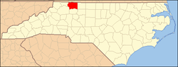 | |
| Towns | ||
| Townships | ||
| CDPs | ||
| Unincorporated communities |
| |
| Footnotes | ‡This populated place also has portions in an adjacent county or counties | |