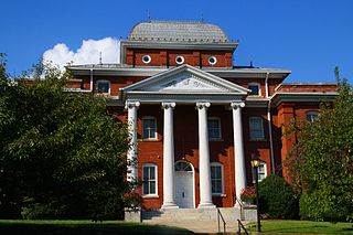
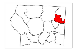
Surry County is a county located in the U.S. state of North Carolina. As of the 2020 census, the population was 71,359. Its county seat is Dobson, and its largest community is Mount Airy.
Stokes County is a county located in the U.S. state of North Carolina. As of the 2020 census, the population was 44,520. Its county seat is Danbury.
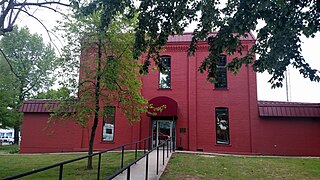
Fulton County is a county located in the U.S. state of Arkansas. As of the 2020 census, the population was 12,075. The county seat is Salem. Fulton County was formed on December 21, 1842, and named for William Fulton, the last governor of the Arkansas Territory. It is an alcohol prohibition or dry county.
Mount Airy is a city within Surry County, in the U.S. state of North Carolina. As of the 2020 United States census, the city's population was 10,676, an increase of 288 (+2.8%) from the 2010 census count of 10,388. As of 2020, the city was one of the most populous municipalities in Surry County. Mount Airy is a part of the Piedmont Triad metropolitan region.
Ararat is an unincorporated community in the Long Hill Township of Surry County, North Carolina, United States. Ararat is situated on, and is named for, the Ararat River. Ararat is along the former Atlantic & Yadkin Railway line from Mount Airy to Rural Hall that is now operated by the Yadkin Valley Railroad. Landmarks near the center of the community include the community post office, fire department and area churches.
Eldora Township is one of fifteen townships in Surry County, North Carolina, United States. The township had a population of 3,659 according to the 2020 census.
Dobson Township is one of fifteen townships in Surry County, North Carolina, United States. The township had a population of 8,367 according to the 2020 census.
Shoals Township is one of 15 townships in Surry County, North Carolina, United States. The township had a population of 1,936 according to the 2020 census.
Siloam Township is one of fifteen townships in Surry County, North Carolina, United States. The township had a population of 1,091 according to the 2020 census, making it the smallest township in Surry County by population.
South Westfield Township is one of fifteen townships in Surry County, North Carolina, United States. The township had a population of 2,069 according to the 2020 census.
Stewarts Creek Township is one of fifteen townships in Surry County, North Carolina, United States. The township had a population of 7,000 according to the 2020 census.
Westfield Township is one of fifteen townships in Surry County, North Carolina, United States. The township had a population of 2,372 according to the 2020 census.
Westfield in an unincorporated community in Surry and Stokes counties in North Carolina, United States. The community itself is located almost entirely within Surry County, with a small portion extending east into Stokes County. The majority of Westfield's Zip Code Tabulation Area is located within Stokes County.
Salem is an unincorporated community located in northern Surry County, North Carolina, United States on the outskirts of the city of Mount Airy. The community generally lies between Lovills Creek and the Ararat River. Prominent landmarks include Salem United Methodist Church.
White Sulphur Springs is an unincorporated community in Surry County, North Carolina, United States on the outskirts of the city of Mount Airy near the Virginia state line. The community sits on the Ararat River and once served as a popular late-nineteenth century resort. The community's name comes from the White Sulphur Springs Hotel that once stood here.
Franklin is an unincorporated community in the Mount Airy Township of Surry County, North Carolina, United States, on the outskirts of the city of Mount Airy. The community is located on South Franklin Road just south of Toast. Area landmarks include Franklin Elementary School and Franklin Volunteer Fire Department.
Pine Ridge is an unincorporated community in the Stewarts Creek Township of northern Surry County, North Carolina, United States, located near the city of Mount Airy on North Carolina Highway 89. The community is located between the Little Fisher River and Stewarts Creek and has an altitude of 1,347 feet. Area attractions include Pine Ridge Classic Golf Course. Noted 19th-century humorist Hardin E. Taliaferro was born near Pine Ridge in 1811.
Boones Hill is a small unincorporated community in the Mount Airy Township of northern Surry County, North Carolina, United States, on the outskirts of the city of Mount Airy near Bannertown. The community is centered on the intersection of Business U.S. Highway 52 and U.S. Highway 52 Bypass south of Bannertown. Local lore is that Daniel Boone camped on this hill.
Combstown is an unincorporated community in Surry County, North Carolina, United States, located on the outskirts of the city of Mount Airy, between Bannertown and Flat Rock.
Yadkin Township is one of nine townships in Stokes County, North Carolina, United States. The township had a population of 19,592 according to the 2000 census and is by the far the largest township by population in Stokes County.
This page is based on this Wikipedia article Text is available under the CC BY-SA 4.0 license; additional terms may apply. Images, videos and audio are available under their respective licenses.