Franksville, Wisconsin

Last updated

Franksville, Wisconsin
WIMap-doton-Franksville.png
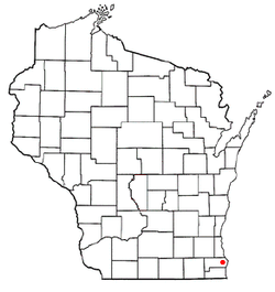
Location of Franksville, Wisconsin
Coordinates: 42°45′40″N87°54′19″W / 42.76111°N 87.90528°W / 42.76111; -87.90528
Country United States
State Wisconsin
County Racine
Area
  Total
4.3 sq mi (11.2 km2)
  Land4.3 sq mi (11.2 km2)
  Water0.0 sq mi (0.0 km2)
Elevation
[1]
728 ft (222 m)
Population
 (2000)
  Total
1,789
  Density412.4/sq mi (159.2/km2)
Time zone UTC-6 (Central (CST))
  Summer (DST) UTC-5 (CDT)
ZIP Code
53126 [2]
Area code 262
FIPS code 55-27425 [3]
GNIS feature ID1565278 [1]

Franksville is a former census-designated place (CDP) in Racine County, Wisconsin, United States. The population was 1,789 at the 2000 census.

Contents

History

Originally occupied by the Potowatomi tribe, the first white settlers in the area then known as Skunk Grove arrived in the 1830s. By the 1850s, plank roads were built through the area, and by the 1870s the Chicago, Milwaukee and St. Paul Railway (Milwaukee Road) laid tracks through the area and a plat was filed with Racine County. [4] :3–5 This track is now used by the Canadian Pacific Railway as the C&M Subdivision.

In 1907, the Frank Pure Food Company was established and built a plant in Franksville for the purpose of making sauerkraut. [4] :22 Contrary to popular belief, however, the company did not give Franksville its name, which had already been established. The name likely came from either Frank Brandecker, a surveyor who platted the area, or Frank Drandieker, a foreman of the crew that laid the railroad tracks through the area. [4] :5 In 1949, the company held the first Kraut Festival, which was originally a picnic for employees and friends, but later expanded to a 4-day event. [4] :12 The festival's run ended in 2002, but was revived in 2015 as Kraut Music Fest. [5]

Franksville became part of the newly established village of Caledonia on March 20, 2006. [6]

Geography

Franksville is located at 42°45′40″N87°54′19″W / 42.76111°N 87.90528°W / 42.76111; -87.90528 (42.761085, -87.905173). [7]

According to the United States Census Bureau, the CDP had a total area of 4.3 square miles (11.2 km2), all of it land.

Demographics

As of the census [3] of 2000, there were 1,789 people, 651 households, and 531 families residing in the CDP. The population density was 412.4 people per square mile (159.2/km2). There were 661 housing units at an average density of 152.4/sq mi (58.8/km2). The racial makeup of the CDP was 96.76% White, 0.61% African American, 0.45% Native American, 0.95% Asian, 0.56% from other races, and 0.67% from two or more races. Hispanic or Latino of any race were 2.91% of the population.

There were 651 households, out of which 39.8% had children under the age of 18 living with them, 71.6% were married couples living together, 6.0% had a female householder with no husband present, and 18.4% were non-families. 14.3% of all households were made up of individuals, and 4.9% had someone living alone who was 65 years of age or older. The average household size was 2.75 and the average family size was 3.04.

In the CDP, the population was spread out, with 27.9% under the age of 18, 5.8% from 18 to 24, 34.3% from 25 to 44, 24.0% from 45 to 64, and 7.9% who were 65 years of age or older. The median age was 36 years. For every 100 females, there were 101.9 males. For every 100 females age 18 and over, there were 100.5 males.

The median income for a household in the CDP was $65,863, and the median income for a family was $67,173. Males had a median income of $41,957 versus $30,104 for females. The per capita income for the CDP was $25,951. None of the families and 1.7% of the population were living below the poverty line, including no under eighteens and none of those over 64.

Notable people

Related Research Articles

<span class="mw-page-title-main">Union, Alabama</span> Town in Alabama, United States

Union is a town in rural Greene County, Alabama, United States. Per the 2020 census, the population was 180. According to the 1980 U.S. Census, it was incorporated in the 1970s.

<span class="mw-page-title-main">Goodland, Florida</span> Census-designated place in Florida

Goodland is a census-designated place (CDP) in Collier County, Florida, United States. The population was 312 at the 2020 census, up from 267 at the 2010 census. It is part of the Naples–Marco Island Metropolitan Statistical Area. Located on the southeast portion of Marco Island, it is the closest community to Cape Romano, the southern tip of a nearby island that was the official site of the Florida landfall of Hurricane Wilma. Goodland is home to several seafood restaurants and some charter boat operators.

Gages Lake is a census-designated place (CDP) in Warren Township, Lake County, Illinois, United States. The population was 10,637 at the 2020 census.

<span class="mw-page-title-main">Susquehanna Trails, Pennsylvania</span> CDP in Pennsylvania, United States

Susquehanna Trails is a census-designated place (CDP) in York County, Pennsylvania, United States. The population was 2,264 at the 2010 census.

<span class="mw-page-title-main">Bohners Lake, Wisconsin</span> CDP in Wisconsin, United States

Bohners Lake is a census-designated place (CDP) in Racine County, Wisconsin, United States. Its first syllable is pronounced as in "bone". The population of the CDP was 2,374 at the 2020 census. It is politically part of the Town of Burlington, together with Browns Lake, Wisconsin. There has been discussion of incorporating Bohners Lake as a village to prevent annexation by the City of Burlington. It was named for Antony Bohner, a French immigrant who established a resort on the lake of the same name.

<span class="mw-page-title-main">Browns Lake, Wisconsin</span> CDP in Wisconsin, United States

Browns Lake is a census-designated place (CDP) in Racine County, Wisconsin around a lake of the same name. The population was 1,879 at the 2020 census. It is politically a part of the town of Burlington, along with Bohners Lake.

<span class="mw-page-title-main">Caledonia, Wisconsin</span> Village in Wisconsin, United States

Caledonia is a village in Racine County, Wisconsin, United States. The population was 25,361 at the 2020 census. The residential community of Franksville is located within the village. Franksville is a former census-designated place. The residential neighborhood of Husher is also located within the village. The lakeside community of Tabor is also in the village.

<span class="mw-page-title-main">Dover, Racine County, Wisconsin</span> Town in Wisconsin, United States

The Town of Dover is located in Racine County, Wisconsin, United States. The population was 4,282 at the 2020 census. The unincorporated communities of Beaumont, Eagle Lake Manor, Eagle Lake Terrace, Kansasville, and Rosewood are located in the town. The census-designated place of Eagle lake is also located in the town.

<span class="mw-page-title-main">Eagle Lake, Wisconsin</span> CDP in Wisconsin, United States

Eagle Lake is a census-designated place (CDP) in the town of Dover, Racine County, Wisconsin, United States. The population was 1,251 at the 2020 census.

<span class="mw-page-title-main">Elmwood Park, Wisconsin</span> Village in Wisconsin, United States

Elmwood Park is a village in Racine County, Wisconsin, United States. The population was 510 at the 2020 census.

<span class="mw-page-title-main">North Bay, Wisconsin</span> Village in Wisconsin, United States

North Bay is a village in Racine County, Wisconsin, United States. The population was 209 at the 2020 census.

<span class="mw-page-title-main">Sturtevant, Wisconsin</span> Village in Wisconsin, United States

Sturtevant is a village in Racine County, Wisconsin, United States. The population was 6,919 at the 2020 census.

<span class="mw-page-title-main">Tichigan, Wisconsin</span> Census-designated place in Wisconsin, United States

Tichigan is a census-designated place (CDP) in Racine County, Wisconsin, United States. The population was 5,277 at the 2020 census.

<span class="mw-page-title-main">Wind Lake, Wisconsin</span> Place in Wisconsin, United States

Wind Lake is a census-designated place (CDP) in Racine County, Wisconsin, United States. The population was 5,355 at the 2020 census. Wind Lake is in the town of Norway.

<span class="mw-page-title-main">Little Round Lake, Wisconsin</span> CDP in Wisconsin, United States

Little Round Lake is a census-designated place (CDP) in the town of Bass Lake, Sawyer County, Wisconsin, United States. The population was 1,081 at the 2010 census. It is the largest community on the reservation of the federally recognized tribe of the Lac Courte Oreilles Band of Lake Superior Chippewa Indians.

<span class="mw-page-title-main">Como, Wisconsin</span> CDP in Wisconsin, United States

Como is a census-designated place (CDP) in the town of Geneva, Walworth County, Wisconsin, United States. The population was 2,356 at the 2020 census.

<span class="mw-page-title-main">Warren (CDP), Massachusetts</span> CDP in Massachusetts, United States

Warren is a census-designated place (CDP) in the town of Warren in Worcester County, Massachusetts, United States. The population was 1,405 at the 2010 census.

<span class="mw-page-title-main">Elk Mound (town), Wisconsin</span>

Elk Mound is a town in Dunn County, Wisconsin, United States. The population was 1,121 according to the 2000 census. The town is named after the Village of Elk Mound, located in the eastern part of the town.

Seymour is a census-designated place (CDP) in Eau Claire County, Wisconsin, United States. The population was 1,501 at the 2020 census, up from 1,418 at the 2010 census. It is located within the town of Seymour and is part of the Eau Claire urban area.

<span class="mw-page-title-main">Hebron (CDP), Wisconsin</span> Census-designated place in Wisconsin, United States

Hebron is a census-designated place (CDP) in the town of Hebron, Jefferson County, Wisconsin, United States. The population was 209 at the 2020 census. It is located on the Bark River.

References

  1. 1 2 "US Board on Geographic Names". United States Geological Survey. October 25, 2007. Retrieved January 31, 2008.
  2. "Zip Code 53126 Map and Profile". zipdatamaps.com. 2022. Retrieved November 9, 2022.
  3. 1 2 "U.S. Census website". United States Census Bureau . Retrieved January 31, 2008.
  4. 1 2 3 4 Wieman, C. J. Bud, ed. (1975). Franksville: "the first 100 years", Franksville, Wisconsin, 1875-1975; in conjunction with the 25th annual Kraut Festival, July 24-27, 1975. Franksville Businessmen's Association.
  5. Mintz, Hillary (June 16, 2015). "Kraut Music Fest returns to Racine County this weekend". WISN.com. Hearst Television Inc. Retrieved June 8, 2017.
  6. Population Estimates Boundary Changes Archived August 6, 2010, at the Wayback Machine , United States Census Bureau, 2007-07-01. Accessed 2008-11-05.
  7. "US Gazetteer files: 2010, 2000, and 1990". United States Census Bureau. February 12, 2011. Retrieved April 23, 2011.
  8. 'Wisconsin Blue Book 1960,' Walter S. Goodland 1943-1946, pg. 192-194
  9. "Wisconsin Historical Society-Elmer Addison Morse". Archived from the original on March 4, 2016. Retrieved December 3, 2013.