Fry's Gap, Texas | |
|---|---|
 Fry's Gap  Fry's Gap | |
| Coordinates: 31°59′15″N95°20′32″W / 31.98750°N 95.34222°W | |
| Country | United States |
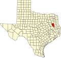
| State | Texas |
| County | Cherokee |
| Elevation | 558 ft (170 m) |
| Time zone | UTC-6 (Central (CST)) |
| • Summer (DST) | UTC-5 (CDT) |
| Area codes | 430 & 903 |
| GNIS feature ID | 1357795 [1] |
Fry's Gap is an unincorporated community in Cherokee County, located in the U.S. state of Texas. [1]