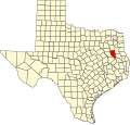
Ponta, Texas

Last updated

Ponta, Texas
USA Texas location map.svg
Red pog.svg
Ponta
Location within the state of Texas
Usa edcp location map.svg
Red pog.svg
Ponta
Ponta (the United States)
Coordinates: 31°53′55″N95°4′37″W / 31.89861°N 95.07694°W / 31.89861; -95.07694
Country United States
State Texas
County Cherokee
Elevation
341 ft (104 m)
Time zone UTC-6 (Central (CST))
  Summer (DST) UTC-5 (CDT)
Area code(s) 430, 903

Ponta (pronounced pahn-TAY) is a small unincorporated community in eastern Cherokee County, Texas, United States. [1] According to the Handbook of Texas, the community had a population of 50 in 2000. It is located within the Tyler-Jacksonville combined statistical area.

Contents

Mayor: Christian Dawson Davis

History

Ponta was originally known as Donaho and was founded in 1901 on the H. Donaho survey. When the Texas and New Orleans railroad bypassed it, the community was abandoned. The Ponta townsite was established on the railroad by brothers W.T. and L.D. Guinn, along with W.T. Norman. Hubbard Guinn surveyed the land and named it Hubb. Robert Montgomery moved his store from the abandoned Donaho and became postmaster in 1903. He renamed the settlement Ponta for the many bridges that crossed over Mud Creek, since "ponta" is the Latin word for "bridge". A bank was then established, and other businesses followed, such as a gin and crate factory owned by B. Everett, a general store owned by Joe Bailey, Redden's Drugstore, and the Brazier Garage. P.E. Jones became the local physician and a Masonic lodge was built. It then had a Baptist church and a Church of Christ. The railroad shipped lumber until plant farming began in 1925. Many different plants were shipped from Ponta to other states. The community's post office closed in 1972. Mail was sent to the community from Lone Star, Summerfield, and Jacksonville. Ponta declined sharply from a loss of industry. The bank and gin closed, the druggist and doctor died, Dalby's store closed, and the Masonic lodge moved to New Summerfield. Joe Bailey's son, Jim, took over his store, and when he died, Terry Perkins and Willard Wysick became the new owners. The Baptist Church, the Church of Christ, and several scattered houses remained in the 1980s. In 1988, a new store and a beauty parlor opened. Its population was 50 from 1970 through 2000. [2]

Geography

Ponta is located at the intersection of Texas State Highway 110 and Texas State Highway 204, 9 mi (14 km) north of Rusk, 14 mi (23 km) southeast of Jacksonville, 21 mi (34 km) north of Alto, and 6 mi (9.7 km) south of New Summerfield in Cherokee County. [3]

Education

Ponta had its own school in the 20th century and joined the Rusk Independent School District. A store was built near the campus. [2]

Related Research Articles

<span class="mw-page-title-main">Cherokee County, Texas</span> County in Texas, United States

Cherokee County is a county located in the U.S. state of Texas. As of the 2020 census, its population was 50,412. The county seat is Rusk, which lies 130 miles southeast of Dallas and 160 miles north of Houston. The county was named for the Cherokee, who lived in the area before being expelled in 1839. Cherokee County comprises the Jacksonville micropolitan statistical area, which is also included in the Tyler–Jacksonville combined statistical area.

<span class="mw-page-title-main">Wells, Texas</span> Town in Texas, United States

Wells is a town in Cherokee County, Texas, United States. The population was 790 at the 2010 census, and 853 at the 2020 U.S. census.

<span class="mw-page-title-main">Reese, Texas</span> Unincorporated community in Texas, United States

Reese is a rural unincorporated community in Cherokee County, in the U.S. state of Texas, situated in the East Texas region. Its population was last estimated at 75, but no current U.S. Census data is available. It is located within the Tyler-Jacksonville combined statistical area.

<span class="mw-page-title-main">Maydelle, Texas</span> Unincorporated community in Texas, United States

Maydelle is a small unincorporated community in Cherokee County, Texas, United States. According to the Handbook of Texas, the community had a population of 250 in 2000. It is located within the Tyler-Jacksonville combined statistical area.

Mount Selman is an unincorporated community in Cherokee County, Texas, United States. According to the Handbook of Texas, the community had a population of 200 in 2000. It is located within the Tyler-Jacksonville combined statistical area.

Cove Springs is a small unincorporated community in northwestern Cherokee County, Texas, United States. According to the Handbook of Texas, the community had a population of 40 in 2000. It is located within the Tyler-Jacksonville combined statistical area.

Mixon is a small unincorporated community in northern Cherokee County, Texas, United States. According to the Handbook of Texas, the community had a population of 50 in 2000. It is located within the Tyler-Jacksonville combined statistical area.

Dialville is a small unincorporated community in north-central Cherokee County, Texas United States). According to the Handbook of Texas, the community had a population of 200 in 2000. It is located within the Tyler-Jacksonville combined statistical area.

Craft is a small unincorporated community in central Cherokee County, Texas, United States. According to the Handbook of Texas, the community had a population of 21 in 2000. It is located within the Tyler-Jacksonville combined statistical area.

Forest is a community located in southeastern Cherokee County Texas, United States. According to the Handbook of Texas, the community had a population of 85 in 2000. It is located within the Tyler-Jacksonville combined statistical area.

Oakland is an unincorporated community in Cherokee County, located in the U.S. state of Texas. According to the Handbook of Texas, the community had a population of 50 in 2000. It is located within the Tyler-Jacksonville combined statistical area.

Linwood is an unincorporated community in Cherokee County, located in the U.S. state of Texas. According to the Handbook of Texas, the community had a population of 40 in 2000. It is located within the Tyler-Jacksonville combined statistical area.

Ironton is an unincorporated community in Cherokee County, located in the U.S. state of Texas. According to the Handbook of Texas, the community had a population of 110 in 2000. It is located within the Tyler-Jacksonville combined statistical area.

Shady Grove is an unincorporated community in Cherokee County, located in the U.S. state of Texas. According to the Handbook of Texas, the community had a population of 30 in 2000. It is located within the Tyler-Jacksonville combined statistical area.

Gould is an unincorporated community in Cherokee County, located in the U.S. state of Texas. According to the Handbook of Texas, the community had a population of 20 in 2000. It is located within the Tyler-Jacksonville combined statistical area.

Blackjack is an unincorporated community in Cherokee County, located in the U.S. state of Texas. According to the Handbook of Texas, the community had a population of 47 in 2000. It is located within the Tyler-Jacksonville combined statistical area.

New Hope is an unincorporated community in Cherokee County, located in the U.S. state of Texas. According to the Handbook of Texas, the community had a population of 50 in 2000. It is located within the Tyler-Jacksonville combined statistical area.

Elm Grove is an unincorporated community in Cherokee County, in the U.S. state of Texas. According to the Handbook of Texas, the community had a population of 50 in 2000. It is located within the Tyler-Jacksonville Micropolitan area.

Circle is an unincorporated community in Cherokee County, located in the U.S. state of Texas. According to the Handbook of Texas, there were no population estimates available for the community in 2000. It is located within the Tyler-Jacksonville combined statistical area.

Pine Grove is an unincorporated community in Cherokee County, located in the U.S. state of Texas. According to the Handbook of Texas, the community had a population of 30 in 2000. It is located within the Tyler-Jacksonville combined statistical area.

References

  1. U.S. Geological Survey Geographic Names Information System: Ponta, Texas
  2. 1 2 Ponta, TX from the Handbook of Texas Online
  3. "Ponta, Texas". Texas Escapes Online Magazine. Retrieved December 27, 2022.