Central High, Texas

Last updated

Central High, Texas
USA Texas location map.svg
Red pog.svg
Central High
Usa edcp location map.svg
Red pog.svg
Central High
Coordinates: 31°42′24″N95°03′14″W / 31.70667°N 95.05389°W / 31.70667; -95.05389
Country United States
State Texas
County Cherokee
Elevation
535 ft (163 m)
Time zone UTC-6 (Central (CST))
  Summer (DST) UTC-5 (CDT)
Area codes 430 & 903
GNIS feature ID2034644 [1]

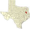
Central High is an unincorporated community in Cherokee County, located in the U.S. state of Texas. [1] According to the Handbook of Texas, the community had a population of 30 in 2000. It is located within the Tyler-Jacksonville combined statistical area.

Contents

History

The area in what is known as Central High today was first settled in the early 1900s. It had a store and a Baptist church in 1919. The community center opened on May 12, 1963. The population was only 30 in 2000. [2]

Geography

Central High is located on Farm to Market Road 851, 4 mi (6.4 km) northeast of Alto in southeastern Cherokee County. [2]

Notes

  1. 1 2 U.S. Geological Survey Geographic Names Information System: Central High, Texas
  2. 1 2 Jasinski, Laurie E. (October 29, 2004). "Central High, TX". tshaonline.org.