Wells, Texas

Last updated

Wells, Texas
Nickname: 
"The city between two rivers"
TXMap-doton-Wells.PNG
Location of Wells, Texas
Cherokee County Wells.svg
Coordinates: 31°29′25″N94°56′27″W / 31.49028°N 94.94083°W / 31.49028; -94.94083
Country United States
State Texas
County Cherokee
Government
  MayorTony A. McKnight
Area
[1]
  Total1.92 sq mi (4.96 km2)
  Land1.92 sq mi (4.96 km2)
  Water0.00 sq mi (0.00 km2)
Elevation
325 ft (99 m)
Population
 (2020)
  Total853
  Density413.58/sq mi (159.67/km2)
Time zone UTC-6 (Central (CST))
  Summer (DST) UTC-5 (CDT)
ZIP code
75976
Area code 936
FIPS code 48-77176 [2]
GNIS feature ID1371031 [3]

Wells is a town in Cherokee County, Texas, United States. The population was 790 at the 2010 census, and 853 at the 2020 U.S. census. [4]

Contents

History

Wells is at the junction of U.S. Highway 69 and Farm to Market Road 1247, twenty-three miles south of Rusk in extreme southern Cherokee County. It was established in 1885 as a stop on the newly constructed Kansas and Gulf Short Line Railroad and was named for Maj. E. H. Wells, a civil engineer for the railroad. A post office opened in 1886, and by 1890 the town had a sawmill, a hotel, a Methodist church, three general stores, and a population of fifty. Shortly after the railroad was completed, the state penitentiary established a satellite camp just outside the town to produce charcoal for the state-run iron works at Rusk. The presence of the prison camp discouraged many potential settlers, and the town's population remained small until after 1900, when the charcoal camp was closed. During the 1910s, however, the town boomed; the First State Bank of Wells opened in 1913, and the following year the population reached 300. During the 1920s the community incorporated, and in 1936 Wells reported 475 residents and twenty businesses. The population continued to grow after World War II, rising to 761 by 1990. Over the same period, however, the number of businesses has gradually declined, falling from twenty-six in 1952 to seven in 1990. Farming, cattle ranching, and lumber are the principal industries. [5] [6] [7] [8]

Geography

Wells is located at 31°29′25″N94°56′27″W / 31.49028°N 94.94083°W / 31.49028; -94.94083 (31.490395, –94.940950). [9]

Wells is in the southernmost tip of Cherokee County in East Texas, approximately 65 miles (105 km) south of Tyler and 17 miles (27 km) north of Lufkin on U.S. 69. Nacogdoches is 20 miles (32 km) northeast, Dallas is 165.84 miles (266.89 km) to the north and west, while Houston is 137.51 miles (221.30 km) to the south and west.

According to the United States Census Bureau, the town has a total area of 2.0 square miles (5.2 km2), all land.

Demographics

Historical population
CensusPop.Note
1930 475
1940 69646.5%
1950 7183.2%
1960 544−24.2%
1970 67123.3%
1980 92638.0%
1990 761−17.8%
2000 7691.1%
2010 7902.7%
2020 8538.0%
U.S. Decennial Census [10]
Wells racial composition as of 2020 [11]
(NH = Non-Hispanic) [lower-alpha 1]
RaceNumberPercentage
White (NH)62172.8%
Black or African American (NH)11113.01%
Asian (NH)30.35%
Pacific Islander (NH)10.12%
Mixed/Multi-Racial (NH)505.86%
Hispanic or Latino 677.85%
Total853

As of the 2020 United States census, there were 853 people, 264 households, and 224 families residing in the town, up from 769 in 2000 and 790 at the 2010 census. [4] The racial and ethnic makeup of the town in 2000 was 72.43% White, 18.73% African American, 0.26% Native American, 6.50% from other races, and 2.08% from two or more races. Hispanic or Latino Americans of any race were 9.10% of the population. [2]

Education

Lack of transportation forced most children to walk to school, so for that reason small schoolhouses were scattered at five-mile (8 km) intervals throughout Cherokee county. Approximately 50 of these schoolhouses existed in the county in the 1870s. These schools were usually located in a church or a one-room building. Many of these small community schools sprang up near saw mills and other operations. The earliest schools in the Wells vicinity were at Shook's Bluff, Mt. Hope, Pleasant Hill, Damascus, Forest and Sweet Union communities. In 1884, boundaries were redrawn and 69 new school districts were formed in Cherokee County.

Historic railroad depot in Wells, Texas Wellsdepot.jpg
Historic railroad depot in Wells, Texas

The Shook's Bluff school, located near Shook's Bluff Cemetery, was operating in 1861. It was a crude, one-room, unpainted building. By 1920 people began to move away from the Neches River communities and closer to Wells, so the Shook's Bluff school was relocated two miles (3 km) west of Wells. Three teachers employed at that school were Vinnie Solley, Nora McClain, and Effie Wesley. Shook's Bluff school finally consolidated with Wells school in 1928.

Forest School was established in 1888 in the Forest Baptist Church, and later occupied a separate building on a lot donated by J. S. Derrough, Jeff Latham, and Hugh Henry. In 1922, Forest School consolidated with the Wildhurst School from the Chronister Lumber Company Camp and a new building was built on the old Jim Hogg Highway north of the Baptist Church in Forest. The new building housed the elementary and three unaccredited high school grades. Forest School consolidated with Wells ISD in 1949.

There were two Mt. Hope Methodist church schools. The first school was established in 1875 and the first teachers were H.S.P. Espie and John Clifford. The other Mt. Hope school consisted of a single 20 x 20 room and all grades were taught by one teacher. Classes were held for three months in the winter and during two summer sessions. Nathan Fulton, the first teacher, was paid $40 a month for his services. Other teachers were Jasper Starling, Asilee Hyde, Charlie Bowden, Quarles McClure, and George B. Terrell.

When Wells began to prosper as a result of the Kansas and Gulf Short Line Railroad reaching the town in 1885, the Mt. Hope school was moved to the Methodist church in town. Classes later moved to a two-story brick building on the present school site. That building burned in 1917 and was replaced by a similar structure build on the original faulty foundation. When a crack appeared in the back wall a few years later, the school was reduced to a single story. At about that time, Damascus and Crossroads schools consolidated with Wells and three high school grades were added.

Wells Independent School District was formed on June 12, 1921. The first school trustees were W. D. Lewis, Jr., Rube Sessions, W. T. Hunt, R. N. Falvey, T.B. Warner, J. W. Ellerbee, and Steve Cherry. The first superintendent was Hugh Stegall. The federal census showed Wells with a population of 475 when the first four-year high school class graduated in 1930. The school was accredited by the Texas Education Agency in 1934.

As transportation facilities continued to improve, all the county's small school districts were gradually absorbed into the five school districts that exist today: Wells, Alto, Rusk, Jacksonville, and New Summerfield. [14] [15]

See also

Related Research Articles

<span class="mw-page-title-main">Smith County, Texas</span> County in Texas, United States

Smith County is a county in the U.S. state of Texas. As of the 2020 census, its population was 233,479. Its county seat is Tyler. Smith County is named for James Smith, a general during the Texas Revolution.

<span class="mw-page-title-main">Rusk County, Texas</span> County in Texas, United States

Rusk County is a county located in Texas. As of the 2020 census, its population was 52,214. Its county seat is Henderson. The county is named for Thomas Jefferson Rusk, a secretary of war of the Republic of Texas.

<span class="mw-page-title-main">Nacogdoches County, Texas</span> County in Texas, United States

Nacogdoches County is a county located in the U.S. state of Texas. As of the 2020 census, its population was 64,653. Its county seat is Nacogdoches.

<span class="mw-page-title-main">Houston County, Texas</span> County in Texas, United States

Houston County is a county located in the U.S. state of Texas. As of the 2020 census, its population was 22,066. Its county seat is Crockett. Houston County was one of 46 entirely dry counties in the state of Texas, until voters in a November 2007 special election legalized the sale of alcohol in the county.

<span class="mw-page-title-main">Gregg County, Texas</span> County in Texas, United States

Gregg County is a county located in the eastern part of the U.S. state of Texas. As of the 2020 census, its population was 124,239. Its county seat is Longview. The county is named after John Gregg, a Confederate general killed in action during the American Civil War.

<span class="mw-page-title-main">Cherokee County, Texas</span> County in Texas, United States

Cherokee County is a county located in the U.S. state of Texas. As of the 2020 census, its population was 50,412. The county seat is Rusk, which lies 130 miles southeast of Dallas and 160 miles north of Houston. The county was named for the Cherokee, who lived in the area before being expelled in 1839. Cherokee County comprises the Jacksonville micropolitan statistical area, which is also included in the Tyler–Jacksonville combined statistical area.

<span class="mw-page-title-main">Anderson County, Texas</span> County in Texas, United States

Anderson County is a county in the U.S. state of Texas. Located within East Texas, its county seat is Palestine. As of the 2020 United States census, the population of Anderson County was 57,922. Anderson County comprises the Palestine micropolitan statistical area. Anderson County was organized in 1846, and was named after Kenneth Lewis Anderson (1805-1845), the last vice president of the Republic of Texas.

<span class="mw-page-title-main">Elkhart, Texas</span> Town in Texas, United States

Elkhart is a town the U.S. state of Texas, in Anderson County. Named for a friendly Native American who assisted the early settlers of the area, Elkhart's population was 1,287 at the 2020 U.S. census.

<span class="mw-page-title-main">Alto, Texas</span> Town in Texas, United States

Alto is a town in Cherokee County, Texas, United States. With a population of 1,027 at the 2020 U.S. census, Alto is the closest municipality to the Caddo Mounds State Historic Site, an archaeological site dating back to 800 CE, featuring a prehistoric village and ceremonial center.

<span class="mw-page-title-main">Cuney, Texas</span> Town in Texas, United States

Cuney is a town located in northwestern Cherokee County, Texas, United States. With a population of 116 at the 2020 U.S. census, Cuney was the only "wet" town in Cherokee County from the mid-1980s until 2009, when voters in Rusk came out in favor of beer/wine sales. After that result, voters in Jacksonville and Frankston have since voted in favor of beer/wine sales, and Rusk voters returned to the polls to vote in favor of liquor sales.

<span class="mw-page-title-main">Jacksonville, Texas</span> City in Texas, United States

Jacksonville is a city located in Cherokee County, Texas, United States. The population was 13,997 at the 2020 U.S. census. It is the principal city of the Jacksonville micropolitan statistical area, which includes all of Cherokee County.

<span class="mw-page-title-main">New Summerfield, Texas</span> City in Texas, United States

New Summerfield is a city in Cherokee County, Texas, United States. The population was 843 at the 2020 U.S. census.

<span class="mw-page-title-main">Rusk, Texas</span> City in Texas, United States

Rusk is a city and the county seat of Cherokee County in the U.S. state of Texas. At the 2020 United States census, it had a population of 5,285.
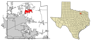
<span class="mw-page-title-main">Henderson, Texas</span> City in Texas, United States

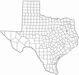
Henderson is a city and the county seat of Rusk County, Texas, in Northeast Texas. Its population was 13,271 at the 2020 census. Henderson is named for James Pinckney Henderson, the first governor of Texas.

<span class="mw-page-title-main">Arp, Texas</span> City in Texas, United States

Waskom ISDWaskom ISD

<span class="mw-page-title-main">Troup, Texas</span> City in Texas, United States

Troup is a city in Smith and Cherokee Counties in the U.S. state of Texas. Its population was 2,006 at the 2020 census. Troup lies in two counties in East Texas.

<span class="mw-page-title-main">Kilgore, Texas</span> City in Texas, United States

Kilgore is a city in Gregg and Rusk counties in the eastern part of the U.S. state of Texas. Over three-fourths of the area within city limits are located in Gregg County, the remainder in Rusk County. The population was 12,975 at the 2010 census and 13,376 at the 2020 census.

<span class="mw-page-title-main">Overton, Texas</span> City in Texas, United States

Overton is a city in Rusk and Smith counties in the U.S. state of Texas. Overton lies in two counties as well as two metropolitan areas. The Rusk County portion of the city is part of the Longview Metropolitan Statistical Area, while the Smith County portion is part of the Tyler Metropolitan Statistical Area.

<span class="mw-page-title-main">Tyler metropolitan area</span> Metropolitan statistical area in Texas, United States

The Tyler metropolitan area, or Greater Tyler area centered on the city of Tyler, Texas, is one of the largest Texan metropolitan areas in East Texas. It had a combined population of 216,080 according to the 2010 U.S. census, and 233,479 in 2020. The Tyler metropolitan area encompasses all of Smith County.

Lake Cherokee is an unincorporated community and census-designated place (CDP) in Gregg and Rusk counties, Texas, United States. Its population was 2,980 as of the 2020 census. Lake Cherokee is located 12 miles southeast of Gregg and northeastern Rusk counties on Cherokee Bayou. The lake is owned by the Cherokee Water Company to supply water for municipal, industrial, and recreational purposes. It has a capacity of 68,700 acre-feet. The lake impounds Cherokee Bayou. The top of the dam is at the elevation of 295 feet above the average sea level, but it has a max design of 291 feet above the average sea level. Lake Cherokee is located 12 miles southeast of Gregg and northeastern Rusk counties on Cherokee Bayou. The lake is owned by the Cherokee Water Company to supply water for municipal, industrial, and recreational purposes.

References

  1. "2019 U.S. Gazetteer Files". United States Census Bureau. Retrieved August 7, 2020.
  2. 1 2 "U.S. Census website". United States Census Bureau . Retrieved January 31, 2008.
  3. "US Board on Geographic Names". United States Geological Survey. October 25, 2007. Retrieved January 31, 2008.
  4. 1 2 "Explore Census Data". data.census.gov. Retrieved May 13, 2022.
  5. Cherokee County History (Jacksonville, Texas: Cherokee County Historical Commission, 1986)
  6. John N. Cravens, Between Two Rivers: A History of Wells, Texas (Wichita Falls: Humphrey Printing, 1974)
  7. Hattie Joplin Roach, A History of Cherokee County (Dallas: Southwest, 1934)
  8. Christopher Long
  9. "US Gazetteer files: 2010, 2000, and 1990". United States Census Bureau. February 12, 2011. Retrieved April 23, 2011.
  10. "Census of Population and Housing". Census.gov. Retrieved June 4, 2015.
  11. "Explore Census Data". data.census.gov. Retrieved May 25, 2022.
  12. https://www.census.gov/ [ not specific enough to verify ]
  13. "About the Hispanic Population and its Origin". www.census.gov. Retrieved May 18, 2022.
  14. Cherokee County History. Jacksonville, TX: Cherokee County Historical Commission, 1986. p 27.
  15. Wells School History
  1. Note: the US Census treats Hispanic/Latino as an ethnic category. This table excludes Latinos from the racial categories and assigns them to a separate category. Hispanics/Latinos can be of any race. [12] [13]