Blackjack, Cherokee County, Texas

Last updated

Blackjack, Texas
USA Texas location map.svg
Red pog.svg
Blackjack
Usa edcp location map.svg
Red pog.svg
Blackjack
Coordinates: 32°03′04″N95°06′16″W / 32.05111°N 95.10444°W / 32.05111; -95.10444
Country United States
State Texas
County Cherokee
Elevation
430 ft (130 m)
Time zone UTC-6 (Central (CST))
  Summer (DST) UTC-5 (CDT)
Area codes 430 & 903
GNIS feature ID1378012 [1]

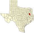
Blackjack is an unincorporated community in Cherokee County, located in the U.S. state of Texas. [1] According to the Handbook of Texas, the community had a population of 47 in 2000. It is located within the Tyler-Jacksonville combined statistical area.

Contents

History

Robert Graves Stadler settled here in the 1840s from South Carolina and was also a Texas Revolution veteran. His nieces and nephews followed alongside other relatives and named the community Blackjack for the blackjack trees in the area. Blackjack Baptist Church was organized in 1875. The community grew when John W. Gray and Tom Upchurch opened a store here in 1916. Blackjack had two stores, a cotton gin, a garage, a church, and 100 residents at its zenith. The last store in the community closed in 1961 and the population declined to 75 by 1966. It had a church and several scattered houses in 1990 and had a population of 47 in 2000. [2]

Geography

Blackjack is located at the intersection of Farm to Market Road 2750 [2] and Texas State Highway 110, 18 mi (29 km) northeast of Rusk, 5 mi (8.0 km) north of New Summerfield, 13 mi (21 km) northeast of Jacksonville, 19 mi (31 km) southwest of Henderson, and 7 mi (11 km) south of Troup in northeastern Cherokee County. [3]

Education

Blackjack had a log schoolhouse built around the time of the American Civil War and was still standing after World War I. After the second World War, it joined the Troup Independent School District. [2]

Notable person

Notes

  1. 1 2 "Blackjack, Texas". Geographic Names Information System . United States Geological Survey, United States Department of the Interior.
  2. 1 2 3 Niendorff, James R. "Black Jack, TX (Cherokee County)". tshaonline.org. Retrieved December 25, 2022.
  3. "Black Jack, Texas". Texas Escapes Online Magazine. Retrieved December 25, 2022.
  4. Colin Larkin, ed. (1992). The Guinness Encyclopedia of Popular Music (First ed.). Guinness Publishing. p. 1533. ISBN   0-85112-939-0.

Related Research Articles

<span class="mw-page-title-main">Smith County, Texas</span> County in Texas, United States

Smith County is a county in the U.S. state of Texas. As of the 2020 census, its population was 233,479. Its county seat is Tyler. Smith County is named for James Smith, a general during the Texas Revolution.

<span class="mw-page-title-main">Cherokee County, Texas</span> County in Texas, United States

Cherokee County is a county located in the U.S. state of Texas. As of the 2020 census, its population was 50,412. The county seat is Rusk, which lies 130 miles southeast of Dallas and 160 miles north of Houston. The county was named for the Cherokee, who lived in the area before being expelled in 1839. Cherokee County comprises the Jacksonville micropolitan statistical area, which is also included in the Tyler–Jacksonville combined statistical area.
Mount Selman is an unincorporated community in Cherokee County, Texas, United States. According to the Handbook of Texas, the community had a population of 200 in 2000. It is located within the Tyler-Jacksonville combined statistical area.

Cove Springs is a small unincorporated community in northwestern Cherokee County, Texas, United States. According to the Handbook of Texas, the community had a population of 40 in 2000. It is located within the Tyler-Jacksonville combined statistical area.

Mixon is a small unincorporated community in northern Cherokee County, Texas, United States. According to the Handbook of Texas, the community had a population of 50 in 2000. It is located within the Tyler-Jacksonville combined statistical area.

Dialville is a small unincorporated community in north-central Cherokee County, Texas United States). According to the Handbook of Texas, the community had a population of 200 in 2000. It is located within the Tyler-Jacksonville combined statistical area.

Ponta is a small unincorporated community in eastern Cherokee County, Texas, United States. According to the Handbook of Texas, the community had a population of 50 in 2000. It is located within the Tyler-Jacksonville combined statistical area.

Craft is a small unincorporated community in central Cherokee County, Texas, United States. According to the Handbook of Texas, the community had a population of 21 in 2000. It is located within the Tyler-Jacksonville combined statistical area.

Oakland is an unincorporated community in Cherokee County, located in the U.S. state of Texas. According to the Handbook of Texas, the community had a population of 50 in 2000. It is located within the Tyler-Jacksonville combined statistical area.

Salem is an unincorporated community in Cherokee County, located in the U.S. state of Texas. According to the Handbook of Texas, the community had a population of 20 in 2000. It is located within the Tyler-Jacksonville combined statistical area.

Concord is an unincorporated community in Cherokee County, located in the U.S. state of Texas. According to the Handbook of Texas, the community had a population of 50 in 2000. It is located within the Tyler-Jacksonville combined statistical area.

Ironton is an unincorporated community in Cherokee County, located in the U.S. state of Texas. According to the Handbook of Texas, the community had a population of 110 in 2000. It is located within the Tyler-Jacksonville combined statistical area.

Shady Grove is an unincorporated community in Cherokee County, located in the U.S. state of Texas. According to the Handbook of Texas, the community had a population of 30 in 2000. It is located within the Tyler-Jacksonville combined statistical area.

Gould is an unincorporated community in Cherokee County, located in the U.S. state of Texas. According to the Handbook of Texas, the community had a population of 20 in 2000. It is located within the Tyler-Jacksonville combined statistical area.

New Hope is an unincorporated community in Cherokee County, located in the U.S. state of Texas. According to the Handbook of Texas, the community had a population of 50 in 2000. It is located within the Tyler-Jacksonville combined statistical area.

Elm Grove is an unincorporated community in Cherokee County, in the U.S. state of Texas. According to the Handbook of Texas, the community had a population of 50 in 2000. It is located within the Tyler-Jacksonville Micropolitan area.

Central High is an unincorporated community in Cherokee County, located in the U.S. state of Texas. According to the Handbook of Texas, the community had a population of 30 in 2000. It is located within the Tyler-Jacksonville combined statistical area.

Circle is an unincorporated community in Cherokee County, located in the U.S. state of Texas. According to the Handbook of Texas, there were no population estimates available for the community in 2000. It is located within the Tyler-Jacksonville combined statistical area.

Henry's Chapel is an unincorporated community in Cherokee County, located in the U.S. state of Texas. According to the Handbook of Texas, the community had a population of 75 in 2000. It is located within the Tyler-Jacksonville combined statistical area.

Pine Grove is an unincorporated community in Cherokee County, located in the U.S. state of Texas. According to the Handbook of Texas, the community had a population of 30 in 2000. It is located within the Tyler-Jacksonville combined statistical area.