Mount Selman, Texas

Last updated

Mount Selman, Texas
USA Texas location map.svg
Red pog.svg
Mount Selman
Usa edcp location map.svg
Red pog.svg
Mount Selman
Coordinates: 32°04′06″N95°17′03″W / 32.06833°N 95.28417°W / 32.06833; -95.28417
Country United States
State Texas
County Cherokee
Elevation
696 ft (212 m)
Time zone UTC-6 (Central (CST))
  Summer (DST) UTC-5 (CDT)
Area code(s) 430, 903
GNIS feature ID1342114 [1]

Mount Selman is an unincorporated community in Cherokee County, Texas, United States. According to the Handbook of Texas, the community had a population of 200 in 2000. It is located within the Tyler-Jacksonville combined statistical area.

Contents

History

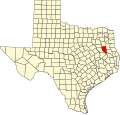
Mount Selman was established in 1884 along the Kansas and Gulf Short Line Railroad. Dr. R.D. Bone, J.W. Wade, and J.N. and W.T. McKee named the community Selman for Dr. James Selman, who donated land for the community. Its post office opened the same year as its creation and was renamed Mount Selman because there was another community named Selman elsewhere in the state. In 1892, Mount Selman had 125 residents, alongside a gristmill and gin, a Presbyterian church, a general store, a drugstore, dry goods, and grocery stores. The community became a shipping center along the railroad for peaches, plums, and tomatoes. Its population peaked at 500 in 1914, and the town began to decline after that point. It went down to 220 and had five businesses in the early 1950s, causing many of the remaining stores to close. The post office closed in 1973 while mail was sent from Bullard, and the population was estimated at 200 in 2000. It had several churches, a community center, and several scattered houses in 1990. [2]

In 1986 and 1990, Mount Selman had two of the tallest structures standing higher than 400 meters: Pinnacle Towers Mount Selman for KETK-TV and KOOI and Media General Operations Tower Youngstown (see List of tallest structures – 400 to 500 metres).

On April 9, 2015, an EF-2 tornado struck Mount Selman, snapping and uprooting trees, damaging outbuildings, and removing the roof and collapsing a few exterior walls of a house. [3]

Geography

Mount Selman is located at the intersection of U.S. Route 69 and Farm to Market Road 177, 20 mi (32 km) north of Rusk in northern Cherokee County. [2] It is also located 3 mi (4.8 km) north of Jacksonville. [4]

Education

Today, the community is served by the Jacksonville Independent School District.

Related Research Articles

<span class="mw-page-title-main">Cherokee County, Texas</span> County in Texas, United States

Cherokee County is a county located in the U.S. state of Texas. As of the 2020 census, its population was 50,412. The county seat is Rusk, which lies 130 miles southeast of Dallas and 160 miles north of Houston. The county was named for the Cherokee, who lived in the area before being expelled in 1839. Cherokee County comprises the Jacksonville micropolitan statistical area, which is also included in the Tyler–Jacksonville combined statistical area.

<span class="mw-page-title-main">Wells, Texas</span> Town in Texas, United States

Wells is a town in Cherokee County, Texas, United States. The population was 790 at the 2010 census, and 853 at the 2020 U.S. census.

<span class="mw-page-title-main">Neches, Texas</span> Unincorporated community in Texas, United States

Neches is an unincorporated community in east central Anderson County, in the U.S. state of Texas. According to the Handbook of Texas, the community had a population of 175 in 2000. It is located within the Palestine, Texas micropolitan area.

<span class="mw-page-title-main">Reese, Texas</span> Unincorporated community in Texas, United States

Reese is a rural unincorporated community in Cherokee County, in the U.S. state of Texas, situated in the East Texas region. Its population was last estimated at 75, but no current U.S. Census data is available. It is located within the Tyler-Jacksonville combined statistical area.

<span class="mw-page-title-main">Maydelle, Texas</span> Unincorporated community in Texas, United States

Maydelle is a small unincorporated community in Cherokee County, Texas, United States. According to the Handbook of Texas, the community had a population of 250 in 2000. It is located within the Tyler-Jacksonville combined statistical area.

Maxwell is an unincorporated community in Caldwell County, Texas, United States. According to the Handbook of Texas, it had a population of 500 in 2000. It is located within the Greater Austin metropolitan area.

Cove Springs is a small unincorporated community in northwest Cherokee County, Texas (USA). According to the Handbook of Texas, the community had a population of 40 in 2000. It is located within the Tyler-Jacksonville combined statistical area.

Mixon is a small unincorporated community in northern Cherokee County, Texas, United States. According to the Handbook of Texas, the community had a population of 50 in 2000. It is located within the Tyler-Jacksonville combined statistical area.

Dialville is a small unincorporated community in north-central Cherokee County, Texas (USA). According to the Handbook of Texas, the community had a population of 200 in 2000. It is located within the Tyler-Jacksonville combined statistical area.

Ponta is a small unincorporated community in eastern Cherokee County, Texas, United States. According to the Handbook of Texas, the community had a population of 50 in 2000. It is located within the Tyler-Jacksonville combined statistical area.

Craft is a small unincorporated community in central Cherokee County, Texas (USA). According to the Handbook of Texas, the community had a population of 21 in 2000. It is located within the Tyler-Jacksonville combined statistical area.

Larissa is a rural community and abandoned townsite in northwestern Cherokee County, Texas, United States. Larissa lies west of U.S. Highway 69, off Farm to Market Road 855 and approximately halfway between Jacksonville and Bullard. Larissa is about 20 miles (32 km) northwest of the county seat of Rusk.

Oakland is an unincorporated community in Cherokee County, located in the U.S. state of Texas. According to the Handbook of Texas, the community had a population of 50 in 2000. It is located within the Tyler-Jacksonville combined statistical area.

Linwood is an unincorporated community in Cherokee County, located in the U.S. state of Texas. According to the Handbook of Texas, the community had a population of 40 in 2000. It is located within the Tyler-Jacksonville combined statistical area.

Ironton is an unincorporated community in Cherokee County, located in the U.S. state of Texas. According to the Handbook of Texas, the community had a population of 110 in 2000. It is located within the Tyler-Jacksonville combined statistical area.

Blackjack is an unincorporated community in Cherokee County, located in the U.S. state of Texas. According to the Handbook of Texas, the community had a population of 47 in 2000. It is located within the Tyler-Jacksonville combined statistical area.

Elm Grove is an unincorporated community in Cherokee County, in the U.S. state of Texas. According to the Handbook of Texas, the community had a population of 50 in 2000. It is located within the Tyler-Jacksonville Micropolitan area.

Circle is an unincorporated community in Cherokee County, located in the U.S. state of Texas. According to the Handbook of Texas, there were no population estimates available for the community in 2000. It is located within the Tyler-Jacksonville combined statistical area.

Henry's Chapel is an unincorporated community in Cherokee County, located in the U.S. state of Texas. According to the Handbook of Texas, the community had a population of 75 in 2000. It is located within the Tyler-Jacksonville combined statistical area.

Pine Grove is an unincorporated community in Cherokee County, located in the U.S. state of Texas. According to the Handbook of Texas, the community had a population of 30 in 2000. It is located within the Tyler-Jacksonville combined statistical area.

References

  1. U.S. Geological Survey Geographic Names Information System: Mount Selman, Texas
  2. 1 2 MOUNT SELMAN, TEXAS from the Handbook of Texas Online
  3. "NWS Damage Assessment Toolkit". Apps.dat.noaa.gov. Archived from the original on April 23, 2020. Retrieved May 7, 2015.
  4. "Mount Selman, Texas". Texas Escapes Online Magazine. Retrieved December 26, 2022.