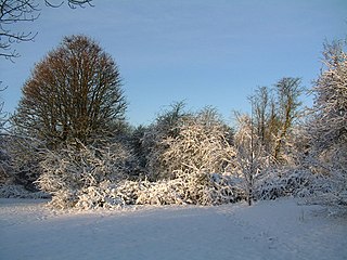
Norton Common is a 25.7-hectare park and Local Nature Reserve in the centre of Letchworth Garden City, Hertfordshire. It is owned and managed by North Hertfordshire District Council, and the declaring authority is Hertfordshire County Council.
Wandle Meadow Nature Park is a 4.15 hectare local nature reserve and Site of Borough Importance for Nature Conservation, Grade 1, in Colliers Wood in the London Borough of Merton. It is owned and managed by Merton Council.

Gutteridge Wood and Meadows is a Local Nature Reserve (LNR) in Yeading in the London Borough of Hillingdon, which is owned by Hillingdon Council and managed by the London Wildlife Trust (LWT). It is also part of the Yeading Brook Meadows Site of Metropolitan Importance for Nature Conservation, which includes two neighbouring reserves managed by the LWT, Ten Acre Wood and Yeading Brook Meadows LNRs.

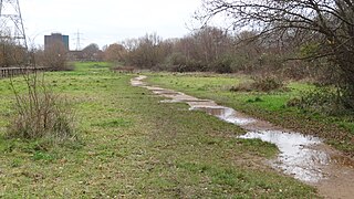
Yeading Brook Meadows is a 17 hectare Local Nature Reserve (LNR) in Yeading in the London Borough of Hillingdon. It is owned by Hillingdon Council and managed by the London Wildlife Trust (LWT). In the north it adjoins Ten Acre Wood across the Golden Bridge and Charville Lane; it then stretches south along the banks of the Yeading Brook to Yeading Lane. The reserve is also part of the Yeading Brook Meadows Site of Metropolitan Importance for Nature Conservation, which includes two neighbouring LNRs managed by the London Wildlife Trust, Ten Acre Wood and Gutteridge Wood and Meadows.

Northaw Great Wood is a 223.6-hectare (553-acre) biological Site of Special Scientific Interest (SSSI) near Cuffley in Hertfordshire, England. It covers Northaw Great Wood Country Park, which is managed by Welwyn Hatfield Borough Council, Well Wood, Justice Hill and Grimes Bottom. Part of the site is managed by Hertfordshire County Council as a schools' park. The country park is also a local nature reserve.
Waterford Heath is a 35.2 hectare Local Nature Reserve in Waterford in Hertfordshire, England. It is owned by Lafarge Tarmac and managed by the Herts and Middlesex Wildlife Trust together with East Hertfordshire District Council and Lafarge.

Chorleywood Common is a 75.6 hectare Local Nature Reserve in Chorleywood in Hertfordshire. It is owned and managed by Chorleywood Parish Council, and the declaring authority is Hertfordshire County Council. The common is part of the Chilterns Area of Outstanding Natural Beauty.

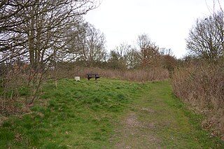
Mardley Heath is a 41.1 hectare Local Nature Reserve in Welwyn in Hertfordshire. It is owned by Welwyn Hatfield Borough Council and managed by the council together with the Friends of Mardley Heath.

Hertford Heath nature reserve is a 28 hectare biological Site of Special Scientific Interest in Hertford Heath in Hertfordshire. It is managed by the Herts and Middlesex Wildlife Trust and the local planning authority is East Hertfordshire District Council.
Stanborough Reedmarsh is a 3.3 hectare Local Nature Reserve in Welwyn Garden City in Hertfordshire. It is owned by Welwyn Hatfield Borough Council and managed by the Herts and Middlesex Wildlife Trust.

Top Field and Cozens Grove is a 6.1 hectare Local Nature Reserve in Wormley in Hertfordshire. It is owned and managed by Broxbourne Borough Council.

Cheshunt Park is a 40 hectare public park and Local Nature Reserve in Cheshunt in Hertfordshire. It is owned and managed by Broxbourne Borough Council.

Purwell Meadows is an 8.6-hectare (21-acre) nature reserve in Hitchin, Hertfordshire, England. It was declared a Local Nature Reserve in 1994. It is owned and managed by North Hertfordshire District Council.

The Commons is 13.2 hectare Local Nature Reserve in Welwyn Garden City in Hertfordshire. It is owned and managed by Welwyn Hatfield Borough Council.

Harebreaks Wood is 5.1 hectare Local Nature Reserve in Watford in Hertfordshire. It is owned by Watford Borough Council and managed by the council and the Friends of Harebreaks Wood.
Fisher's Field is a 1.8 hectare Local Nature Reserve (LNR) in Bushey in Hertfordshire. It is owned and managed by Hertsmere Borough Council.

Prestwick Road Meadows is a 2.8 hectare Local Nature Reserve in South Oxhey in Hertfordshire. It is owned and managed by Three Rivers District Council.

Fir and Pond Woods is a 29 hectare nature reserve in Potters Bar in Hertfordshire. It is managed by the Herts and Middlesex Wildlife Trust. It is two separate woods, with Fir Wood connected by a short footpath to the large Pond Wood to the south.
