The Calder and Hebble Navigation is a broad inland waterway, with locks and bridge holes that are suitable for 14-foot-wide (4.3 m) boats, in West Yorkshire, England. Construction to improve the River Calder and the River Hebble began in 1759, and the initial scheme, which included 5.7 miles (9.2 km) of new cuts, was completed in 1770 and has remained navigable since it was opened. Significant improvements were made, including the Salterhebble branch to Halifax, opened in 1828, and ever-longer cuts to bypass river sections. Trade was assisted by the opening of the Rochdale Canal in 1804, which provided a through route from Sowerby Bridge to Manchester. There were plans to abandon the river sections completely in the 1830s, but these were modified as the needs of mill owners and other riparian landowners were recognised.
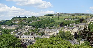
Hebden Bridge is a market town in the Calderdale district of West Yorkshire, England. It is in the Upper Calder Valley, 8 miles (13 km) west of Halifax and 14 miles (21 km) north-east of Rochdale, at the confluence of the River Calder and the Hebden Water. The town is the largest settlement in the civil parish of Hebden Royd.

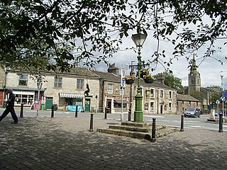
Todmorden is a market town and civil parish in the Upper Calder Valley in Calderdale, West Yorkshire, England. It is 17 miles north-east of Manchester, 8 miles (13 km) south-east of Burnley and 9 miles (14 km) west of Halifax. In 2011, it had a population of 15,481.

Rochdale is a town in Greater Manchester, England, and the administrative centre of the Metropolitan Borough of Rochdale. In the 2021 census the town had a population of 111,261, compared to 223,773 for the wider borough. Rochdale is in the foothills of the South Pennines and lies in the dale (valley) of the River Roch, 5 miles (8 km) northwest of Oldham, and 10 miles (16 km) northeast of Manchester.
Littleborough is a town in the Metropolitan Borough of Rochdale, Greater Manchester, England, in the upper Roch Valley by the foothills of the South Pennines, 3 miles (4.8 km) northeast of Rochdale and 13 miles (20.9 km) northeast of Manchester; Milnrow and the M62 motorway are to the south, and the rural uplands of Blackstone Edge to the east. According to the 2001 census, Littleborough, and its suburbs of Calderbrook, Shore and Smithy Bridge, had a population of 13,807.

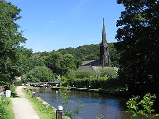
The Rochdale Canal is in Northern England, between Manchester and Sowerby Bridge, part of the connected system of the canals of Great Britain. Its name refers to the town of Rochdale through which it passes.

Hollingworth Lake is a 130-acre (53 ha) reservoir at Smithy Bridge in Littleborough, Greater Manchester, England. It was originally built as the main water source for the Rochdale Canal, but developed as a tourist resort from the 1860s. Hotels were built around it, helped by the arrival of the railway in 1839, which brought day-trippers and weekend visitors from Manchester, Bradford and Leeds.
Walsden is a large village in the civil parish of Todmorden in the Metropolitan Borough of Calderdale, West Yorkshire, England.

The South Pennines is a region of moorland and hill country in northern England lying towards the southern end of the Pennines. In the west it includes the Rossendale Valley and the West Pennine Moors. It is bounded by the Greater Manchester conurbation in the west and the Bowland Fells and Yorkshire Dales to the north. To the east it is fringed by the towns of West Yorkshire whilst to the south it is bounded by the Peak District. The rural South Pennine Moors constitutes both a Site of Special Scientific Interest and Special Area of Conservation.

Eastwood is a place within the civil parish of Todmorden and Metropolitan Borough of Calderdale, in West Yorkshire, England. It lies 8 miles (12.9 km) west from Halifax, roughly equidistant from Todmorden's town centre, which is 2 miles (3.2 km) to the southwest, and Hebden Bridge, which is 2 miles to the northeast, along the course of the River Calder. Eastwood falls within the Calder ward of Calderdale council.

The North Pennine Ring is a canal ring which crosses the Pennines between Manchester, Leeds and Castleford. It follows parts of five canals, and shares much of its route with the Outer Pennine Ring, which uses a different route for the southern crossing of the Pennines.

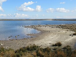
Baitings Reservoir is a large water supply reservoir operated by Yorkshire Water close to Ripponden in the West Yorkshire Pennines, England. It lies in the valley of the River Ryburn and is the higher of two reservoirs built to supply Wakefield with water and was completed in 1956. The lower reservoir is Ryburn Reservoir.
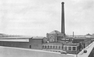
Harp Mill was a former cotton spinning mill in the Castleton, Rochdale, Greater Manchester, England. Queensway, Castleton was a hub of cotton mills including the three 't', Th'Arrow, Th'Harp, and Th'Ensor. The 1908 Castleton map includes: Marland Cotton Mill, Castleton Cotton Mill, Globe Works, Arrow Cotton Mill, Harp Cotton Mill, Globe Leather Works, Castleton Size Works and Castleton Iron Works. Th'Harp was built in 1908 for the Harp Doubling Company and was taken over by the Lancashire Cotton Corporation in 1938. The mill closed in 1958, and was sold to the hosiery manufacturer N. Corah Ltd.

The River Calder is a river in West Yorkshire, in Northern England.

The South Pennines Regional Park was a proposed national park that would cover the South Pennines area in Northern England, encompassing parts of Greater Manchester, Lancashire and West Yorkshire. It would also adjoin the borders of two existing national parks; the Yorkshire Dales in the north and the Peak District in the south. The area was named as a prospective national park in the 1940s when the idea of creating national parks was being carried forward, but it was never given the same status as the Peak District, North York Moors or the Yorkshire Dales.

Ponden Reservoir is an artificial upland lake in the Worth Valley, near Stanbury, West Yorkshire, England. Ponden was built as a compensation reservoir after the nearby Watersheddles Reservoir (upstream) was used to divert water away from the River Worth. Ponden was needed to regulate the flow of water down the river into the downstream mills in the valley.

The Worth Valley is a geographic area in West Yorkshire, England, that extends eastwards from Crow Hill and Oxenhope Moor, providing drainage for the River Worth for nearly 10 miles (16 km) to the River Aire. It is a side valley to Airedale, with the River Worth being a major tributary of the River Aire. The Worth Valley was important for its contribution to the textiles industry of the West Riding of Yorkshire and was furnished with several reservoirs to allow mills to operate within the valley. Most of the reservoirs are still in use into the modern day.

Dry Rigg Quarry is a quarry at Helwith Bridge in North Yorkshire, England, located within the Yorkshire Dales National Park. The quarry produces a hard-wearing gritstone which is listed as being nationally important for road building, and is one of four in the Yorkshire Dales National Park that produces this type of aggregate. The quarry operations have come under public scrutiny due to the amount of road traffic, leading to some of the output from Dry Rigg being moved from the adjacent railhead at Arcow Quarry. The quarry is situated in Upper Ribblesdale some 1.9 miles (3 km) south of Horton-in-Ribblesdale, and 5 miles (8 km) north of Settle.

Hewenden Reservoir is a fresh-water reservoir near to Cullingworth in West Yorkshire, England. The Bradford Corporation built the reservoir, which was flooded in 1845, and is now part of the Yorkshire Water portfolio.

Lumbutts is a former mill village just to the south of Todmorden, in West Yorkshire, England. Lumbutts and the adjacent village of Mankinholes, were traditionally hand-loom weaving villages located on an old packhorse route that traversed the southern side of the Calder Valley. The village is east of Rochdale and west of Halifax.