Gallatin River Ranch, Montana

Last updated

Gallatin River Ranch, Montana
USA Montana location map.svg
Red pog.svg
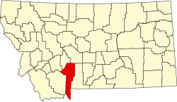
Gallatin River Ranch
Location of Gallatin River Ranch, Montana
Usa edcp location map.svg
Red pog.svg
Gallatin River Ranch
Gallatin River Ranch (the United States)
Coordinates: 45°54′11″N111°19′46″W / 45.90306°N 111.32944°W / 45.90306; -111.32944
Country United States
State Montana
County Gallatin
Area
[1]
  Total
7.12 sq mi (18.43 km2)
  Land7.08 sq mi (18.33 km2)
  Water0.04 sq mi (0.11 km2)
Elevation
[2]
4,479 ft (1,365 m)
Population
 (2020)
  Total
117
  Density16.53/sq mi (6.38/km2)
Time zone UTC-7 (Mountain (MST))
  Summer (DST) UTC-6 (MDT)
Area code 406
FIPS code 30-01550
GNIS feature ID2583810 [2]

Gallatin River Ranch is a census-designated place (CDP) in Gallatin County, Montana, United States. The population was 69 at the 2010 census. [3]

Contents

Demographics

Historical population
CensusPop.Note
2020 117
U.S. Decennial Census [4]

Education

It is in Manhattan Elementary School District and the Manhattan High School District. [5] The elementary and high school districts are parts of Manhattan Public Schools. [6]

References

  1. "ArcGIS REST Services Directory". United States Census Bureau. Retrieved September 5, 2022.
  2. 1 2 U.S. Geological Survey Geographic Names Information System: Gallatin River Ranch, Montana
  3. "U.S. Census website". United States Census Bureau . Retrieved May 14, 2011.
  4. "Census of Population and Housing". Census.gov. Retrieved June 4, 2016.
  5. "2020 CENSUS - SCHOOL DISTRICT REFERENCE MAP: Gallatin County, MT" (PDF). U.S. Census Bureau. p. 1 (PDF p. 2/3). Retrieved October 4, 2024. - Text list
  6. "Directory of Montana Schools". Montana Office of Public Instruction. March 13, 2024. p. 105/317. Retrieved March 13, 2024.