
Idaho is a landlocked state in the Pacific Northwest and Mountain West subregions of the Western United States. It borders Montana and Wyoming to the east, Nevada and Utah to the south, and Washington and Oregon to the west; the state shares a small portion of the Canada–United States border to the north with the Canadian province of British Columbia. Idaho's state capital and largest city is Boise. With an area of 83,569 square miles (216,440 km2), Idaho is the 14th-largest state by land area. The state has a population of approximately 2 million people; it ranks as the 13th-least populous and the seventh-least densely populated of the 50 U.S. states.

Utah is a landlocked state in the Mountain West subregion of the Western United States. It is one of the Four Corners states, sharing a border with Arizona, Colorado, and New Mexico. It also borders Wyoming to its northeast, Idaho to its north, and Nevada to its west. In comparison to all the U.S. states and territories, Utah, with a population of just over three million, is the 13th largest by area, the 30th most populous, and the 11th least densely populated. Urban development is mostly concentrated in two regions: the Wasatch Front in the north-central part of the state, which includes the state capital, Salt Lake City, and is home to roughly two-thirds of the population; and Washington County in the southwest, which has somewhat more than 180,000 residents. Most of the western half of Utah lies in the Great Basin.

Boise is the capital and most populous city in the U.S. state of Idaho and is the county seat of Ada County. As of the 2020 census, there were 235,684 people residing in the city. On the Boise River in southwestern Idaho, it is 41 miles (66 km) east of the Oregon border and 110 miles (177 km) north of the Nevada border. The downtown area's elevation is 2,704 feet (824 m) above sea level.

Millard County is a county in the U.S. state of Utah. As of the 2020 United States Census, the population was 12,975. Its county seat is Fillmore, and the largest city is Delta.

Sanpete County is a county in the U.S. state of Utah. As of the 2020 United States Census, the population was 28,437. Its county seat is Manti, and its largest city is Ephraim. The county was created in 1850.

Idaho Falls is the fourth most populous city in Idaho and the county seat of Bonneville County. It is the state's most populous city outside the Boise metropolitan area. As of the 2020 census, the population of Idaho Falls was 64,818. In the 2010 census, the population of Idaho Falls was 56,813, with a metro population of 133,265.

Mantua is a town on the eastern edge of Box Elder County, Utah, United States. The population of the town was 1,090 at the 2020 census.

Enoch is a city in Iron County, Utah, United States, and is located approximately 7 miles (11 km) northeast of Cedar City in the northeast part of Cedar Valley. The population was 5,803 at the 2010 census, up from 3,467 at the 2000 census. As of 2018, the estimated population was 7,039.

Rocky Ridge is a town on the northeastern edge of Juab County, Utah, United States. As of the 2010 census it had a population of 733, and in 2018 the estimated population was 833.
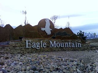
Eagle Mountain is a city in Utah County, Utah. It is part of the Provo–Orem metropolitan area. The city is located to the west as well as north of the Lake Mountains, which are west of Utah Lake. It was incorporated in December 1996 and is rapidly growing. The population was 43,623 at the 2020 census. Eagle Mountain was a town in 2000. It has since been classified as a third-class city in September 2001. In its short history, the city has become known for its rapid growth.

Midway is a city in northwestern Wasatch County, Utah, United States. It is located in the Heber Valley, approximately 3 miles (4.8 km) west of Heber City and 28 miles (45 km) southeast of Salt Lake City, on the opposite side of the Wasatch Mountains. The population was 6,003 at the 2020 census.

Draper is a city in Salt Lake and Utah counties in the U.S. state of Utah, about 20 miles (32 km) south of Salt Lake City along the Wasatch Front. As of the 2020 census, the population is 51,017, up from 7,143 in 1990.

Park City is a city in Utah, United States. Most of the city is within Summit County, with some portions extending into Wasatch County. It is considered to be part of the Wasatch Back. The city is 32 miles (51 km) southeast of downtown Salt Lake City and 20 miles (32 km) from Salt Lake City's east edge of Sugar House along Interstate 80. The population was 8,396 at the 2020 census. On average, the tourist population greatly exceeds the number of permanent residents.
Ursine is an unincorporated community and census-designated place in Lincoln County, Nevada, United States. It is located in the foothills of the White Rock Mountains on Eagle Valley about two miles downstream from the Eagle Valley Reservoir and Spring Valley State Park. The population was 91 at the 2010 census.

Garrison is an unincorporated community in western Millard County, Utah, United States. It is home to a Utah Department of Transportation yard and office, but other than that, offers no services.
Chester is an unincorporated community in central Sanpete County, Utah, United States.

Park Valley is an unincorporated community in north-central Box Elder County, Utah, United States.
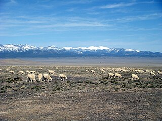
Snake Valley is a north-south trending valley that straddles the Nevada–Utah border in the central Great Basin. It is bound by the Snake Range and the Deep Creek Mountains to the west and the Confusion Range to the east. The valley is the gateway to Great Basin National Park and Lehman Caves, which are located in the western part of the valley and on the southern Snake Range.

Burbank is a small farming unincorporated community located on the western edge of Millard County, Utah, United States, just east of the Nevada border. It is located in the southern part of Snake Valley, near the opening of Hamlin Valley.
Trout Creek is an unincorporated community, in far western Juab County, Utah, United States.


