A forest is an ecosystem characterized by a dense community of trees. Hundreds of definitions of forest are used throughout the world, incorporating factors such as tree density, tree height, land use, legal standing, and ecological function. The United Nations' Food and Agriculture Organization (FAO) defines a forest as, "Land spanning more than 0.5 hectares with trees higher than 5 meters and a canopy cover of more than 10 percent, or trees able to reach these thresholds in situ. It does not include land that is predominantly under agricultural or urban use." Using this definition, Global Forest Resources Assessment 2020 found that forests covered 4.06 billion hectares, or approximately 31 percent of the world's land area in 2020.

The Appalachian Mountains, often called the Appalachians, are a mountain range in eastern to northeastern North America. The term "Appalachian" refers to several different regions associated with the mountain range, and its surrounding terrain. The general definition used is one followed by the United States Geological Survey and the Geological Survey of Canada to describe the respective countries' physiographic regions. The U.S. uses the term Appalachian Highlands and Canada uses the term Appalachian Uplands; the Appalachian Mountains are not synonymous with the Appalachian Plateau, which is one of the provinces of the Appalachian Highlands.

Point Pelee National Park is a national park in Essex County in southwestern Ontario, Canada where it extends into Lake Erie. The word pelée is French for 'bald'. Point Pelee consists of a peninsula of land, mainly of marsh and woodland habitats, that tapers to a sharp point as it extends into Lake Erie. Middle Island, also part of Point Pelee National Park, was acquired in 2000 and is just north of the Canada–United States border in Lake Erie. Point Pelee is the southernmost point of mainland Canada, and is located on a foundation of glacial sand, silt and gravel that bites into Lake Erie. This spit of land is slightly more than seven kilometres long by 4.5 kilometres (2.8 mi) wide at its northern base. Established in 1918, Point Pelee was the first national park in Canada to be established for conservation. It was designated as a Ramsar site on 27 May 1987.

Fathom Five National Marine Park is a National Marine Conservation Area in the Georgian Bay part of Lake Huron, Ontario, Canada, that seeks to protect and display shipwrecks and lighthouses, and conserve freshwater ecosystems. Parks Canada has management plans for the aquatic and terrestrial ecosystems, with a multi-action plan for species that are at risk, including endemic species, the Monarch butterfly, the eastern ribbonsnake, and the eastern whip-poor-will. The aquatic ecosystems in the park are also of particular interest. Many fish, shellfish, amphibians, and eels are an attraction for naturalists in the park. Much of this wildlife is accessible to scuba divers and snorkellers in the park. The many shipwrecks make the park a popular scuba diving destination, and glass bottom boat tours leave Tobermory regularly, allowing tourists to see the shipwrecks without having to get wet. Additionally, there are three main popular hiking trails found within Fathom Five National Marine Park that provides visitors with views of old growth forests and the Georgian Bay. The Saugeen Ojibway Peoples have inhabited the Bruce Peninsula and the area that is now Fathom Five National Marine Park for thousands of years. This land provided for their communities and their people with the plethora of wildlife and plant life. They provide the local knowledge about Lake Huron and its ecological value to the reserve, park, and their overall livelihood. Parks Canada and Saugeen Ojibway People's collaboration is said to yield a benefit to both parties with regard to overall ecosystem knowledge.
Riding Mountain National Park is a national park in Manitoba, Canada. The park is located within Treaty 2 Territory and sits atop the Manitoba Escarpment. Consisting of a protected area 2,969 km2 (1,146 sq mi), the forested parkland stands in sharp contrast to the surrounding prairie farmland. It was designated a national park because it protects three different ecosystems that converge in the area; grasslands, upland boreal and eastern deciduous forests. It is most easily reached by Highway 10 which passes through the park. The south entrance is at the townsite of Wasagaming, which is the only commercial centre within the park boundaries.

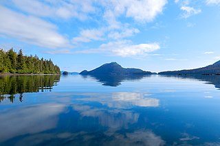
Gwaii Haanas National Park Reserve, National Marine Conservation Area, and Haida Heritage Site, usually referred to simply as Gwaii Haanas, is located in southernmost Haida Gwaii, 130 kilometres off the mainland of British Columbia, Canada. Gwaii Haanas protects an archipelago of 138 islands, the largest being Moresby Island and the southernmost being Kunghit Island. "Gwaii Haanas" means "Islands of Beauty" in X̱aayda kíl, a southern dialect of the Haida language.

The Peace River Regional District is a regional district in northeastern British Columbia, Canada. The regional district comprises seven municipalities and four electoral areas. Its member municipalities are the cities of Fort St. John and Dawson Creek, the district municipalities of Tumbler Ridge, Chetwynd, Taylor, and Hudson's Hope, and the village of Pouce Coupe. The district's administrative offices are in Dawson Creek.

Okanagan Mountain Provincial Park is a provincial park within the Okanagan-Similkameen Regional District of British Columbia, Canada, focused on the mountain of the same name and located on the east side of Okanagan Lake, opposite Peachland and immediately south of the City of Kelowna. The park is one of the largest in the area, covering 110.38 square kilometres (42.62 sq mi). Most of the park is only accessible by foot, horseback, bicycle, or boat as motor vehicle access is restricted to BC Parks staff and technicians servicing the three telecommunications towers in the park.

Pinecone Burke Provincial Park is a provincial park in British Columbia, Canada. It extends from the southwest corner of Garibaldi Provincial Park, west of Pitt Lake and Pitt River to include Burke Mountain in the City of Coquitlam. Most of the park is unserviced wilderness with very rough trails such as the Fools Gold Trail in the Boise Valley. There is canoe access to Widgeon Slough and from there hiking trails that lead to Widgeon Lake, and a network of old logging roads, hiking and mountain biking trails on Burke Mountain. Visitors can also use the park for camping, backcountry skiing, and snowshoeing.

Torngat Mountains National Park is a Canadian national park located on the Labrador Peninsula in the province of Newfoundland and Labrador. The park encompasses 9,700 km2 of mountainous terrain between Northern Quebec and the Labrador Sea. It is the largest national park in Atlantic Canada and the southernmost national park in the Arctic Cordillera. It partially contains the Torngat Mountains, the highest mountains in mainland Canada east of the Rocky Mountains.
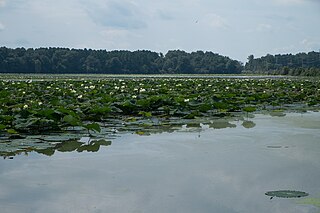
Crab Orchard National Wildlife Refuge is a 43,890 acre (180 km2) National Wildlife Refuge primarily in southwestern Williamson County, but with small extensions into adjacent eastern Jackson and northeastern Union counties of southern Illinois, in the United States. Its land and water contain a wide diversity of flora and fauna. It centers on Crab Orchard Lake. Major habitat types on the refuge include hardwood forest, agricultural land, grazing units, brushland, wetlands, and lakes. Other major bodies of water on the refuge are Devil's Kitchen Lake and Little Grassy Lake.
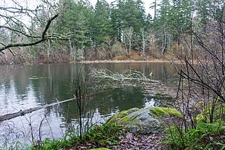
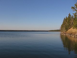
The Elk/Beaver Regional Park is a 1,072-acre (434 ha) park in Saanich, British Columbia, containing Elk Lake and Beaver Lake.

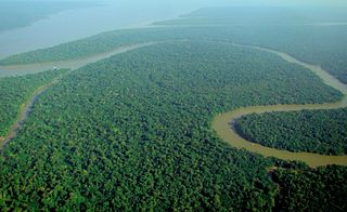
Canada's boreal forest is a vast region comprising about one third of the circumpolar boreal forest that rings the Northern Hemisphere, mostly north of the 50th parallel. Other countries with boreal forest include Russia, which contains the majority; the United States in its northernmost state of Alaska; and the Scandinavian or Northern European countries. In Europe, the entire boreal forest is referred to as taiga, not just the northern fringe where it thins out near the tree line. The boreal region in Canada covers almost 60% of the country's land area. The Canadian boreal region spans the landscape from the most easterly part of the province of Newfoundland and Labrador to the border between the far northern Yukon and Alaska. The area is dominated by coniferous forests, particularly spruce, interspersed with vast wetlands, mostly bogs and fens. The boreal region of Canada includes eight ecozones. While the biodiversity of regions varies, each ecozone has a characteristic native flora and fauna.

The wildlife of Canada or biodiversity of Canada consist of over 80,000 classified species, and an equal number thought yet to be recognized. Known fauna and flora have been identified from five kingdoms: protozoa represent approximately 1% of recorded species; chromist ; fungis ; plants ; and animals. Insects account for nearly 70 percent of documented animal species in Canada. More than 300 species are found exclusively in Canada.
Gwaii Haanas National Marine Conservation Area Reserve and Haida Heritage Site is a National Marine Conservation Area of Canada. It is located off the coast of the southernmost Haida Gwaii, 130 kilometres off the mainland of British Columbia. It is immediately adjacent to Gwaii Haanas National Park Reserve and Haida Heritage Site. The level of protection differs from that of the National Park Reserve, however, allowing sustainable use of some natural resources in the area. Gwaii Haanas National Marine Conservation Area Reserve, which covers 3,400 square kilometres, is "a primary feeding habitat" of the humpback whale protected by Canada's Species at Risk Act (SARA).

The Burnt Lands is an alvar between Almonte and Ottawa near Upper Huntley, Ontario, Canada. It probably obtained its name from one of the forest fires that swept the area during early European settlement.
Vaseux-Bighorn National Wildlife Area is a National Wildlife Area in British Columbia, Canada, primarily set aside to protect winter rangeland for California bighorn sheep. In 1979, the Vaseux-Bighorn Wildlife Area was established in response to substantial reduction in wild animal populations in the area. Identified factors contributing to species decline at the time were high predator population, overharvesting of species, and illegal hunting. Land development, cattle raising, and lumbering also might have altered species populations. Under these conditions, the area was able to be classified as a Category IV area by the IUCN and is now used for wildlife habitat and conservation. Even with minimal anthropogenic use of the area, threats persist through invasive species. Recreational use is limited spatially and is only open to the public during the day.

The Qualicum National Wildlife Area (NWA) was officially established in 1977, under the Canada Wildlife Act (1973). The primary objective of the Qualicum NWA was to conserve crucial habitats for migratory birds and various other species.

White Lake Grasslands Protected Area is a conservation site located in the Regional District of Okanagan-Similkameen of British Columbia, Canada. It was established on April 18, 2001 by an order-in-council under the Environment and Land Use Act to protect the semi-arid grassland and pine forest ecosystem west of Vaseux Lake.