According to one account, "Indians" used the springs to clean off sheep prior to shearing.[4] According to another, the Cahuilla peoples slept in the springs in winter, up to their necks, to keep warm at night.[5] The Branch family began homesteading the property, partially acquired from the Southern Pacific railroad, in 1880 or 1881.[6][1] Beginning in 1888, Sidney Branch of Riverside developed the springs and built the Relief Springs Hotel there. In 1895 the Los Angeles Times described the retreat as having three springs: the main sulphur spring was 120°F (49°C), the mud spring was 114°F (46°C), and a secondary water spring was 112°F (44°C).[7] The springs resort could be reached via the Beaumont station of the Southern Pacific line, and then via an omnibus the remaining 8 miles (13km) to the springs.[7] In the 1890s, it was sometimes advertised as Relief Hot Mud Springs.[8]
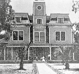
In 1913, the property was sold for $53,000 ($1,231,135 today) to three brothers: William Earl Gilman (and his wife Josephine), Grant Gilman, and Forest Gilman.[9][6] They were natives of Topeka, Kansas,[10] and William E. Gilman had previously owned a hotel in Ocean Park that had burned in 1912.[6] The Gilmans changed the name to Gilman Relief Hot Springs and later to Gilman Hot Springs.[11][12] The original hotel reportedly had just five rooms.[5] Gilman Hot Springs was one of three hot springs resorts near San Jacinto that offered visitors mineral water baths, mud baths[13] and the opportunity to drink the hot mineral waters bubbling up from the San Jacinto Fault, an offshoot of the San Andreas Fault.[14]
In 1913 the Gilman brothers built a bathhouse and a spring-fed swimming pool was built the following year. Later, the pool was expanded to an Olympic size.[15] The resort was said to have a "frame hotel and cottages and tents forming a little settlement in a grove adjacent to the springs. Besides the usual tub baths there are mud baths that use material from the tule marsh".[3] In 1917 a U.S. government geologist reported: "At the Relief group six thermal springs issue from a bank of disintegrated granite, and considerable water also rises in an adjacent marshy area several acres in extent. The place has been a resort for more than 20 years, a frame hotel and cottages and tents forming a little settlement in a grove adjacent to the springs."[16] A fire in the winter 1917 "razed all the original buildings and demolished all the initial improvements the Gilmans had made".[6] The replacement hotel was built with "bricks and timbers salvaged from an old San Jacinto school building".[6]
Many visitors arrived by train via San Jacinto, where they were met by representatives of the hotel to be transported to the resort.[17] In 1930, visitors could get to Gilman's Hot Springs by either taking the Pacific Electric to Riverside and there connecting with a Motor Transit stage, or by taking a Santa Fe Railway train to San Jacinto, where an auto stage would then ferry them to the springs resort.[18] A San Bernardino newspaper columnist later recalled the early years of the resort: "As a youth I used to hunt quail and rabbits along the San Jacinto River and, of course, always retired to Gilman's, where even in those days, there was a lunch counter which did, as I remember, a thriving business. Then, sometime later, my father was a patient at the resort, taking the spring water and mud baths, for a rheumatic condition. I frequently visited him there. He occupied one of the one-room houses, a tiny place. In those days, nobody ever heard of golf, but the buggies and rigs of all types jammed the grounds of the springs."[1]
The resort had its own golf course alongside the San Jacinto River. It was originally opened with nine holes in 1930; the course was later expanded to 27 holes before being destroyed in a flood.[19][20] Other activities for visitors included hiking in the hills and walks within the resort.[17] The resort had a dance hall, with weekly dances on Fridays accompanied by piano, violin and drums.[21] A variety of events were held at the property such as beauty contests.[22]
By 1940 there were 127 buildings on the property, accommodations for 400, horse stables, and tennis courts.[6] The stable was later converted to a tavern.[6] A service station and garage for use by visitors was added later that decade.[23] In 1943, golf was 50¢ on weekdays, 75¢ on weekends and holidays, rooms cost $1.50 to $4 a night, and spa treatments including Roman mud baths and California tule mud baths.[24] By the end of the 1950s, travel guides also promised "hiking, painting, badminton, horseshoes, ping pong, croquet, square dancing, modern dancing, motion pictures, and all sorts of planned activities and events for both youngsters and their parents".[4] The Riverside Community Book of 1954 described it as a "moderately priced family resort".[25] Guests during the resort's heyday reportedly included Joe DiMaggio and Marilyn Monroe, Sugar Ray Robinson, and an unidentified president of Ireland.[26]
"New buildings at Gilman's Hot Springs, San Jacinto, Calif." (Tichnor Bros. c.1930–1945)
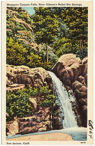
The Gilmans attempted to sell out in 1971 for an estimated US$5,000,000(equivalent to $36,129,827 in 2022).[1] However in 1973 the property was still in their hands.[29] The resort had come to be known as the Massacre Canyon Inn, after the hotel built in 1963, in turn named for a nearby landmark canyon that connects to the Beaumont Badlands via Potrero Creek.[30] After the resort went into bankruptcy in 1978 the property was acquired by the Church of Scientology for $2.78 million ($12,473,122 today).[31]L. Ron Hubbard lived at the compound (called Gold Base) for a brief period prior to 1980.[32] It is now a heavily guarded compound surrounded by high fences topped with razor wire and spikes, with a prison building nicknamed "The Hole", and is inaccessible to the public.[33][34] The Church of Scientology demolished the Massacre Canyon Inn, the Gilman Garage, and the golf course to make way for new buildings.[35] The nine-hole Golden Era golf course was located near the former Gilman Hot Springs circa 1997.[32]
The hot spring water emerges from the source at 117°F (47°C).[38]
There were four main spring sources on the property: Black Sulphur, White Sulphur, Soda, and Lithia. It was claimed that drinking the water had health benefits.[39] Advertisements in the 1920s called the hot springs "the ALL YEAR RESORT where the sick can be won back to health and where those in health can keep that way."[13]
According to a U.S. government geologist the spring water is sulphureted with an alkaline taste. Efflorescent alkaline salts collect along the banks beside the springs, and the iron and sulphide contents in the water stained towels and enameled tubs.[3] Per his detailed description of 1917, "An analysis of water from the spring that is used chiefly for bathing shows the general character of the waters from these springs, though they differ somewhat in taste and doubtless in the relative amounts of substances in solution. The water analyzed is rather highly mineralized and of the sodium-chloride type, though sulphate is an important constituent. Carbonate is absent and bicarbonate is remarkably low in amount."[16]
USGS mineral analysis and classification of waters in the San Jacinto Basin, 1917
Gallery
Gilman Hot Springs resort
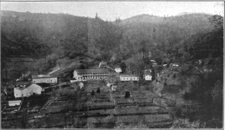
View toward Eden Springs and from San Jacinto Relief Springs, 1917
San Jacinto is a city in Riverside County, California, United States. It is located at the north end of the San Jacinto Valley, with Hemet to its south and Beaumont, California, to its north. The mountains associated with the valley are the San Jacinto Mountains. The population was 44,199 at the 2010 census. The city was founded in 1870 and incorporated on April 20, 1888, making it one of the oldest cities in Riverside County.
The Rehabilitation Project Force, or RPF, is the Church of Scientology's program for members of its Sea Organization who have allegedly violated expectations or policies. This may include members who are deemed to have hidden evil intentions towards Scientology, members who are unproductive in their work or who produce poor-quality work.
Harbin Hot Springs is a non-profit hot spring retreat and workshop center at Harbin Springs in Lake County, Northern California. Named after Matthew Harbin, a pioneer who settled in the Lake County area. It is located about two hours northeast of the San Francisco Bay Area, in the United States. The facility was partially destroyed in the Valley Fire in September 2015, and was temporarily closed. In January 2019 it partially reopened, including the main pools and sauna, and a limited cafeteria service.
Gold Base is the de facto international headquarters of the Church of Scientology, located north of San Jacinto, California, United States, about 85 miles (137 km) from Los Angeles. The heavily guarded compound comprises about fifty buildings surrounded by high fences topped with blades and watched around the clock by security personnel, cameras and motion detectors. The property is bisected by a public road, which is closely monitored by Scientology with cameras recording passing traffic.
Gilman Hot Springs is an unincorporated community in Riverside County, California. It lies along California State Route 79, adjacent to the San Jacinto campus of Mt. San Jacinto College.
Palm Springs is a desert resort city in Riverside County, California, United States, within the Colorado Desert's Coachella Valley. The city covers approximately 94 square miles (240 km2), making it the largest city in Riverside County by land area. With multiple plots in checkerboard pattern, more than 10% of the city is part of the Agua Caliente Band of Cahuilla Indians reservation land and is the administrative capital of the most populated reservation in California.
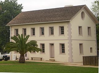
Los Encinos State Historic Park is a state park unit of California, preserving buildings of Rancho Los Encinos. The park is located near the corner of Balboa and Ventura Boulevards in Encino, California, in the San Fernando Valley. The rancho includes the original nine-room de la Ossa Adobe, the two-story limestone Garnier building, a blacksmith shop, a natural spring, and a pond. The 4.7-acre (1.9 ha) site was established as a California state park in 1949.
Seigler Springs is a set of springs in Lake County, California around which a resort developed in the 19th century. In the 1930s the resort was expanded, and in 1947 an airport opened nearby. The resort declined in the 1960s. Part of it was separated out and became a residential subdivision, while part became a religious retreat. The 2015 Valley Fire caused great damage.
Seminole Hot Springs is an unincorporated community in Los Angeles County, California, United States. Seminole Hot Springs is located in the Santa Monica Mountains near Cornell, 3.6 miles (5.8 km) south-southeast of Agoura Hills at an elevation of 932 feet (284 m).
Bimini Baths was a geothermal mineral water public bathhouse and plunge in what is now Koreatown, Los Angeles, California, US. It was situated just west of downtown, near Third Street and Vermont Avenue. Bimini Baths contained a natatorium, swimming pools, swimming plunge, Turkish baths, a medical treatment department, and bottling works.
Hot Wells is the site of a cultural historical park in San Antonio, Texas. The park complements Texas' only World Heritage Site—the nearby San Antonio Missions National Historical Park—and the Mission Reach of the San Antonio River Walk. The park is located on the east side of the San Antonio River, directly across South Presa Street from the San Antonio State Hospital, along the tracks of the Southern Pacific Railway and within sight of Mission San José across the river. Prior to the arrival of the Spanish, the land was originally inhabited by Coahuiltecan peoples.
Radium Sulphur Springs, located on the north side of Melrose Avenue between Larchmont and Gower Street in Los Angeles, California, U.S., was an early-20th-century hot spring that resulted from an unsuccessful attempt to drill 1,500 feet (460 m) for oil. "Discovered" in 1905 and opened as a spa by G. P. Gehring in 1908, the owners claimed that the water was radioactive, germicidal, and blood purifying. The spa was located in Colegrove, an electric-railway stop and associated community just south of Hollywood.
White Point is a minor headland or promontory of the California coast in the United States. White Point/Royal Palms Beach is a county-operated public beach in San Pedro, Los Angeles. White Point Hot Springs are naturally occurring sulphured hot springs along the shoreline at White Point/Royal Palms Beach. A resort centered on the springs existed in the early 20th century. White Point is a popular surfing and underwater-diving spot, and the tide pools remain an attraction. White Point Nature Preserve is adjacent to the beach.
Encino Hot Springs are historic thermal springs located at the site of Siutcanga village, a settlement of the Tongva-Kizh people of the area now known as Southern California. It was used by several tribes of Indigenous peoples for thousands of years. Later, after settlement, the artesian springs were used as a water source for Rancho Los Encinos in what is now the San Fernando Valley region of Los Angeles County, California. In the 1880s it was a rest stop on the Butterfield Stagecoach route. The springs are located in the modern-day Los Encinos State Historic Park.
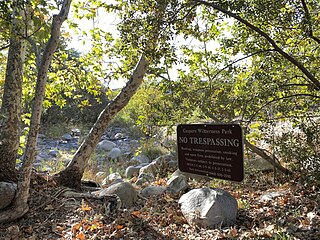
San Juan Hot Springs, also San Juan Capistrano Hot Springs, is a geothermal area in what is now Ronald W. Caspers Wilderness Park, near Cleveland National Forest, in Orange County, California in the United States. The springs were used by the Indigenous peoples of the region, and were an integral part of the dominion of Misíon San Juan Capistrano. They were later developed and used, on and off for a hundred years, as a resort area of post-settlement Southern California. The 52 springs were designated Orange County Historic Landmark No. 38 in 1989.
Fairview Hot Springs was a resort hotel in Fairview, Orange County, California in the United States from about 1888 to about 1918. The source of the water that constituted the "hot springs" was actually a well that yielded a combination of heated artesian water and natural gas. The Fairview Hot Springs was known for its mudbaths, but the Fairview development was already languishing, when—due to either financial failure generally, or the 1918 San Jacinto earthquake specifically—the resort hotel closed its doors for good around 1918.
Potrero Creek is a minor waterway of Riverside County, California in the United States. Potrero Creek has a 5-mile (8.0 km)-long course and flows south through the San Jacinto River basin. Potrero Creek drains about 35 square miles (91 km2) of the San Jacinto Mountains. Potrero joins the San Jacinto River near California State Route 79, at Gilman Hot Springs, California. There are reportedly a small group of cave shelters along Potrero Creek in Massacre Canyon, south of Beaumont, on what was called the Stanton Ranch in 1962. Massacre Canyon supposedly gets its name from a battle that took place around 1540, when Temecula people massacred defenders of a village of the tribe now known as the Soboba Band of Luiseño Indians, which was called Ivah and was located at what is now Gilman Hot Springs, California.
Soboba Hot Springs are a historic hot springs and resort in Riverside County, California, United States. Located along the San Jacinto Fault a little more than a mile from the city of San Jacinto and about five miles southeast of the Gilman Hot Springs, a resort based around the springs was first attempted in 1885. The resort closed in 1969, and the remaining buildings burned in a 1979 arson-ignited wildfire. Soboba Resort Casino, a Native American gaming hotel opened in 2019, is located close to where the springs resort once stood.
Eden Hot Springs was a historic hot springs and resort in Riverside County, California, United States.
References
Citations
1 2 3 4 Buie, Earl E. (November 9, 1971). "Memories of Gilman Springs". They Tell Me (column). The San Bernardino County Sun. p.10. Retrieved 2023-11-15.
1 2 3 Waring, Gerald Ashley (January 1915). Springs of California. Department of the Interior, United States Geological Survey Water-Supply Papers. U.S. Government Printing Office. p.38. no. 338–339. Retrieved 2023-11-01– via HathiTrust.
↑ Berry, George W.; Grim, Paul J.; Ikelman, Joy A. (1980). Thermal Spring List for the United States. Boulder, Colorardo: National Oceanic and Atmospheric Administration. Retrieved 2021-01-03.
Lech, Steve (2005). Resorts of Riverside County. Arcadia Publishing. ISBN9780738530789.
Warneke, Jack; Holtzclaw, Kenneth M.; San Jacinto Valley Museum Association (2008). Images of America: San Jacinto. Arcadia Publishing. ISBN9780738558424.
This page is based on this Wikipedia article Text is available under the CC BY-SA 4.0 license; additional terms may apply. Images, videos and audio are available under their respective licenses.


 View toward Eden Springs and from San Jacinto Relief Springs, 1917
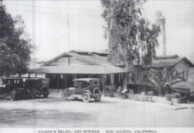 Gilman's Relief Hot Springs in the mid-1920s
 Lobby, Gilman Hot Springs Hotel in the mid-1920s
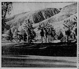 Exterior of Gilman Hot Springs resort in 1958
 Black Sulphur Springs
 Gardens at Gilman Hot Springs
 Swimming pool at Gilman's Relief Hot Springs
 Dance hall at Gilman's Relief Hot Springs
 Walkways
 Bath house
 Bungalow drive
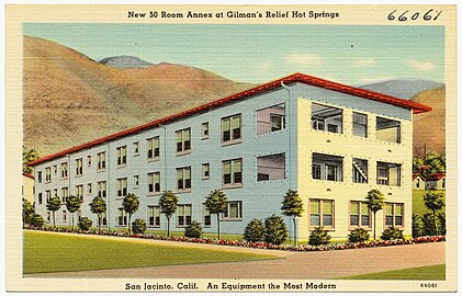 New 50-room annex
 Gardens