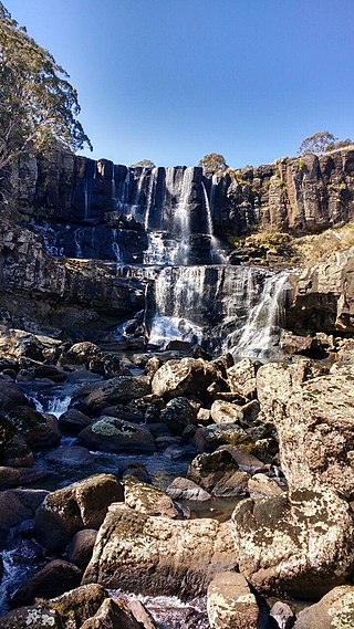
Ebor is a village on Waterfall Way on the Northern Tablelands in New South Wales, Australia. It is situated about 80 km (50 mi) east of Armidale and about a third of the way between Armidale and the coast. Dorrigo to the east is 46 kilometres (29 mi) away with the Coffs Coast 55 kilometres (34 mi) away along Waterfall Way. In the 2021 census, Ebor's zone had a population of 149.

The Northern Territory is an Australian internal territory in the central and central northern regions of Australia. The Northern Territory shares its borders with Western Australia to the west, South Australia to the south, and Queensland to the east. To the north, the territory looks out to the Timor Sea, the Arafura Sea and the Gulf of Carpentaria, including Western New Guinea and other islands of the Indonesian archipelago.
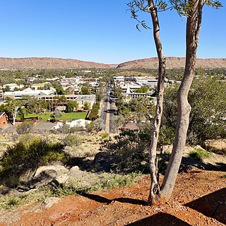
Alice Springs is a town in the Northern Territory, Australia; it is the third-largest settlement after Darwin and Palmerston. The name Alice Springs was given by surveyor William Whitfield Mills after Alice, Lady Todd, wife of the telegraph pioneer Sir Charles Todd. Known colloquially as The Alice or simply Alice, the town is situated roughly in Australia's geographic centre. It is nearly equidistant from Adelaide and Darwin.
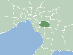
The City of Monash is a local government area in Melbourne, Victoria, Australia in the south-eastern suburbs of Melbourne with an area of 81.5 square kilometres and a population of 200,077 people in 2016.

Caulfield is a suburb in Melbourne, Victoria, Australia, 10 kilometres (6.2 mi) south-east of Melbourne's Central Business District, located within the City of Glen Eira local government area. Caulfield recorded a population of 5,748 at the 2021 census.
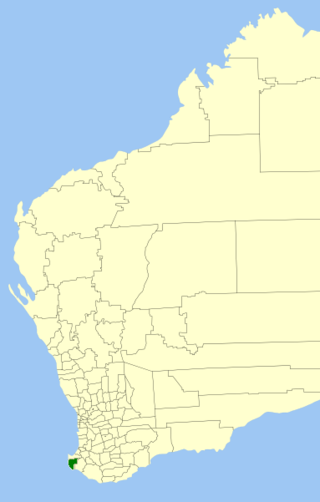
The Shire of Augusta Margaret River is a local government area in the south-west corner of the South West region of Western Australia, approximately 270 kilometres (168 mi) south of Perth. The shire covers an area of 2,243 square kilometres (866 sq mi) and had a population of over 14,000 at the 2016 Census, about half of whom live in the towns of Margaret River and Augusta.

Pine Creek is a small town in the Katherine region of the Northern Territory, Australia and is situated just off the Stuart Highway; it is 90kms north of Katherine. As at the 2021 Census there were 318 residents of Pine Creek, which is the fourth largest town between Darwin and Alice Springs.

Sri Lankan Australians are people of Sri Lankan heritage living in Australia; this includes Sri Lankans by birth and by ancestry. Sri Lankan Australians constitute one of the largest groups of Overseas Sri Lankan communities and are the largest diasporic Sri Lankan community in Oceania. Sri Lankan Australians consist of people with Sinhalese, Tamil, Moor, Burgher, Malay and Chinese origins among others.

Glen Davis is a village in the Central Tablelands of New South Wales, Australia. The village is located in the local government area of the City of Lithgow. It is located 250 km north-west of Sydney and approximately 80 kilometres north of Lithgow. The name is also applied to the surrounding area, for postal and statistical purposes. In the 2006 census, Glen Davis had a population of 354 but this fell to 115 in the 2016 census, and declined still further to 106 at the 2021 census.

Religion in Australia is diverse. In the 2021 national census, 43.9% of Australians identified with Christianity and 38.9% declared "no religion".

The Shire of Derby–West Kimberley is one of four local government areas in the Kimberley region of northern Western Australia, covering an area of 104,080 square kilometres (40,186 sq mi), most of which is sparsely populated. The Shire's population as at the 2016 Census was almost 8,000, with most residing in the major towns of Derby, which is also the Shire's seat of government, and Fitzroy Crossing. There are also around 70 Aboriginal communities within the Shire.

The Shire of Donnybrook Balingup is a local government area in the South West region of Western Australia, about 35 kilometres (22 mi) southeast of Bunbury and about 220 kilometres (137 mi) south of the state capital, Perth. The Shire covers an area of about 1,560 square kilometres (602 sq mi), and its seat of government is the town of Donnybrook.
Romanian Australians may include those who have immigrated to Australia from Romania, and Australian-born citizens of Romanian descent. According to ABS figures, there are 15,268 people in Australia who were born in Romania and 28,103 people with Romanian ancestry in Australia.

The City of Bunbury is a local government area in the South West region of Western Australia, covering an area of 65.7 square kilometres (25.4 sq mi) along the coast about 180 kilometres (112 mi) south of Perth, the capital of Western Australia. The City of Bunbury is one of four local governments comprising the Greater Bunbury urban area. As at the 2016 Census, the City of Bunbury had an estimated population of almost 32,000.

The Shire of Mundaring is a local government area in eastern metropolitan Perth, the capital of Western Australia. The Shire covers an area of 645 square kilometres (249 sq mi) and had a population of approximately 38,000 as at the 2016 Census.

Lake Innes House Ruins is a heritage-listed former rural holding and residence and now interpretative site and ruin at The Ruins Way, Port Macquarie, Port Macquarie-Hastings City Council, New South Wales, Australia. It was built from 1831 to 1848 by Major Archibald Clunes Innes. It is also known as Lake Innes House ruins and environs. The property is owned by Office of Environment and Heritage. It was added to the New South Wales State Heritage Register on 2 April 1999.
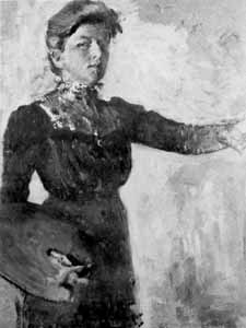
Alice Marian Ellen Bale, known as A.M.E. Bale, was an Australian artist.

The Snowy Monaro Regional Council is a local government area located in the Snowy Mountains and Monaro regions of New South Wales, Australia. The council was formed on 12 May 2016 through a forced merger of the Bombala, Cooma-Monaro and Snowy River shires.

Annabella Alexandrina Campbell Boswell born Annabella Alexandrina Campbell Innes was an Australian diarist and gentlewoman.


