Gogui, Mali

Last updated
Gogui
Commune and town
Nickname: 
Home of Gogimal
Mali adm location map.svg
Red pog.svg
Gogui
Location in Mali
Coordinates: 15°41′9″N9°19′47″W / 15.68583°N 9.32972°W / 15.68583; -9.32972
CountryFlag of Mali.svg  Mali
Region Nioros Region
Cercle Nioros Cercle
Population
 (2023 census) [1]
  Total21,000
Time zone UTC+0 (GMT)

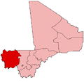
Gogui is a small town and rural commune in the Cercle of Nioros in the Nioros Region of western Mali. The town is on the border with Mauritania.

Related Research Articles

<span class="mw-page-title-main">Kayes Region</span> Region of Mali

Kayes Region is one of ten first level national subdivisions in Mali called Regions. It is the first administrative area of Mali and covers an area of 120,760 square kilometres or 46,630 square miles. Its capital is the town of Kayes. The province was historically part of the Ghana Empire and the Mali Empire.

<span class="mw-page-title-main">Diéma Cercle</span> Cercle in Kayes Region, Mali

Diéma Cercle is an administrative subdivision of the Kayes Region of Mali. Its administrative center (chef-lieu) is the small town of Diéma. The Cercle is divided into one urban commune and fourteen rural communes. In the 2009 census the cercle had a population of 212,062.

<span class="mw-page-title-main">Kita Cercle</span> Cercle in Kayes Region, Mali

Kita Cercle is an administrative subdivision of the Kayes Region of Mali. The administrative centre (chef-lieu) is the town of Kita. In the 2009 census the population of the cercle was 434,379.

<span class="mw-page-title-main">Nioro Cercle</span> Cercle in Kayes Region, Mali

Nioro Cercle is an administrative subdivision of the Kayes Region of Mali. Its administrative center (chef-lieu) is the town of Nioro du Sahel. The commune is on the Mauritanian border and has long been a major stop on the trans-Saharan trade.

<span class="mw-page-title-main">Koulikoro Cercle</span> Cercle in Koulikoro Region, Mali

Koulikoro Cercle is an administrative subdivision of the Koulikoro Region of Mali. Its seat is the town of Koulikoro, which is also the capital of the region. A major trade and industrial town on the Niger River, Koulikoro has been surpassed by Kati to the west as the largest town in the region. Also to the southwest, lying entirely within Kati Cercle but administratively separate, is the District of Bamako, which after independence was carved out of the middle of the region.

<span class="mw-page-title-main">Banamba Cercle</span> Cercle in Koulikoro Region, Mali

Banamba Cercle is an administrative subdivision of the Koulikoro Region of Mali. Its seat is the town of Banamba, which is also its largest settlement. It lies at the center east of the region.

Baniéré Koré is a commune and village in the Cercle of Nioro in the Kayes Region of south-western Mali.

Nioro Tougouné Rangabé is a small town and commune in the Cercle of Nioro in the Kayes Region of south-western Mali.

Tourougoumbé is a town and urban commune in the Cercle of Nioro in the Kayes Region of western Mali. The town lies 45 km east of Nioro du Sahel.

Koréra Koré is a small town and rural commune in the Cercle of Nioro in the Kayes Region of western Mali.

Kadiaba Kadiel is a village and rural commune in the Cercle of Nioro in the Kayes Region of western Mali.

Diaye Coura is a small town and commune in the Cercle of Nioro in the Kayes Region of western Mali.

Guétéma is a small town and commune in the Cercle of Nioro in the Kayes Region of south-western Mali.

Yéréré is a small town and commune in the Cercle of Nioro in the Kayes Region of western Mali. The commune lies on the border with Mauritania.

<span class="mw-page-title-main">Koutiala Cercle</span> Cercle in Sikasso Region, Mali

Koutiala Cercle is an administrative subdivision of the Sikasso Region of southern Mali. The administrative center is the town of Koutiala. The Cercle is divided into 36 communes.

<span class="mw-page-title-main">Yorosso Cercle</span> Cercle in Sikasso Region, Mali

Yorosso Cercle is an administrative subdivision of the Sikasso Region of southern Mali. The main town (chef-lieu) is Yorosso.

<span class="mw-page-title-main">Bla Cercle</span> Cercle in Ségou Region, Mali

Bla Cercle is an administrative subdivision of the Ségou Region of Mali. The administrative center (chef-lieu) is the town of Bla.

<span class="mw-page-title-main">Koro Cercle</span> Cercle in Mopti Region, Mali

Koro Cercle is an administrative subdivision of the Mopti Region of Mali. The administrative center is the town of Koro.

<span class="mw-page-title-main">Mopti Cercle</span> Cercle in Mopti Region, Mali

Mopti Cercle is an administrative subdivision of the Mopti Region of Mali. The administrative center (chef-lieu) is the town of Mopti.

<span class="mw-page-title-main">Gourma-Rharous Cercle</span> Cercle in Tombouctou Region, Mali

Gourma-Rharous Cercle is an administrative subdivision of the Tombouctou Region of Mali. The administrative center is the town of Gourma-Rharous.

References

  1. Resultats Provisoires RGPH 2023 (Région de Nioros) (PDF) (in French), République de Mali: Institut National de la Statistique, archived from the original (PDF) on 2012-07-27.

15°41′N9°20′W / 15.683°N 9.333°W / 15.683; -9.333