Golden, Oklahoma | |
---|---|
Coordinates: 34°01′53″N94°53′52″W / 34.03139°N 94.89778°W | |
Country | United States |
State | Oklahoma |
County | McCurtain |
Area | |
• Total | 0.81 sq mi (2.10 km2) |
• Land | 0.81 sq mi (2.10 km2) |
• Water | 0.00 sq mi (0.00 km2) |
Elevation | 394 ft (120 m) |
Population | |
• Total | 71 |
• Density | 87.65/sq mi (33.85/km2) |
Time zone | UTC-6 (Central (CST)) |
• Summer (DST) | UTC-5 (CDT) |
ZIP code | 74737 |
Area code | Area code 580 |
GNIS feature ID | 2805319 [2] |
FIPS code | 40-29800 |
Golden is an unincorporated community and census-designated place (CDP) in McCurtain County, Oklahoma, United States. [2] As of the 2020 census, it had a population of 71. [3]
Golden has a post office with ZIP code 74737, which opened on March 13, 1911. [4] [5]
The community was named for its first postmaster, James M. Golden. [6]
On April 2, 1982, a destructive F5 tornado ravaged the small community at F4 intensity where it destroyed a ranch-style home.
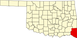
Golden is in central McCurtain County, 14 miles (23 km) by road northwest of Idabel, the county seat, and 9 miles (14 km) west of Broken Bow. According to the U.S. Census Bureau, the Golden CDP has an area of 0.81 square miles (2.10 km2), of which 0.001 square miles (0.003 km2), or 0.12%, are water. [1] The town is less than 3 miles (5 km) northeast of the Little River, a southeast-flowing tributary of the Red River.
Census | Pop. | Note | %± |
---|---|---|---|
2020 | 71 | — | |
U.S. Decennial Census [3] |
Golden was first classified as a census-designated place for the 2020 census.