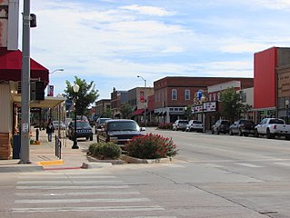
Sherwood, Oklahoma | |
---|---|
Unincorporated community | |
Coordinates: 34°19′52″N94°46′42″W / 34.33111°N 94.77833°W Coordinates: 34°19′52″N94°46′42″W / 34.33111°N 94.77833°W | |
Country | United States |
State | Oklahoma |
County | McCurtain |
Elevation | 1,040 ft (320 m) |
Time zone | Central (CST) (UTC-6) |
• Summer (DST) | CDT (UTC-5) |
Area code(s) | Area code 580 |
GNIS feature ID | 1100830 [1] |
Sherwood is an unincorporated community in McCurtain County, Oklahoma, United States. [1] The community is 4 miles (6.4 km) southeast of Bethel. A post office opened in Sherwood on March 20, 1912. The community was named for early settler Sherwood Davis. [2]
In law, an unincorporated area is a region of land that is not governed by a local municipal corporation; similarly an unincorporated community is a settlement that is not governed by its own local municipal corporation, but rather is administered as part of larger administrative divisions, such as a township, parish, borough, county, city, canton, state, province or country. Occasionally, municipalities dissolve or disincorporate, which may happen if they become fiscally insolvent, and services become the responsibility of a higher administration. Widespread unincorporated communities and areas are a distinguishing feature of the United States and Canada. In most other countries of the world, there are either no unincorporated areas at all, or these are very rare; typically remote, outlying, sparsely populated or uninhabited areas.
McCurtain County is located in the southeastern corner of the U.S. state of Oklahoma. As of the 2010 census, the population was 33,151. Its county seat is Idabel. It was formed at statehood from part of the earlier Choctaw Nation in Indian Territory. The name honors an influential Choctaw family that lived in the area. Green McCurtain was the last chief when the Choctaw Nation was dissolved before Oklahoma became a state in 1907.
Oklahoma is a state in the South Central region of the United States, bordered by Kansas on the north, Missouri on the northeast, Arkansas on the east, Texas on the south, New Mexico on the west, and Colorado on the northwest. It is the 20th-most extensive and the 28th-most populous of the fifty United States. The state's name is derived from the Choctaw words okla and humma, meaning "red people". It is also known informally by its nickname, "The Sooner State", in reference to the non-Native settlers who staked their claims on land before the official opening date of lands in the western Oklahoma Territory or before the Indian Appropriations Act of 1889, which dramatically increased European-American settlement in the eastern Indian Territory. Oklahoma Territory and Indian Territory were merged into the State of Oklahoma when it became the 46th state to enter the union on November 16, 1907. Its residents are known as Oklahomans, and its capital and largest city is Oklahoma City.
Sherwood is a city in Pulaski County, Arkansas, United States. As of the 2010 census, the population of the city was 29,523. It is part of the Little Rock−North Little Rock−Conway Metropolitan Statistical Area with 699,757 people according to the 2010 census.
Kingfisher is a city in and the county seat of Kingfisher County, Oklahoma, United States. The population was 4,633 at the 2010 census. It is the former home and namesake of Kingfisher College. According to the Encyclopedia of Oklahoma History and Culture, Kingfisher is now primarily a bedroom community for people employed in Enid and Oklahoma City.
Stillwater is a city in northeast Oklahoma at the intersection of US-177 and State Highway 51. It is the county seat of Payne County, Oklahoma, United States. As of 2012, the city population was estimated to be 46,560, making it the tenth largest city in Oklahoma. Stillwater is the principal city of the Stillwater Micropolitan Statistical Area which had a population of 78,399 according to the 2012 census estimate. Stillwater was part of the first Oklahoma Land Run held on April 22, 1889 when the Unassigned Lands were opened for settlement and became the core of the new Oklahoma Territory. The city charter was adopted on August 24, 1889. Stillwater is home to the main campus of Oklahoma State University as well as Northern Oklahoma College - Stillwater, Meridian Technology Center, and the Oklahoma Department of Career and Technology Education.
Sherwood is a city in Washington County, Oregon, United States. Located in the southeast corner of the county, it is a residential community in the Tualatin Valley, southwest of Portland. As of the 2010 census, Sherwood had a population of 18,194 residents. The city's population for 2014 was estimated to be 18,978 by the U.S. Census. Sherwood was first incorporated in 1893 as a town. Originally named Smockville after its founder, James Christopher Smock, the town was given its current name by local businessman Robert Alexander in 1891, who likely named it after his hometown of Sherwood, Michigan.
Sherwood is a village in Calumet County, Wisconsin, United States. The population was 2,713 at the 2010 census. The former historical unincorporated community of High Cliff is located within present-day Sherwood.
Broken Arrow is a city located in the northeastern part of the U.S. state of Oklahoma, primarily in Tulsa County but also with a section of the city in western Wagoner County. It is the largest suburb of Tulsa. According to the 2010 census, Broken Arrow has a population of 98,850 residents and is the fourth-largest city in the state. However, a July 2017, estimate reports that the population of the city is just under 112,000, making it the 280th-largest city in the United States. The city is part of the Tulsa Metropolitan Area, which has a population of 961,561 residents.
Lake Sherwood is an unincorporated community in the Santa Monica Mountains, in Ventura County, California overlooking Lake Sherwood reservoir. It is a body contact lake, swimming, fishing, SUP and boating allowed, located south of the Conejo Valley and city of Thousand Oaks, and west of Westlake Village. The lake is naturally fed by thousand of acres of open-space, watershed mountains and natural springs.
Sherwood is an unincorporated community in Talbot County, Maryland, United States. Sherwood is located along Maryland Route 33 on the eastern shore of the Chesapeake Bay south of Claiborne and north of Tilghman Island. The United States Postal Service has assigned Sherwood the ZIP Code 21665. The Sandy, a log canoe ported in Sherwood, was listed on the National Register of Historic Places in 1985.
Sherwood Forest is an unincorporated community in Anne Arundel County, Maryland, United States.
Sherwood Forest is an area in Detroit, Michigan, United States. The district is bounded by Seven Mile Road, Livernois, Pembroke, and Parkside. The community, with about 435 houses, consists of two subdivisions: Sherwood Forest and Sherwood Forest Manor.
Peter Miles Anson Sherwood is Dean, College of Arts and Sciences at Oklahoma State University, Oklahoma, United States. He is also a Regents Professor of Physics at Oklahoma State University and a University Distinguished Professor Emeritus of Chemistry at Kansas State University.
Idlewild is an unincorporated community located in the town of Nasewaupee, Door County, Wisconsin, United States.
Nevins is an unincorporated community located in the town of Sherwood, Clark County, Wisconsin, United States.
Highland Beach is an unincorporated community located in the town of Harrison, Calumet County, Wisconsin, United States. Highland Beach is located on the northeast shore of Lake Winnebago 2.9 miles (4.7 km) west-northwest of Sherwood.
Sherwood is an unincorporated community located in the town of Sherwood, Clark County, Wisconsin, United States.
Solar power in Oklahoma can provide 44.1% of all electricity used in Oklahoma from 19,300 MW of rooftop solar panels.
Sherwood is an unincorporated community at the north end of Crow Creek Valley in Franklin County, Tennessee, United States. It is located along Tennessee State Route 56 13.1 miles (21.1 km) southeast of Winchester, and just north of the Alabama state line. Sherwood has a post office with ZIP code 37376.
Foreman is an unincorporated community in Sequoyah County, Oklahoma, United States. The community is 5.5 miles (8.9 km) southwest of Muldrow, 4.3 miles (6.9 km) northwest of Fort Coffee, Oklahoma and 6.6 miles (10.6 km) north of Spiro, Oklahoma.
Sherwood Shores is an unincorporated community and census-designated place in Grayson County, Texas, United States. Its population was 1,190 as of the 2010 census. The community is located on the Red River, which forms the state line with Oklahoma.
This Oklahoma state location article is a stub. You can help Wikipedia by expanding it. |