Boulevard Gardens is a census-designated place (CDP) in Broward County, Florida, United States. The population was 1,457 at the 2020 census.
Hillsboro Pines is a census-designated place (CDP) in Broward County, Florida, United States. The population was 496 at the 2020 census.
Opa-locka North is a neighborhood in Miami Gardens, Florida, United States. It was formerly a census-designated place. The population was 6,224 at the 2000 census.

Holden Heights is a census-designated place and unincorporated area in Orange County, Florida, United States. The population was 3,679 at the 2010 census. The ZIP code serving the CDP is 32839. It is part of the Orlando–Kissimmee Metropolitan Statistical Area.

Cypress Lakes was a former census-designated place (CDP) and current unincorporated place in Palm Beach County, Florida, United States. The population was 1,468 at the 2000 census.

Golden Lakes was a former census-designated place (CDP) and current unincorporated place in Palm Beach County, Florida, United States. The population was 6,694 at the 2000 census.

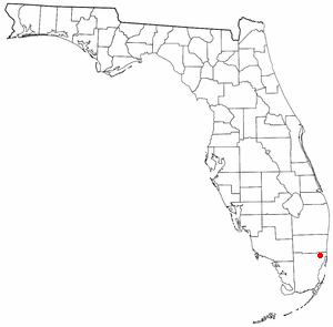
Hamptons at Boca Raton was a former census-designated place (CDP) and current unincorporated place near Boca Raton in Palm Beach County, Florida, United States. The population was 11,306 at the 2000 census. While it is not officially in the City of Boca Raton, the community is frequently classified under its umbrella term.

High Point was a former census-designated place (CDP) and current unincorporated place in Palm Beach County, Florida, United States. The population was 2,191 at the 2000 census. The CDP was removed from the 2010 census.

South Miami Heights is a census-designated place (CDP), originally known as Eureka, in Miami-Dade County, Florida. It is part of the Miami metropolitan area of South Florida. The population was 36,770 as of the 2020 census.

Crystal Lake is a census-designated place (CDP) in Polk County, Florida, United States. The population was 5,341 at the 2000 census, an increase from 5,300 in 1990. The 2010 Census reported a population of 5,514. It is part of the Lakeland–Winter Haven Metropolitan Statistical Area.
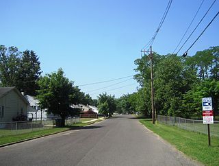
Pemberton Heights is an unincorporated community and census-designated place (CDP) located within Pemberton Township, in Burlington County, in the U.S. state of New Jersey. As of the 2010 United States Census, the CDP's population was 2,423.

Golden Triangle is an unincorporated community and census-designated place (CDP) located within Cherry Hill, in Camden County, in the U.S. state of New Jersey. As of the 2010 United States Census, the CDP's population was 4,145.

Holiday Heights is an unincorporated community and census-designated place (CDP) located within Berkeley Township, in Ocean County, in the U.S. state of New Jersey. As of the 2010 United States Census, the CDP's population was 2,099.

West Brattleboro is a census-designated place (CDP) in the town of Brattleboro, Vermont, United States. The population was 3,222 at the 2000 census.

Longview Heights is a census-designated place (CDP) in Cowlitz County, Washington, United States. The population was 4,033 at the 2020 Census. The CDP is known locally as Columbia Heights.

Maple Heights-Lake Desire is a census-designated place (CDP) in King County, Washington, United States. At the 2020 census, the population was 3,873.

Hooverson Heights is a census-designated place (CDP) in Brooke County, West Virginia, United States. It is part of the Weirton–Steubenville metropolitan area. The population was 2,590 at the 2010 census.

Bridgewater was a census-designated place (CDP) in the town of Bridgewater in Plymouth County, Massachusetts, United States. The CDP ceased to exist when Bridgewater was given de facto city status in 2010. The population was 7,841 at the 2010 census.

Hingham is a census-designated place (CDP) in the town of Hingham in Plymouth County, Massachusetts, United States. The population was 5,650 at the 2010 census.

Kingston is a census-designated place (CDP) in the town of Kingston in Plymouth County, Massachusetts, United States. The population was 5,591 at the 2010 census.

