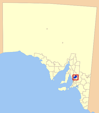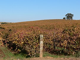
The Barossa Valley is a valley in South Australia located 60 kilometres (37 mi) northeast of Adelaide city centre. The valley is formed by the North Para River. It is notable as a major wine-producing region and tourist destination.

Sturt Highway is an Australian national highway in New South Wales, Victoria, and South Australia. It is an important road link for the transport of passengers and freight between Sydney and Adelaide and the regions along the route.

Barossa Valley Way is the main road linking most of the major towns of the Barossa Valley in South Australia, designated as route B19 for its entire length. It is 35 km long, roughly following the North Para River.

Tanunda is a town situated in the Barossa Valley region of South Australia. In the 2021 census, Tanunda recorded a population of 4,710 people.

Light Regional Council is a local government area north of Adelaide in South Australia. It is based in the town of Kapunda, and includes the towns of Freeling, Greenock, Hansborough, Hewett, Roseworthy and Wasleys.

The Kaiserstuhl Conservation Park is a protected area located in the Australian state of South Australia in the suburb of Flaxman Valley about 80 kilometres (50 mi) north-east of the state capital of Adelaide and about 12 kilometres (7.5 mi) south-east of the town of Tanunda.

Sedan is a rural town in South Australia. It is located about 100 kilometres east of Adelaide and about 20 kilometres west of the Murray River. It is located on the dry eastern side of the Mount Lofty Ranges.
Lowbank is a locality in South Australia's riverland. It is between the Sturt Highway and the left (south) bank of the Murray River east of Waikerie.

Marananga is a locality in South Australia. It was known as Gnadenfrei before 1918 when names of "enemy origin" were changed to sound less German.

Ebenezer is a locality in the northern Barossa Valley of South Australia. It includes the historic Ebenezer settlement settled by 72 Wendish Lutherans who had migrated from Silesia in January 1852.

Steinfeld is a locality in South Australia on the plains east of the Mount Lofty Ranges, and north of the Sturt Highway. The village of Steinfeld was established in the 19th century. It was renamed to Stonefield in 1918 as many places with German or German-sounding names were changed around World War I. The name reverted to Steinfeld in 1986.
Buchfelde is now a suburb of Gawler, South Australia, on the northern outskirts of Adelaide in South Australia.

Daveyston is a small town in the northern Barossa Valley region of South Australia. It is adjacent to the current Sturt Highway which previously ran through the middle of the town. The town is named after Benjamin Davey who had established a mill there before the town was established.

Light Pass is a settlement in the Barossa Valley region of South Australia. It was named by Charles Flaxman in honour of William Light. Light Pass is the site of two Lutheran churches and a public primary school.

Paisley is a locality in the Murray Mallee region of South Australia, across the Murray River from Blanchetown, South Australia. It was formally named in September 2000 for the Hundred of Paisley which contains it. The Hundred of Paisley was named by Governor MacDonnell in 1861 for his private secretary, J. G. Paisley.
Sandleton is a locality and former town in South Australia. It is located on the plains on the eastern side of the Mount Lofty Ranges. The current boundaries for the locality were created in 2003 for the long-established name of the area.
Annadale is a locality in South Australia. It is located on the plains east of the Mount Lofty Ranges astride the Sturt Highway 110 kilometres (68 mi) from Adelaide, between Truro and Blanchetown, South Australia. Halfway House Road is a heavy vehicle detour route that runs south from the Sturt Highway at Annadale. Annadale occupies the central part of the hundred of Anna.

The Hundred of Barossa is a cadastral unit of hundred in South Australia in the northern Adelaide Hills. It lies west of the Barossa Range at the south end of the Barossa Valley and is bounded on the north and south by the North Para and South Para rivers, respectively. It is the most northern of the eleven hundreds of the County of Adelaide and was named in 1846 by Governor Frederick Robe after the Barossa Range.
Concordia is a locality at the western end of the Barossa Valley, South Australia, situated 5 km ENE of Gawler.

The Hundred of Nuriootpa is a cadastral unit of hundred in the County of Light, South Australia split between in the eastern Adelaide Plains and western Barossa Valley. Named in 1847 for an indigenous term officially thought to mean "bartering place" and traditionally used as neutral ground for trading between various indigenous tribes, it is bounded on the south and east by the North Para River.


