Goodwill, South Dakota

Last updated
Goodwill, South Dakota
Coordinates: 45°33′58″N97°03′21″W / 45.56611°N 97.05583°W / 45.56611; -97.05583
Country Flag of the United States.svg  United States
State Flag of South Dakota.svg  South Dakota
County Roberts
Elevation
[1]
1,444 ft (440 m)
Population
 (2010)
  Total513
Time zone UTC-6 (Central (CST))
  Summer (DST) UTC-5 (CDT)
FIPS code 46-24775
GNIS feature ID2584555 [1]

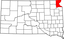
Goodwill is an unincorporated community and former census-designated place (CDP) in Roberts County, South Dakota, United States. Prior to the 2020 Census, the CDP was merged into the Agency Village census-designated place. Over 90% of the population is Native American.
Contents

Demographics

Historical population
CensusPop.Note
2010 513
U.S. Decennial Census [2]
merged into the Agency Village CDP
prior to the 2020 Census

2010 census

Goodwill CDP, South Dakota - Demographic Profile
(NH = Non-Hispanic)
Race / EthnicityPop 2010 [3] % 2010
White alone (NH)132.53%
Black or African American alone (NH)00.00%
Native American or Alaska Native alone (NH)47091.62%
Asian alone (NH)00.00%
Pacific Islander alone (NH)00.00%
Some Other Race alone (NH)00.00%
Mixed Race/Multi-Racial (NH)224.29%
Hispanic or Latino (any race)81.56%
Total513100.00%

Note: the US Census treats Hispanic/Latino as an ethnic category. This table excludes Latinos from the racial categories and assigns them to a separate category. Hispanics/Latinos can be of any race.

Related Research Articles

<span class="mw-page-title-main">Agency Village, South Dakota</span> Census-designated place in South Dakota, United States

Agency Village is an unincorporated area and census-designated place (CDP) in Roberts County, South Dakota, United States. It is the headquarters of the Sisseton Wahpeton Oyate and home to Sisseton Wahpeton College. Since 2020, the CDP includes the community known as Goodwill. The population of the CDP was 776 at the 2020 census.

<span class="mw-page-title-main">Conestee, South Carolina</span> Census-designated place in South Carolina, United States

Conestee is an unincorporated community and census-designated place (CDP) in Greenville County, South Carolina, United States. It was first listed as a CDP in the 2020 census with a population of 904.

Edisto is an unincorporated community and census-designated place in Orangeburg County, South Carolina, United States. Its population was 2,058 as of the 2020 census. U.S. Route 601 passes through the community.

Pimlico is a housing development and census-designated place (CDP) in Berkeley County, South Carolina, United States. It was first listed as a CDP prior to the 2020 census with a population of 1,208.

<span class="mw-page-title-main">Foreston, South Carolina</span> Census-designated place in South Carolina, United States

Foreston is an unincorporated community and census-designated place (CDP) in Clarendon County, South Carolina, United States. It was first listed as a CDP prior to the 2020 census with a population of 159.

Wyboo is a lakeside community and census-designated place (CDP) in Clarendon County, South Carolina, United States. It was first listed as a CDP prior to the 2020 census with a population of 3,661.

Newtown is an unincorporated community and census-designated place (CDP) in Dillon County, South Carolina, United States. It was first listed as a CDP prior to the 2020 census which listed a population of 770.

Danwood is an unincorporated community and census-designated place (CDP) in Florence County, South Carolina, United States. It was first listed as a CDP prior to the 2020 census with a population of 453.

Finklea is an unincorporated community and census-designated place (CDP) in Horry County, South Carolina, United States. As of the 2020 census it had a population of 291.

Live Oak is an unincorporated community and census-designated place (CDP) in Horry County, South Carolina, United States. As of the 2020 census it had a population of 93.

East Camden is an unincorporated area and census-designated place (CDP) in Kershaw County, South Carolina, United States. It was first listed as a CDP prior to the 2020 census with a population of 3,215.

Manville is an unincorporated community and census-designated place (CDP) in Lee County, South Carolina, United States. It was first listed as a CDP prior to the 2020 census with a population of 471.

<span class="mw-page-title-main">St. Charles, South Carolina</span> Census-designated place in South Carolina, United States

St. Charles is an unincorporated community and census-designated place (CDP) in Lee County, South Carolina, United States. It was first listed as a CDP prior to the 2020 census with a population of 114.

Daviston is an unincorporated community and census-designated place (CDP) in Marion County, South Carolina, United States. It was first listed as a CDP prior to the 2020 census with a population of 417.

South Union is an unincorporated community and census-designated place (CDP) in Oconee County, South Carolina, United States. It was first listed as a CDP prior to the 2020 census with a population of 341.

Cateechee is an unincorporated community and census-designated place (CDP) in Pickens County, South Carolina, United States. It was first listed as a CDP prior to the 2020 census. The population as of 2020 was 321.

Arkwright is an unincorporated area and census-designated place (CDP) adjacent to the city of Spartanburg in Spartanburg County, South Carolina, United States. It was first listed as a CDP prior to the 2020 census with a population of 2,311.

Ben Avon is an unincorporated area and census-designated place (CDP) adjacent to the city of Spartanburg in Spartanburg County, South Carolina, United States. It was first listed as a CDP prior to the 2020 census. The population as of 2020 was 2,428.

Sacred Heart University CDP is a census-designated place (CDP) covering the Sacred Heart University campus in Fairfield County, Connecticut, United States.

Fairfield University is a census-designated place (CDP) covering the Fairfield University campus in Fairfield County, Connecticut, United States.

References

  1. 1 2 U.S. Geological Survey Geographic Names Information System: Goodwill, South Dakota
  2. "Decennial Census of Population and Housing by Decades". US Census Bureau.
  3. "P2 HISPANIC OR LATINO, AND NOT HISPANIC OR LATINO BY RACE - 2010: DEC Redistricting Data (PL 94-171) - Goodwill CDP, South Dakota". United States Census Bureau .