
The Truro River is a river in the city of Truro in Cornwall, England, UK. It is the product of the convergence of the two rivers named Kenwyn and Allen which run under the city: the Truro River flows into the River Fal, estuarial waters where wildlife is abundant, and then out into the Carrick Roads. The river is navigable up to Truro.

The A390 is a road in Cornwall and Devon, England. It runs from Tavistock to 5 miles (8.0 km) north west of the city of Truro. Starting in Tavistock, it heads south-westwards towards Liskeard, crossing over the River Tamar and into Cornwall, then through Gunnislake and Callington. Immediately before Liskeard, it merges with the A38 north of the town. It diverges from the A38 at Dobwalls, where it then runs in a south-westerly direction to Truro via Lostwithiel, St. Blazey, and St Austell. It then forms an upside down elongated square loop, and bypasses Truro City Centre. It then heads north west out of the city, where it forms the main corridor into Truro from the west. It passes the Royal Cornwall Hospital and skirts the village of Threemilestone, before linking up with the A30 road at Chiverton Cross, where the A390 terminates. Chiverton Cross is where the A390 trunk road from Truro and the B3277 to St Agnes meet the east–west A30 trunk road. Before the A390 was rerouted away from Chacewater it ended at its junction with the A30 at Scorrier.

Mount Hawke is a village in Cornwall, United Kingdom. It is situated approximately eight miles (13 km) west-northwest of Truro, five miles (8.0 km) north-northeast of Redruth, and two and a half miles (4.0 km) south of St Agnes.

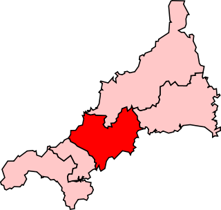
Truro and Falmouth is a constituency that has been represented in the House of Commons of the UK Parliament since 2019 by Cherilyn Mackrory, a Conservative Party politician. The seat was held by Sarah Newton from 2010 to 2019.

The Cornwall Railway company constructed a railway line between Plymouth and Truro in the United Kingdom, opening in 1859, and extended it to Falmouth in 1863. The topography of Cornwall is such that the route, which is generally east–west, cuts across numerous deep river valleys that generally run north–south. At the time of construction of the line, money was in short supply due to the collapse in confidence following the railway mania, and the company sought ways of reducing expenditure.

Perranzabuloe is a coastal civil parish and a hamlet in Cornwall, England, United Kingdom. Perranzabuloe parish is bordered to the west by the Atlantic coast and St Agnes parish, to the north by Cubert parish, to the east by St Newlyn East and St Allen parishes and to the south by Kenwyn parish. The hamlet is situated just over a mile (2 km) south of the principal settlement of the parish, Perranporth; the hamlet is also seven miles (11 km) south-southwest of Newquay. Other settlements in the parish include Perrancoombe, Goonhavern, Mount and Callestick. The parish population was 5,382 in the 2001 census, increasing to 5,486 at the 2011 census.
There are seventeen disused railway stations on the Cornish Main Line between Plymouth in Devon and Penzance in Cornwall, England. The remains of nine of these can be seen from passing trains. While a number of these were closed following the so-called "Beeching Axe" in the 1960s, many of them had been closed much earlier, the traffic for which they had been built failing to materialise.
The Truro and Newquay Railway was a Great Western Railway line in Cornwall, United Kingdom designed to keep the rival London and South Western Railway (LSWR) out of the west of the county. The line was completed in 1905 and closed in 1963.

Blowinghouse is the name of two settlements in Cornwall, England, United Kingdom.

Chiverton Cross is a road junction in west Cornwall, England, United Kingdom, about four miles north-east of Redruth and five miles (8 km) west of Truro at OS grid ref SW747469. Its name derives from Chyverton House which is in the extreme east of the parish of Perranzabuloe.
Truro and St Austell was a county constituency represented in the House of Commons of the Parliament of the United Kingdom. It elected one Member of Parliament (MP) by the first past the post system of election.

Mithian is a village in Cornwall, England, United Kingdom. It is about six miles (9.6 km) northeast of Redruth and a mile east of St Agnes.

Devoran is a village in south Cornwall, England, United Kingdom. It is 4 miles (6.4 km) southwest of Truro at grid reference SW 793 392. Formerly an ecclesiastical parish, Devoran is now in the civil parish of Feock.

The River Allen in north Cornwall is one of two rivers in Cornwall which share this name. In this case the name is the result of a mistake made in 1888 by Ordnance Survey, replacing the name Layne with Allen which is the old name for the lower reaches of the Camel. The other River Allen runs through Truro.

Scorrier is a village in Cornwall, England, United Kingdom. It is in the civil parish of St Day, about 2 miles (3 km) northeast of the centre of Redruth and 3 miles (5 km) southeast of the coast at Porthtowan, on the A30 road at the junction of the A3047 road that leads west to Camborne and the B3298 road south to Carharrack. The Plymouth to Penzance railway line passes through the village and between 1852 and 1964 it had its own station. A. E. Rodda & Son, the principal maker of clotted cream is based here.

Restronguet Creek is a tidal ria in south Cornwall, United Kingdom. It is a tributary of Carrick Roads, the estuary of the River Fal, and is situated approximately four miles (6.5 km) south of Truro and three miles (5 km) north of Falmouth.

New Downs is a farm near Camborne and St Agnes in Cornwall, England.

Trevaunance Cove is a small bay on the north Cornish coast and a residential area of St Agnes, Cornwall, United Kingdom. In the 18th and 19th centuries it was a busy harbour despite storms often destroying the quay. The South West Coast Path passes over the coastal slope to the north.
Truro Rural District was a local government division of Cornwall in England, UK, between 1894 and 1974. Established under the Local Government Act 1894 in 1934, the rural district was enlarged by the abolition of East Kerrier Rural District, Redruth Rural District and St Columb Major Rural District, but was reduced to enlarge Truro Municipal Borough.

St Agnes is an electoral division of Cornwall in the United Kingdom and returns one member to sit on Cornwall Council. The current Councillor is Pete Mitchell, a Liberal Democrat.
