Gouraya | |
---|---|
Commune and town | |
Country | |
Province | Tipaza Province |
Time zone | CET (UTC+1) |
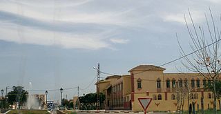
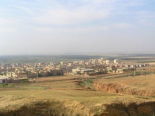
Gouraya is a town and commune in Tipaza Province in northern Algeria. [1]
The municipalities of Algeria form the second level of administrative subdivisions of Algeria. As of 2002, there were 1,541 municipalities in the country.
Tipaza or Tipasa is a province (wilaya) on the coast of Algeria, Its capital is Tipasa, 50 km west of the capital of Algeria.
Algeria, officially the People's Democratic Republic of Algeria, is a country in the Maghreb region of North Africa. The capital and most populous city is Algiers, located in the far north of the country on the Mediterranean coast. With an area of 2,381,741 square kilometres (919,595 sq mi), Algeria is the tenth-largest country in the world, the world's largest Arab country, and the largest in Africa. Algeria is bordered to the northeast by Tunisia, to the east by Libya, to the west by Morocco, to the southwest by the Western Saharan territory, Mauritania, and Mali, to the southeast by Niger, and to the north by the Mediterranean Sea. The country is a semi-presidential republic consisting of 48 provinces and 1,541 communes (counties). It has the highest human development index of all non-island African countries.
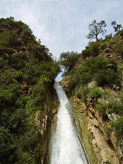
Taskriout is a commune of Kabylia in Algeria, located in the southeast of the province of Bejaia, crossed by the highway 09, leading to Aït Smail, Kherrata, upwards Sétif. It consists of five villages; Aït Idriss, where Kefrida waterfall is situated, Aït Ali Oumhend, Aït Mbarek, Arrechah and Rif. Bordj Mira is the chief town. Taskriout appertain to the district of Darguina.
Ammal is a town and commune in Boumerdès Province, Algeria. According to the 1998 census it has a population of 8,567.
Ouamri District is a district of Médéa Province, Algeria. In 2008 the population was 25,909.
Beni Haoua is a town and commune in Chlef Province, Algeria. According to the 1998 census it has a population of 17,602.
Zerizer is a town and commune in El Taref Province, Algeria. According to the 1998 census it has a population of 10,105.
Hamala, Algeria is a town and commune in Mila Province, Algeria. At the 1998 census it had a population of 10810.
Hannacha is a town and commune in Médéa Province, Algeria. According to the 1998 census it has a population of 5784.
Ouamri is a town and commune in Médéa Province, Algeria. According to the 1998 census it has a population of 14724.
Seghouane is a town and commune in Médéa Province, Algeria. According to the 1998 census it has a population of 7599.
Zoubiria is a town and commune in Médéa Province, Algeria. According to the 1998 census it has a population of 15,009.
Khadra is a town and commune in Mostaganem Province, Algeria. It is located in Achacha District. According to the 1998 census it has a population of 12,294.
Ouarizane is a town and commune in Relizane Province, Algeria.
Hamadi Krouma is a town and commune in Skikda Province in north-eastern Algeria.
Oum Toub is a town and commune in Skikda Province in north-eastern Algeria.
Ramdane Djamel is a town and commune in Skikda Province in north-eastern Algeria.
Ferkane is a town and commune in Tébessa Province in north-eastern Algeria.
Medrissa is a town and commune in Tiaret Province in northwestern Algeria.
Messelmoun is a town and commune in Tipaza Province in northern Algeria.
Tadmaït is a town and commune in Tizi Ouzou Province in northern Algeria.
Ta Ma is a commune (xã) and village of the Tuần Giáo District of Điện Biên Province, northwestern Vietnam.
Coordinates: 36°34′N1°54′E / 36.567°N 1.900°E
A geographic coordinate system is a coordinate system that enables every location on Earth to be specified by a set of numbers, letters or symbols. The coordinates are often chosen such that one of the numbers represents a vertical position and two or three of the numbers represent a horizontal position; alternatively, a geographic position may be expressed in a combined three-dimensional Cartesian vector. A common choice of coordinates is latitude, longitude and elevation. To specify a location on a plane requires a map projection.
This article about a location in Tipaza Province is a stub. You can help Wikipedia by expanding it. |