Picture Rocks is a census-designated place (CDP) in Pima County, Arizona, United States, home of the Tucson artifacts. The population was 9,551 at the 2020 United States census.

South Highpoint is a census-designated place (CDP) in Pinellas County, Florida, United States. The population was 5,195 at the 2010 census.
St. Dennis is a former census-designated place in western Jefferson County, Kentucky, United States. The population was 9,177 at the 2000 census. In 2003, the area was consolidated into the new Louisville Metro due to the merger of the Jefferson County and Louisville governments into one entity, thus St. Dennis remains as a unique neighborhood within Louisville.
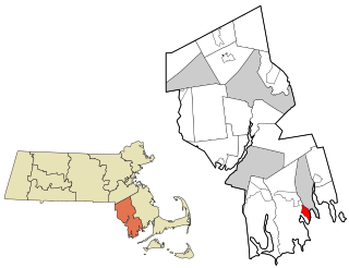
Bliss Corner is a census-designated place (CDP) in the town of Dartmouth in Bristol County, Massachusetts, United States. The population was 5,280 at the 2010 census.

Mansfield Center is a census-designated place (CDP) in the town of Mansfield in Bristol County, Massachusetts, United States. The population was 7,360 at the 2010 census.

Norton Center is a census-designated place (CDP) in the town of Norton in Bristol County, Massachusetts, United States. The population was 2,671 at the 2010 census.

Ocean Grove is a census-designated place (CDP) in the town of Swansea in Bristol County, Massachusetts, United States, on the north shore of Mount Hope Bay near the Cole River. The population was 2,811 at the 2010 census, and 2,904 as of the 2020 census.

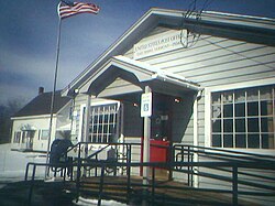
Three Rivers is a village and former census-designated place (CDP) in the city of Palmer in Hampden County, Massachusetts, United States. It is part of the Springfield, Massachusetts Metropolitan Statistical Area. It is named for the confluence of the Ware and Quaboag rivers, which form the Chicopee River.

Marshfield Hills is a census-designated place (CDP) in the town of Marshfield in Plymouth County, Massachusetts, United States. The population was 2,356 at the 2010 census. The historic center of the village has been designated a historic district and listed on the National Register of Historic Places.

East Douglas is a census-designated place (CDP) in the town of Douglas in Worcester County, Massachusetts, United States. The population was 2,557 at the 2010 census.

Fiskdale is a census-designated place (CDP) in the town of Sturbridge in Worcester County, Massachusetts, United States. The population was 2,583 at the 2010 census.

Crystal Lake is a census-designated place (CDP) in Polk County, Florida, United States. The population was 5,341 at the 2000 census, an increase from 5,300 in 1990. The 2010 Census reported a population of 5,514. It is part of the Lakeland–Winter Haven Metropolitan Statistical Area.

Erlton-Ellisburg was an unincorporated community and census-designated place (CDP) located within Cherry Hill Township, in Camden County, in the U.S. state of New Jersey. As of the 2000 United States Census, the CDP's population was 8,168. The area comprises Erlton and Ellisburg, two neighborhoods in western Cherry Hill. As of the 2010 United States Census, the Erlton-Ellisburg CDP was discontinued and a portion of the old CDP was included in the new Ellisburg CDP.

Valley Falls is a village and census-designated place (CDP) in the town of Cumberland, Providence County, Rhode Island, United States. The population was 12,094 at the 2020 census.

Ashaway is an unincorporated village and census-designated place (CDP) in the town of Hopkinton, Rhode Island, USA. It is a principal village of Hopkinton, along with Hope Valley, although it is the smaller of the two. The population was 1,485 at the 2010 census. The name Ashaway is derived from the American Indian name for the river that runs through the village, the Ashawague or Ashawaug, which means "land in the middle" or "land between" in the Niantic and Mohegan languages. The name "Ashawague River" appears as late as 1832 on the Findley map of Rhode Island published in Philadelphia.

Narragansett Pier is an unincorporated village and a census-designated place (CDP) in the town of Narragansett in Washington County, Rhode Island, United States. The population was 3,409 at the 2010 census.

South Barre is a census-designated place (CDP) in the town of Barre in Washington County, Vermont, United States. The population was 1,242 at the 2000 census.

West Brattleboro is a census-designated place (CDP) in the town of Brattleboro, Vermont, United States. The population was 3,222 at the 2000 census.

Chester is a census-designated place (CDP) in Windsor County, Vermont, United States. The population was 1,005 at the 2010 census. The CDP is a statistical area encompassing three distinct places: the urbanized center of the town of Chester; a locale known as Chester Depot, which is separated from the town center by the tracks of the former Rutland Railroad; and the village of North Chester.

Barre is a census-designated place (CDP) in the town of Barre in Worcester County, Massachusetts, United States. The population was 1,009 at the 2010 census.