
Interstate 94 (I-94) is an east–west Interstate Highway connecting the Great Lakes and northern Great Plains regions of the United States. Its western terminus is just east of Billings, Montana, at a junction with I-90; its eastern terminus is in Port Huron, Michigan, where it meets with I-69 and crosses the Blue Water Bridge into Sarnia, Ontario, Canada, where the route becomes Ontario Highway 402. It thus lies along the primary overland route from Seattle to Toronto and is the only east–west Interstate Highway to have a direct connection to Canada.

Kane County is a county in the U.S. state of Illinois. According to the 2020 census, it has a population of 516,522, making it the fifth-most populous county in Illinois. Its county seat is Geneva, and its largest city is Aurora. Kane County is one of the collar counties of the metropolitan statistical area designated "Chicago–Naperville–Elgin, IL–IN–WI" by the US census.

DuPage County is a county in the U.S. state of Illinois, and one of the collar counties of the Chicago metropolitan area. As of the 2020 census, the population was 932,877, making it Illinois' second-most populous county. Its county seat is Wheaton.

Lombard is a village in DuPage County, Illinois, United States, and a suburb of Chicago. The population was 44,476 at the 2020 census.

Villa Park is a village in DuPage County, Illinois, United States, within the Chicago metropolitan area. The population as of the 2020 Census is 21,113. Villa Park is a western suburb of Chicago.

West Chicago is a city in DuPage County, Illinois, United States. The population was 27,086 at the 2010 census. It was formerly named Junction and later Turner, after its founder, John B. Turner, president of the Galena and Chicago Union Railroad (G&CU) in 1855. The city was initially established around the first junction of railroad lines in Illinois, and today is still served by the Union Pacific West Metra service via West Chicago station.

Winfield is an incorporated village located in Milton and Winfield Townships, DuPage County, Illinois, United States. The population was 9,080 at the 2010 census and as of 2019, the estimated population was 9,636.

Interstate 355 (I-355), also known as the Veterans Memorial Tollway, is an Interstate Highway and tollway in the western and southwest suburbs of Chicago in the U.S. state of Illinois. Like most other toll roads in the northeastern portion of the state, I-355 is maintained by the Illinois State Toll Highway Authority (ISTHA). I-355 runs from I-80 in New Lenox north to I-290 in Itasca, a distance of 32.5 miles (52.3 km). With the exception of a four-mile (6.4 km) expansion in 2009, from U.S. Route 34 to 75th Street, the highway is six lanes wide for its entire length.

The Chicago Great Western Railway was a Class I railroad that linked Chicago, Minneapolis, Omaha, and Kansas City. It was founded by Alpheus Beede Stickney in 1885 as a regional line between St. Paul and the Iowa state line called the Minnesota and Northwestern Railroad. Through mergers and new construction, the railroad, named Chicago Great Western after 1892, quickly became a multi-state carrier. One of the last Class I railroads to be built, it competed against several other more well-established railroads in the same territory, and developed a corporate culture of innovation and efficiency to survive.
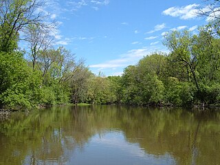
The Des Plaines River is a river that flows southward for 133 miles (214 km) through southern Wisconsin and northern Illinois in the United States Midwest, eventually meeting the Kankakee River west of Channahon to form the Illinois River, a tributary of the Mississippi River.
The Grand Illinois Trail is a multipurpose recreational trail in the northern part of the U.S. state of Illinois. At over 575 miles (925 km) in length, it is the longest trail in Illinois. Parts of it are in the coast-to-coast American Discovery Trail.
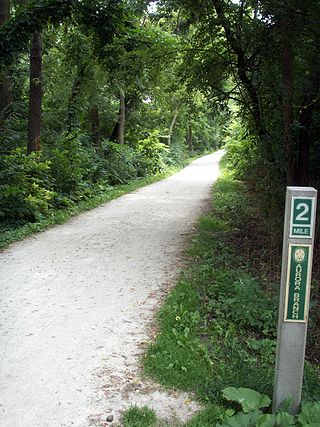
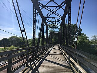
The Illinois Prairie Path is a network of 61 miles (98 km) of bicycle trails, mostly in DuPage County, Illinois. Portions of the trail extend west to Kane County and east to Cook County. Most of the trail is categorized as rail-to-trail, meaning that the bicycle path is built atop a converted former railroad right of way. In the case of the Prairie Path, the vast majority of its routing runs on the former right-of-way of the Chicago Aurora and Elgin Railroad.

Illinois's 6th congressional district covers parts of Cook and DuPage counties. It has been represented by Democrat Sean Casten since 2019.

North Avenue is a major east–west street in Chicago, Illinois, and its western suburbs. Starting at St. Charles's eastern border with West Chicago, its name changes from Main Street to North Avenue, just east of the Kane/DuPage county line. From there, it travels straight east, carrying Illinois Route 64 until LaSalle Drive in Chicago. Illinois Route 64 then continues north onto LaSalle Drive for a very short distance until ending at U.S. Route 41, while North Avenue continues east for less than one-half mile, changing its name to North Boulevard at Clark Street, and then continuing until its termination in a cul-de-sac at 200 East, just west of Lake Shore Drive. From Illinois Route 43 to its east end, North Avenue is within the city limits of Chicago.

York Township is one of nine townships in DuPage County, Illinois, USA. As of the 2020 census, its population was 128,425 and it contained 53,543 housing units.
Southwest LRT Trail is a system of shared-use paths for bicycles and pedestrian paths that extends through several western suburbs of Minneapolis, Minnesota. They are operated by the Three Rivers Park District. Two former rail corridors originally built by the Minneapolis and St. Louis Railway were acquired and converted to trails in anticipation of the Southwest Corridor light rail project. The two former railway corridors are now divided into three distinct trails.
95th Street is a major east–west highway on Chicago's South Side, and in the southwest suburbs, is obviously designated as 9500 South in Chicago's address system. 95th Street is 11 miles (18 km) south of Madison Street.
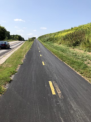
The Fox River Trail is a multi-use path in Illinois along the Fox River. Largely in Kane County, the trail connects the communities of Algonquin, Carpentersville, Dundee, Elgin, South Elgin, St. Charles, Geneva, Batavia, North Aurora, Aurora, Montgomery, and Oswego.


