Related Research Articles
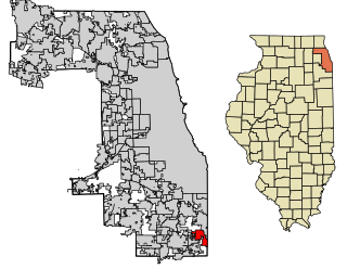
Lynwood is a village in Cook County, Illinois, United States and a suburb of Chicago. The population was 9,116 at the 2020 census.
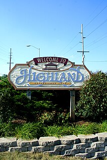
Highland is a town in Lake County, Indiana, United States. The population was 23,727 at the 2010 census. The town was incorporated on April 4, 1910. It is a part of the Chicago metropolitan area and North Township, and is surrounded by Hammond to the north, Munster to the west, Schererville to the south and Griffith to the east.

Merrillville is a town in Ross Township, Lake County, Indiana, United States. The population was 35,246 at the 2010 census. Merrillville is in east-central Lake County, in the Chicago metropolitan area. On January 1, 2015, Merrillville became the most populated town in Indiana, as Fishers in Hamilton County was converted from a town to a city. The town serves as a major shopping hub for Northwest Indiana.

Munster is a town located in North Township, Lake County, Indiana, United States. This bedroom community lies in the Chicago metropolitan area, approximately 30 miles (48 km) southeast of the Chicago Loop, and shares municipal boundaries with Hammond to the north, Highland to the east, Dyer and Schererville to the south and Lansing and Lynwood directly west of the Illinois border. The 2010 U.S. Census counted the town's population at 23,603.

Schererville is a town in St. John Township, Lake County, Indiana, United States. The population was 29,646 at the 2020 census It is a suburb of Chicago located just 30 miles south of the city

Interstate 275 (I-275) is an auxiliary Interstate Highway in the US state of Michigan that acts as a western bypass of the Detroit metropolitan area. The Michigan Department of Transportation (MDOT) maintains the highway as part of the larger State Trunkline Highway System. The freeway runs through the western suburbs near Detroit Metropolitan Wayne County Airport, and crosses several rivers and rail lines in the area. The southern terminus is the interchange with I-75 near Newport, northeast of Monroe. MDOT considers the Interstate to run to an interchange with I-96, I-696 and M-5 on the Farmington Hills–Novi city line, running concurrently with I-96 for about five miles (8.0 km). This gives a total length of about 35.03 miles (56.38 km), which is backed up by official signage. According to the Federal Highway Administration (FHWA), the length is 29.97 miles (48.23 km) because that agency considers I-275 to end at the junction with I-96 and M-14 along the boundary between Livonia and Plymouth Township. All other map makers, like the American Automobile Association, Rand McNally and Google Maps follow MDOT's practice.
The Monon Trail is a rail trail located entirely within the state of Indiana. The Monon Railroad was a popular railroad line connecting the cities of Chicago and Indianapolis, with stops at major settlements along its route. After the decline of railroad travel and the sale of the company in 1987, the portion of the line between Indianapolis and Delphi, Indiana, was abandoned.

The Bloomingdale Trail is a 2.7-mile (4.3 km) elevated rail trail linear park running east–west on the northwest side of Chicago. It is the longest greenway project of a former rail line in the Western Hemisphere, and the second longest in the world, after the Promenade plantee linear park in Paris. In 2015, the City of Chicago converted the former Bloomingdale railway line to an elevated greenway, which forms the backbone of the 606 trail network. The Bloomingdale Trail elevated park is in the Logan Square, Humboldt Park, and West Town neighborhoods.

Cedar Lake Trail is a 4.3-mile (6.9 km), shared-use path in the U.S. state of Minnesota, from downtown Minneapolis to the neighboring suburb of St. Louis Park. The trail begins at its eastern trailhead in downtown Minneapolis (44°59′11″N93°16′01″W) and continues west to Minnesota State Highway 100 in St. Louis Park (44°57′43″N93°20′36″W). At the trail's west end, a paved path continues for another 4.2 miles (6.8 km) through St. Louis Park to Hopkins under the former name of Hutchinson Spur Trail, but known as North Cedar Lake Regional Trail since 2009. In 2019, large portions of the Cedar Lake Trail were closed due to construction of the Southwest LRT extension with expected reopening in 2021 or 2022.

The Cardinal Greenway (TGC) is a multi-use recreational network combining a rail trail and an on-street route that together cross 62 miles (100 km) and five counties — in east central Indiana. The greenway, which was designated a National Recreation Trail in June 2003 and in 2018 was named to the Rails-to-Trails Conservancy's "Rail Trail Hall of Fame." uses the former CSX railroad track between Richmond and Marion. It is named after the Cardinal, the last regular passenger train service on the (Chicago-Cincinnati-Washington) route. Currently it is Indiana's longest rail trail project.

Area code 219 is a telephone area code in the North American Numbering Plan for Northwest Indiana, including the state's portion of the Chicago metropolitan area, which includes Lake, Porter, La Porte, Newton, and Jasper Counties. The area code includes the cities of Schererville, Chesterton, Lake Station, Lowell, Crown Point, Cedar Lake, Hobart, Whiting, Gary, Hammond, East Chicago, Merrillville, Munster, Griffith, Highland, Portage, Valparaiso, Michigan City, Ogden Dunes, St. John, La Porte, DeMotte, Roselawn, Kouts, Lake Village, and Rensselaer. 219 is largely co-extensive with the Indiana side of the Chicago metropolitan area. Service is provided by AT&T, Frontier Communications, and Northwestern Indiana Telephone Company.
Lansing Municipal Airport is a public airport located 21 miles (34 km) south of Chicago, in Lansing, a village in Cook County, Illinois, United States. It is owned by the Village of Lansing.

Miller is a train station in Gary, Indiana, serving the South Shore Line commuter rail system. It serves the community of Miller Beach and is one of three South Shore Line stations within the municipal boundaries of Gary.
The Old Plank Road Trail is a 21-mile (34 km) long public rail trail in Cook County and Will County within the U.S. state of Illinois. It stretches westward from Chicago Heights to Joliet, serving fast-growing suburbs such as Frankfort and New Lenox.

The Kenilworth Trail is a paved bicycle trail in Minneapolis, Minnesota, United States. It runs nearly 1.5 miles (2.4 km) and acts as a connector between the Cedar Lake Trail in the north and the Midtown Greenway in the south. Like the Cedar Lake Trail, most of the route is composed of a triple-divided cycleway/pedway with a pair of one-way paths for bicycles and another path for pedestrians. On some maps, a southern segment of the Kenilworth Trail is called the Burnham Trail. The trail corridor has been considered the most highly trafficked in the Minneapolis park system.
The Pleasant Run Greenway, also known as the Pleasant Run Trail, is a shared-use path in Indianapolis, Indiana. It runs for 6.9 miles (11.1 km) from Ellenberger Park, through Christian Park, to Garfield Park. It follows the general course of Pleasant Run Creek as it flows to the south and west. Most of the greenway is located within the parkway on one side or the other of the creek; the parkway itself is part of the historic Indianapolis Park and Boulevard System. In several places, the greenway is routed on sidewalks of city streets due to existing structures and facilities that make the parkway itself discontinuous.

Erie Lackawanna Trail is a rail trail located in Lake County, Indiana which runs along the former Erie Lackawanna Railway. The trail begins in the city of Hammond then passes through the towns of Highland, Griffith, Schererville, and Merrillville before coming to an end in the county seat Crown Point. It covers a total of 17.7 miles (28.5 km).

Hartsdale was a town in St. John Township, Lake County, Indiana, United States. It was part of the Chicago metropolitan area. Hartsdale was annexed by Schererville, Indiana, in 1911.
References
- ↑ "Pennsy Greenway". TrailLink. Rails-to-Trails Conservancy. Retrieved 30 October 2022.
- ↑ "Greenways & Blueways Northwest Indiana Regional Map" (PDF). www.nirpc.com. Northwestern Indiana Regional Planning Commission. Retrieved 30 October 2022.
Coordinates: 41°28′11.4″N87°25′12.5″W / 41.469833°N 87.420139°W
| | This Lake County, Indiana location article is a stub. You can help Wikipedia by expanding it. |
| | This United States trail or long-distance path–related article is a stub. You can help Wikipedia by expanding it. |