Frankfort is the capital city of the U.S. state of Kentucky and the seat of Franklin County. It is a home rule-class city. The population was 28,602 at the 2020 United States census. Located along the Kentucky River, Frankfort is the principal city of the Frankfort, Kentucky Micropolitan Statistical Area, which includes all of Franklin and Anderson counties. It is the 4th least populous state capital in the United States, and the 13th most populous city in Kentucky.

Daviess County ( "Davis"), is a county in Kentucky. As of the 2020 census, the population was 103,312. Its county seat is Owensboro. The county was formed from part of Ohio County on January 14, 1815.

Scouting in Kentucky has a long history, from the 1910s to the present day, serving thousands of youth in programs that suit the environment in which they live. Kentucky has a very early Scouting heritage, as the home state of Daniel Carter Beard.

The Daniel Boone National Forest is a national forest in Kentucky. Established in 1937, it includes 708,000 acres (287,000 ha) of federally owned land within a 2,100,000-acre (850,000 ha) proclamation boundary. The name of the forest was changed in 1966 in honor of the explorer Daniel Boone.

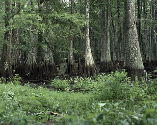
The Cache River National Wildlife Refuge is a 68,993 acre (223 km2) (2014) wildlife refuge in the state of Arkansas managed by the United States Fish and Wildlife Service (FWS). The refuge is one of the Ramsar wetlands of international importance under the Ramsar Convention signed in 1971. It is one of the most important wintering area for ducks and the largest remaining tract of contiguous bottomland hardwood forest on the North American continent. In 2005, a possible sighting of the ivory-billed woodpecker, thought to be extinct, brought attention to the refuge.

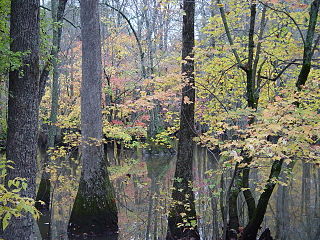
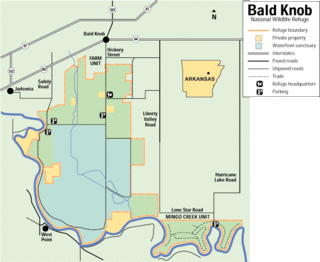
The Bald Knob National Wildlife Refuge is a 15,022 acres (60.79 km2) (2014) wildlife refuge located in White County, Arkansas about two miles south of the town of Bald Knob. The refuge is managed by the United States Fish and Wildlife Service. The refuge features large numbers of migratory waterfowl and bald eagles during the winter months.

Big Lake National Wildlife Refuge is an 11,047-acre (45 km2) National Wildlife Refuge located in Mississippi County, Arkansas, managed by the United States Fish and Wildlife Service. It is situated 2 miles (3.2 km) east of Manila, Arkansas, and consists mostly of a shallow lake, swamp, and bottomland hardwood forests. The preservation of habitat for waterfowl in an intensely agricultural region is the primary purpose of the refuge. 6,400 acres (20 km2) of Big Lake is classified as a National Natural Landmark and 2,144 acres (8 km2) are classified as wilderness.

The Lake George State Forest is a designated protected area and state forest in the U.S. state of Florida. The 21,176-acre (8,570 ha) forest is located in northwestern Volusia County, Florida, near Lake George and the communities of Pierson, Barberville, and Volusia. It is overseen by the Florida Forest Service within the Florida Department of Agriculture and Consumer Services.

Kentucky is situated in the Upland South region of the United States. A significant portion of eastern Kentucky is part of Appalachia.
Amelia Wildlife Management Area is a 2,217-acre (8.97 km2) Wildlife Management Area located in Amelia County, Virginia. Primarily upland habitat, it also preserves around 175 acres (0.71 km2) of bottomland hardwoods and beaver swampland along the Appomattox River. Much of the land was formerly used for farming; today it is managed to preserve wildlife habitat. The forest is mature, with gently rolling terrain, and an altitude between 200 and 300 feet above sea level. Much of the area is bounded on the north by the Appomattox River.
Bogue Chitto National Wildlife Refuge is located 60 mi (97 km) northeast of New Orleans, Louisiana, U.S., and encompasses 36,000 acres (150 km2) of Pearl River Basin swampland.

Bayou Cocodrie National Wildlife Refuge was established in 1992 to protect some of the last remaining, least-disturbed bottomland hardwood forest tracts in the Lower Mississippi Valley. These wooded wetlands, oxbow lakes, brakes, sloughs, and bayous, are inhabited seasonally by over 150 species of migratory birds, including forest-breeding birds, water birds, and waterfowl. The 15,155-acre (61.33 km2) refuge is located in Concordia Parish, Louisiana, 10 miles (16 km) southwest of Vidalia, Louisiana. It is named for the state-designated scenic river which runs through its center.

Green Bottom Wildlife Management Area is located on former plantation lands of U.S. Congressman and Confederate General Albert G. Jenkins. The 1,096 acres (444 ha) in Cabell County and Mason County are located along the banks of the Ohio River about 16 miles (26 km) north of Huntington, West Virginia. The Green Bottom WMA land is a mixture of farmland, mixed hardwood forest, wetlands, and open water. The Jenkins Plantation Museum is located on Corps of Engineers land adjacent to the WMA. The museum is located in the original 1835 Green Bottom Plantation House, and is operated by the West Virginia Division of Culture and History.

Knobs State Forest and Wildlife Management Area is a 2,035 acre state forest located in Bullitt County, Kentucky, United States. The forest is located about 28 miles south of Louisville, Kentucky. It is managed for sustainable timber production.

Kentucky Route 1508 is a state highway located in northwestern Kentucky. The route starts at KY 109, west of Sturgis. It travels westward to unincorporated area of Caseyville, and turns north near the Ohio River. KY 1508 then travels through the community of Dekoven, before ending at KY 109, northwest of its southern terminus. The route was designated around 1967, after the KY 130 designation was removed from the section in Caseyville, which was connected to the community since 1939.

Kentucky Route 136 is a 32.342-mile-long (52.049 km) state highway in northwestern Kentucky. It has two disconnected sections, one that goes from the Ohio River near Sloughs Wildlife Management Area to the Green River near Rangers Landing via Henderson, and the other that runs from KY 56 in Beech Grove west of Sebree to U.S. Route 231 (US 231) north of Hartford via Calhoun and Livermore.
The Richard K. Yancey Wildlife Management Area, formerly the Red River/Three Rivers Wildlife Management Area, is a 70,872-acre (28,681 ha) tract of protected area in lower Concordia Parish, Louisiana. The area is owned by the Louisiana Department of Wildlife and Fisheries and the U.S. Army Corps of Engineers (USACOE). The WMA is located off LA 15 approximately 35 miles (56 km) south of Ferriday between the Red River and the Mississippi River.


