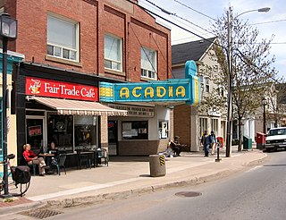
Wolfville is a Canadian town in the Annapolis Valley, Kings County, Nova Scotia, located about 100 kilometres (62 mi) northwest of the provincial capital, Halifax. The town is home to Acadia University and Landmark East School.

The Gulf of Saint Lawrence is the outlet of the North American Great Lakes via the Saint Lawrence River into the Atlantic Ocean. The gulf is a semi-enclosed sea, covering an area of about 226,000 square kilometres (87,000 sq mi) and containing about 34,500 cubic kilometres (8,300 cu mi) of water, which results in an average depth of 152 metres (499 ft).

St. Margarets Bay is a bay located on the Atlantic coast of Nova Scotia, Canada on the border of Halifax County and Lunenburg County.

Spencer's Island is a rural community in Cumberland County, Nova Scotia, located at the western end of Greville Bay on the Bay of Fundy. The community is named after a small island 45°19′50″N64°41′30″W of the same name located offshore from nearby Cape Spencer. According to local oral history, the island, cape and community trace their name to a man named Spencer who is buried on the island. However the name more likely comes from Lord Spencer, a British statesman at the time the community was settled.

The Chebucto Peninsula is a Canadian peninsula located in central Nova Scotia entirely within the Halifax Regional Municipality on the Atlantic coast.

King South is a provincial electoral district in Nova Scotia, Canada, that elects one member of the Nova Scotia House of Assembly. It includes the town of Wolfville, the village of New Minas, the community of Coldbrook, and Glooscap First Nation.
Cape Split is a headland located on the Bay of Fundy coast of the Canadian province of Nova Scotia. The Battle off Cape Split happened during the American Revolution.

East Apple River makes up the eastern and upriver portion of the Canadian rural community of Apple River, Nova Scotia located in Cumberland County, Nova Scotia.

Cumberland Basin is an inlet and northeasternmost part of the Bay of Fundy, located on the border between the Canadian provinces of Nova Scotia and New Brunswick.
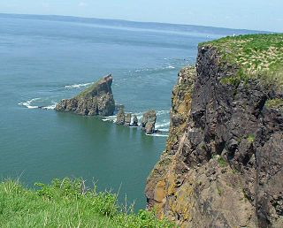
Cape Chignecto is a headland located on the Bay of Fundy coast of the Canadian province of Nova Scotia.
Hamburg was a three masted barque built in 1886 at Hantsport, Nova Scotia. She was the largest three masted barque ever built in Canada.

The Fundy Basin is a sediment-filled rift basin on the Atlantic coast of southeastern Canada. It contains three sub-basins; the Fundy sub-basin, the Minas Basin and the Chignecto Basin. These arms meet at the Bay of Fundy, which is contained within the rift valley. From the Bay of Fundy, the Minas Basin trends northeast to Nova Scotia. Chignecto Bay runs from the Bay of Fundy northwest between New Brunswick and Nova Scotia which is separated from the waters of the Northumberland Strait by the Isthmus of Chignecto. The Fundy Basin is best known for the bay it contains. The Bay of Fundy is home to huge tidal changes and tidal bores. It is part of the system of Eastern North America Rift Basins.
Sand Point is a community in the Canadian province of Nova Scotia, located in Colchester County and just outside of Tatamagouche. It is a small piece of land that juts out into the Tatamagouche Bay. There are numerous cottages and a handful of houses on Sand Point. There used to be a small farm at the end of Sand Point.
Tidnish Bridge is a community in the Canadian province of Nova Scotia, located in Cumberland County on the interprovincial border with New Brunswick between Upper Tidnish, and Lower Tidnish on the Tidnish River. Tidnish Bridge is home to the Chignecto Ship Railway Keystone Bridge and would have been the Baie Verte terminus. Tidnish Dock Provincial Park is where the last piece of the project remained. The name Tidnish is of Indian origin, said to signify "A Paddle".
Shulie is a community in the Canadian province of Nova Scotia, located in Cumberland County.
Morden is a community in the Canadian province of Nova Scotia, located in Kings County. The community was first known as "French Cross" after a cross marking Acadian refugees who fled the Expulsion of the Acadians in 1755. The village was later named Morden after James Morden who received the first land grant in the area in 1783.

The Age of Sail Heritage Centre is a museum and heritage centre at Port Greville, Nova Scotia, Canada. It focuses on the history of Parrsboro Shore communities along the Minas Channel of the Bay of Fundy with an emphasis on the area's shipbuilding and lumbering heritage.

The Parrsboro Shore is an area of Cumberland County, Nova Scotia consisting of the shoreline communities west of the town of Parrsboro. The Parrsboro Shore is generally defined as stretching along the Bay of Fundy from the town of Parrsboro westward around Cape Chignecto as far as Apple River. It includes the communities of Diligent River, Fox River, Port Greville, Ward's Brook, Fraserville, Spencer's Island, Advocate, the ghost town of Eatonville. Linked by Nova Scotia's Route 209, the communities form part of the Fundy Shore Ecotour.

St. George's Anglican Church is an historic Carpenter Gothic style Anglican church building located at 216 Main Street in Parrsboro, Nova Scotia, Canada.
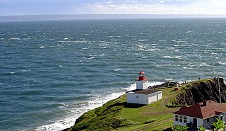
The Dory Rips is a phenomenon involving extreme tidal agitation of waters located in the Bay of Fundy off the headland of Cape d'Or in Nova Scotia, Canada.


