Grover, South Carolina | |
|---|---|
 Grover  Grover | |
| Coordinates: 33°06′19″N80°35′41″W / 33.10528°N 80.59472°W | |
| Country | United States |
| State | South Carolina |
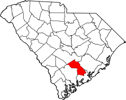
| County | Dorchester |
| Area | |
• Total | 2.59 sq mi (6.70 km2) |
| • Land | 2.59 sq mi (6.70 km2) |
| • Water | 0.00 sq mi (0.00 km2) |
| Elevation | 82 ft (25 m) |
| Population | |
• Total | 297 |
| • Density | 114.80/sq mi (44.32/km2) |
| Time zone | UTC-5 (Eastern (EST)) |
| • Summer (DST) | UTC-4 (EDT) |
| ZIP code | 29477 |
| Area code(s) | 843, 854 |
| GNIS feature ID | 1222923 [3] |
Grover is an unincorporated community and census-designated place (CDP) in Dorchester County, South Carolina, United States. [3] It was first listed as a CDP in the 2020 census with a population of 297. [4]
Contents
Its ZIP code is 29477.