Hamburg-Mitte

Last updated

Hamburg-Mitte
Flag of Hamburg.svg
Location of Hamburg-Mitte within Hamburg
Hamburg Bezirk Hamburg-Mitte.svg
Germany adm location map.svg
Red pog.svg
Hamburg-Mitte
Germany Hamburg adm location map.svg
Red pog.svg
Hamburg-Mitte
Coordinates: 53°33′1″N9°59′39″E / 53.55028°N 9.99417°E / 53.55028; 9.99417
Country Germany
State Hamburg
City Hamburg
Area
  Total
142.2 km2 (54.9 sq mi)
Elevation
10 m (30 ft)
Population
 (2023-12-31) [1]
  Total
312,641
  Density2,200/km2 (5,700/sq mi)
Time zone UTC+01:00 (CET)
  Summer (DST) UTC+02:00 (CEST)
Dialling codes 040
Vehicle registration HH
Website www.hamburg.de

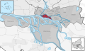
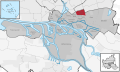
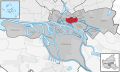
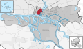
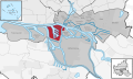
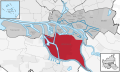
Hamburg-Mitte (Hamburg Central) is one of the seven boroughs of Hamburg, Germany, covering most of the city's urban center. The quarters of Hamburg-Altstadt and Neustadt cover much of the city's historic core. In 2020 the population was 301,231.

Contents

History

In 1937 several settlements (e.g. Finkenwerder), villages and rural areas were passed into Hamburg enforced by the Greater Hamburg Act.

On 1 March 2008 due to a law of Hamburg, [2] the quarter Wilhelmsburg was transferred from the borough Harburg. The neighborhood HafenCity was formed from parts of the quarters Klostertor, Altstadt and Rothenburgsort. The other part of Klostertor was transferred to Hammerbrook. From small parts of the borough Hamburg-Mitte (And Altona and Eimsbüttel) the neighborhood Sternschanze was created as a quarter in the borough Altona.

Geography

Binnenalster between Altstadt and Neustadt HP L4225.JPG
Binnenalster between Altstadt and Neustadt
Elbe and Landungsbrucken in St. Pauli 2013-06-08 Projekt Heissluftballon DSCF0801.jpg
Elbe and Landungsbrücken in St. Pauli

The borough severs Hamburg from the east to the west. In 2006, according to the statistical office of Hamburg and Schleswig-Holstein, Hamburg-Mitte has a total area of 107.1 square kilometres (41 sq mi).

Subdivisions

Hamburg-Mitte consists of the quarters Billbrook, Billstedt, Borgfelde, Finkenwerder, HafenCity, Hamburg-Altstadt, Hamburg-Hamm, Hammerbrook, Horn, Kleiner Grasbrook, Neustadt, Neuwerk, Rothenburgsort, St. Georg, St. Pauli, Steinwerder, Veddel, Waltershof and Wilhelmsburg.

MapStadtteil
Hamburg Mitte Billbrook.svg Billbrook
Hamburg Mitte Billstedt.svg Billstedt
Hamburg Mitte Borgfelde.svg Borgfelde
Hamburg Mitte Finkenwerder.svg Finkenwerder
Hamburg Mitte HafenCity.svg HafenCity
MapStadtteil
Hamburg Mitte Altstadt.svg Hamburg-Altstadt
Hamburg Mitte Hamm-Nord.svg Hamm
Hamburg Mitte Hammerbrook.svg Hammerbrook
Hamburg Mitte Horn.svg Horn
Hamburg Mitte Kleiner Grasbrook.svg Kleiner Grasbrook
MapStadtteil
Hamburg Mitte Neustadt.svg Neustadt
Hamburg Mitte Insel Neuwerk.svg Neuwerk
Hamburg Mitte Rothenburgsort.svg Rothenburgsort
Hamburg Mitte Steinwerdersvg.svg Steinwerder
Hamburg Mitte St. Georg.svg St. Georg
MapStadtteil
Hamburg Mitte St. Pauli.svg St. Pauli
Hamburg Mitte Veddel.svg Veddel
Hamburg Mitte Waltershof.svg Waltershof
Hamburg Mitte Wilhelmsburg.svg Wilhelmsburg

The historic center of Hamburg lies within the districts Altstadt, Neustadt and HafenCity, also defined by being inside the Wallring. These three districts also constitute what is considered Hamburg's Innenstadt (inner city).

Green and open spaces

Planten un Blomen (plants and flowers) is a park located in the quarter St. Pauli and Neustadt. Located in the quarter Billstedt is the lake Öjendorfer See .

Culture

Church of St. Michaelis in 2005 AmburgoSanMichele.jpg
Church of St. Michaelis in 2005

Museums and cultural institutions

Economy

Europa-Passage between Jungfernstieg and Monckebergstrasse Europa-Passage, Hamburg (3148228513).jpg
Europa-Passage between Jungfernstieg and Mönckebergstraße

Hamburg-Mitte is the economic center of Hamburg. Altstadt, Neustadt and HafenCity make up Hamburg's Innenstadt (inner city), the city's shopping and central business district, while Hammerbrook's City Süd is an important decentralized business district. The facilities of the Port of Hamburg are located mostly in Hamburg-Mitte in the quarters of Kleiner Grasbrook, Steinwerder, Veddel, Waltershof and Wilhelmsburg.

Politics

The Bezirksamt Hamburg-Mitte is located at Klosterwall 8.

Diet of the borough

Simultaneously with elections to the state parliament (Bürgerschaft), the Bezirksversammlung is elected as representatives of the citizens. It consists of 53 representatives.

Elections

District parliament election of Mitte in 2024
Parties %±Seats
Social Democratic Party 28.5Increase2.svg 1.514
Alliance 90/The Greens 21.1Decrease2.svg 8.211
Christian Democratic Union 15.6Increase2.svg 3.58
The Left 14.8Decrease2.svg 0.88
Alternative for Germany 10.2Increase2.svg 2.55
Volt 5.1Increase2.svg 5.13
Free Democratic Party 4.8± 0.02
Total51

Demographics

In 2006 233,144 people lived in the borough. The population density was 2,177/km2 (5,638/sq mi). 14.9% were children under the age of 18, and 15.6% were 65 years of age or older. 43% belong to ethnic minorities. [3] 17,550 people were registered as unemployed and 72,608 were employees subject to social insurance contributions. [4]

In 1999 there were 126,753 households, out of which 17.9% had children under the age of 18 living with them and 52.4% of all households were made up of single occupants. The average household size was 1.83. [5]

Population by year [4]

1987198819891990199119921993199419951996199719981999
232,467235,759242,434249,156250,585252,695251,965248,802246,374242,029237,648230,542228,349
2000200120022003200420052006200720082009
228,060227,199227,915228,117227,557230,680233,114

In 2006 there were 71,559 criminal offences in borough (307 crimes per 1000 people). [6]

Infrastructure

The main local office (Bezirksamt Hamburg-Mitte) is located on Klosterwall. It has 4 local offices or "Customer Centres." These are Customer Centre Hamburg-Mitte, Customer Centre Billstedt, Customer Centre St. Pauli, and Customer Centre Wilhelmsburg. The offices are responsible, among other things, for the application for a residence permit for purposes of study after entering the country.

Government

The Federal Maritime and Hydrographic Agency of Germany (BSH) has its head office in St. Pauli in Hamburg-Mitte, [7] and the head office of Federal Bureau for Maritime Casualty Investigation is in the BSH facility. [8]

Education

The borough has 31 elementary schools and 31 secondary schools. [9]

Health systems

There were 125 day-care centers for children and 536 physicians in private practice and 72 pharmacies. [9] The Asklepios Klinik St. Georg located in the quarter St. Georg, is the main hospital in Hamburg-Mitte.

Sports

Transport

The borough is serviced by the rapid transit system of the city train and the underground railway with several stations. The central station Hamburg Hauptbahnhof is also for long-distance passenger trains for the German railway company.

According to the Department of Motor Vehicles (Kraftfahrt-Bundesamt), in the Hamburg-Mitte borough 66,831 private cars were registered (290 cars/1000 people). [9] There were 2,432 traffic accidents in total, including 1,905 traffic accidents resulting in injuries. [10]

Notable residents

References

  1. "Bevölkerung in Hamburg am 31.12.2023 nach Stadtteilen". Statistisches Amt für Hamburg und Schleswig-Holstein. May 2024.
  2. Act of the areal organisation
  3. Bevölkerung mit Migrationshintergrund in den Hamburger Stadtteilen Archived 21 August 2010 at the Wayback Machine statistik-nord.de (in German) 10 August 2010 Retrieved 27 June 2023
  4. 1 2 Residents registration office, source: statistical office Nord of Hamburg and Schleswig-Holstein (31 December 2006)
  5. Source: statistical office Nord of Hamburg and Schleswig-Holstein (1999)
  6. State Investigation Bureaux (Landeskriminalamt), source: statistical office Nord of Hamburg and Schleswig-Holstein (2006)
  7. "Impressum Archived 2015-05-10 at the Wayback Machine ." Federal Maritime and Hydrographic Agency of Germany. Retrieved on 19 April 2014. "Bundesamt für Seeschifffahrt und Hydrographie (BSH) Bernhard-Nocht-Straße 78 20359 Hamburg Postfach 30 12 20 20305 Hamburg"
  8. "Imprint." Federal Bureau for Maritime Casualty Investigation. Retrieved on 16 January 2012. "Bundesstelle für Seeunfalluntersuchung (BSU) Bernhard-Nocht-Strasse 78 20359 Hamburg " – Map Archived 2 July 2007 at the Wayback Machine
  9. 1 2 3 Source: statistical office Nord of Hamburg and Schleswig-Holstein (31 December 2006)
  10. Traffic accident statistic, statistical office Nord of Hamburg and Schleswig-Holstein (2006)
  11. Gutsch, Jochen-Martin; Per Hinrichs; Susanne Koelbl; Gunther Latsch; Sven Röbel; Andreas Ulrich (27 May 2008). "The High Price of Freedom". Der Spiegel . Translated by Christopher Sultan. p. 1. Retrieved 30 November 2019. Obeidi started a business selling used buses in Rothenburgsort, a Hamburg neighborhood. [...] The family lived on another street in the same neighborhood[...] – Original German version: Gutsch, Jochen-Martin; Hinrichs, Per; Koelbl, Susanne; Latsch, Gunther; Röbel, Sven; Ulrich, Andreas (25 May 2008). "Eigentum des Mannes". Der Spiegel. - PDF page

General sources