List of bridges in Hamburg

Last updated

Lombardsbrucke.jpg
Alte Harburger Elbbrucke sw.jpg
Kohlbrandbrucke 2010.jpg
Three generations of bridges in Hamburg
From left to right: (1) Lombardsbrücke with the urban ensemble of the Binnenalster, (2) Alte Harburger Elbbrücke, one of many riveted truss bridges dating from the Industrial Age, (3) Köhlbrandbrücke, part of today's modern transport infrastructure.

This list of bridges in Hamburg is incomplete, with an overview of their history and geography. In this article, the bridges are listed by Hamburg's three major rivers (Alster, Bille and Elbe) and the respectively crossed body of water (river, creek, canal, fleet, harbor basin or else). The Elbe is by far the largest of the three. Unlike Alster and Bille, the Elbe is also within the North Sea's tidal influence, and Elbe bridges differ substantially from the ones on Alster and Bille. All three rivers are fed by a number of smaller rivers and also feature a number of branches or sidearms.

Contents

Hamburg has more than 2,496 bridges, the most bridges of any city in Europe. Besides the Hanseatic city's mercantile and maritime history, the many rivers, canals and bridges lend to Hamburg's claim as the "Venice of the North". A 2004 report by the Department for Roads, Bridges and Waterways (LSBG) states a total number of 2,496 bridges in Hamburg, [1] [2] many more than cities like Venice, Amsterdam or Saint Petersburg. Given the city's waterborne geography and the port's heavy duty requirements, bridges in Hamburg also cover a great variety of architectural styles and innovative structural systems. [3] Function-wise the total number of bridges break down to 1,172 road bridges, 987 railroad bridges (of which 407 Hochbahn bridges) and 470 footbridges (of which 290 within public parks and green spaces). [1] [3] 383 bridges are under management of the Hamburg Port Authority. [3]

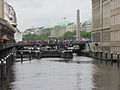
The most notable bridges in Hamburg include the historic inner-city bridges passing the Lower Alster (plus canals), the bridges across Speicherstadt canals, and the grand bridges spanning the Elbe's Norderelbe and Süderelbe anabranches, most commonly known as Elbbrücken.

Bridges in the Alster river system

Map of Hamburg in 1589 Hambvrgvm, 38187429X, original.jpg
Map of Hamburg in 1589
View of Kleine Alster basin from Reesendammbrucke; in the background: Rathaus (left) and Schleusenbrucke (center) 2013-05-27 09-58-45 Germany Hamburg Altstadt 3h.JPG
View of Kleine Alster basin from Reesendammbrücke; in the background: Rathaus (left) and Schleusenbrücke (center)

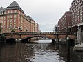
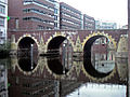
For centuries, the only bridges in Hamburg were across the Lower Alster and its canals in the Altstadt (old town). Repeated redirecting of the Alster canals resulted in ever new bridges to go with them. Ultimately, most of the pre-17th century bridges were destroyed in the Great Fire of 1842; the oldest remaining bridges in Hamburg are Zollenbrücke (1633) and Ellerntorsbrücke (1668).

Most of today's bridges in the inner city date from the 1840s reconstruction, during which over two dozen, mainly Renaissance Revival stone arch bridges were erected under then building director Johann Hermann Maack  [ de ] (1809–1868). Maack's bridges tied into a general urban redevelopment of the inner city [3] which was similarly seen in a number of European cities of the mid 19th century, and still characterizes many of the Neustadt's canals.

Most of the bridges across the Upper Alster and adjoining canals were first built in conjunction with the area's extensive residential developments from the 1860s onwards. Some of them were gradually replaced during the 1920s, with Fritz Schumacher in particular establishing a brick-arch-prototype for many bridges.

Alster

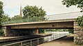
Bridges across the Alster (Alsterbrücken) in Hamburg; some 31 km (19 mi) of the Alster's total of 56 km (35 mi) lie within Hamburg.

Upper Alster

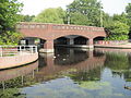
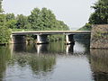
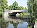
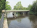
A great number of the city's Alster bridges are located in the residential districts along the Upper Alster and its tributaries and accompanying side canals.

ImageNameBuiltLengthLocationNotes
Alster (Hamburg state border)
Ratsmuhlendammbrucke 1.jpg
Ratsmühlendammbrücke1991 Fuhlsbüttel, Ohlsdorf
Hasenbergbrucke 2.jpg
Hasenbergbrücke1913 Ohlsdorf
Sengelmannbrucke 3.jpg
Sengelmannbrücke1919
(2001)
36 m
(118 ft)
Alsterdorf
Hindenburgbrucke 1.jpg
Hindenburgbrücke1920 Alsterdorf
Dammbrucke 1.jpg
Dammbrücke1918 Alsterdorf
Metzgerbrucke 2.jpg
Metzgerbrücke Alsterdorf
Deelbogebrucke 2.jpg
Deelbögebrücke Alsterdorf
Bahnbrücke1941 Alsterdorf carries the Hamburg freight rail bypass
Meenkbrucke.jpg
Meenkbrücke Eppendorf, Winterhude
Fahrhausbrucke 2.jpg
Fährhausbrücke Eppendorf, Winterhude
↓ Eppendorfer Mühlenteich
Winterhuder Brucke 1.jpg
Hudtwalckerbrücke192172 m
(236 ft)
Eppendorf, Winterhude carries Hudtwalckerstraße, part of Bundesstraße 5
Brucke U1 Winterhude 1.jpg
U1 Hochbahn Viaduct1912 Eppendorf, Winterhude carries Hamburg U-Bahn line Hamburg U1.svg
Brucke U3 Winterhude.jpg
U3 Hochbahn Viaduct1912 Eppendorf, Winterhude carries Hamburg U-Bahn line Hamburg U3.svg (Circle line)
Goernebrucke.jpg
Goernebrücke190972 m
(236 ft)
Eppendorf, Winterhude
Streekbrucke 3.jpg
Streekbrücke
53°35′1″N9°59′43″E / 53.58361°N 9.99528°E / 53.58361; 9.99528
1913 [4] (1927)40 m
(130 ft)
Harvestehude, Winterhude
Krugkoppelbrucke o.jpg
Krugkoppelbrücke
53°34′48″N9°59′58″E / 53.58000°N 9.99944°E / 53.58000; 9.99944
1890 [4] (1928)72 m
(236 ft)
Harvestehude, Winterhude designed by Fritz Schumacher
Außenalster
The Alster with Winterhuder Brucke (left) and Leinpfadbrucke (right). Hamburg Winterhuder Brucke Leinpfadbrucke DS279n.jpg
The Alster with Winterhuder Brücke (left) and Leinpfadbrücke (right).
View from Stadthallenbrucke: the Stadtparkhafen with Saarlandbrucke (right). Stadtparkhafen (Hamburg-Winterhude).3.22022.ajb.jpg
View from Stadthallenbrücke: the Stadtparkhafen with Saarlandbrücke (right).
Map of the Aussenalster and its joining rivers and canals. The Isebekkanal joins the Alster prior to its mouth into the Aussenalster (top left corner), the Goldbekkanal joins the lake through Rondelkanal (top center).
Rivers and canals joining from the left are: Osterbekkanal at Langer Zug, and Mundsburger Kanal at the Aussenalster's greatest width. Karte Aussen- und Binnenalster.svg
Map of the Außenalster and its joining rivers and canals. The Isebekkanal joins the Alster prior to its mouth into the Außenalster (top left corner), the Goldbekkanal joins the lake through Rondelkanal (top center).
Rivers and canals joining from the left are: Osterbekkanal at Langer Zug, and Mundsburger Kanal at the Außenalster's greatest width.

The Alster is joined by the Tarpenbek at Eppendorfer Mühlenteich on its right side; a little further downstream, the Leinpfadkanal branches off the Alster's left side and creates a water link with a number of canals, including the Goldbekkanal, which in turn feeds into the Alster's system at Außenalster. Again on the right ride, the Isebekkanal joins the Alster's water shortly before reaching the Außenalster.

Tarpenbek

Bridges across Tarpenbek; the Tarpenbek empties into the Alster at Eppendorfer Mühlenteich.

  • Roosenbrookbrücke
  • Bahnbrücke
  • Borsteler Brücke
Leinpfadkanal

Bridges across Leinpfadkanal; the Leinpfadkanal runs parallel to the Alster.

  • Leinpfadbrücke (1907)
  • Klärchenbrücke (1909)
  • Maria-Louisen-Brücke
  • Werftbrücke
Isebekanal

Bridges across Isebek and Isebekkanal

  • Eimsbütteler Brücke (1909)
  • Goebenbrücke
  • Mansteinbrücke
  • Hoheluftbrücke
  • Klosteralleebrücke (1906)
  • Eppendorfer Brücke (1927)
  • Hochbahn Viaduct (1910)
  • Isebrücke (1900)
  • Heilwigbrücke
Goldbekkanal

Bridges across Barmbeker Stichkanal, Goldbekkanal, Mühlenkampkanal and Rondelkanal

  • Stichkanalbrücke
  • Hellbrookstraßenbrücke
  • Saarlandbrücke
  • Stadthallenbrücke
  • Schleidenbrücke (1925)
  • Wiesendammbrücke (1930)
  • Moorfuhrtbrücke (1912)
  • Poelchaukampbrücke (1895)
  • Fernsichtbrücke (1928)

Lower Alster

The Lombardsbrucke is one of only two bridges between the two Alster lakes; it is the inner city's most frequented bridge, with an average of 67,000 cars and 1,000 trains per day. Lombardsbrucke in Hamburg 2.jpg
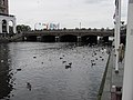
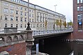
The Lombardsbrücke is one of only two bridges between the two Alster lakes; it is the inner city's most frequented bridge, with an average of 67,000 cars and 1,000 trains per day.

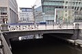
Bridges across the Lower Alster (from the Außenalster downstream); this section lists most bridges in the inner city districts Altstadt and Neustadt.

ImageNameBuiltLengthLocationNotes
Außenalster
Hamburg Kennedybrucke DS433n.jpg
Kennedybrücke
53°33′28″N9°59′53″E / 53.55778°N 9.99806°E / 53.55778; 9.99806
1953126 m
(413 ft)
Rotherbaum, St. Georg designed by Bernhard Hermkes; originally named Neue Lombardsbrücke (until 1963)
Hamburg Lombardsbrucke DS456n.jpg
Lombardsbrücke
53°33′25″N9°59′50″E / 53.55694°N 9.99722°E / 53.55694; 9.99722
1651
(1868) [4]
69 m
(226 ft)
Neustadt, Altstadt designed by Johann Hermann Maack  [ de ]; part of the Wallring, also carries the Hamburg-Altona link line
Binnenalster
Reesendammbrucke 2.jpg
Reesendammbrücke
53°33′7″N9°59′39″E / 53.55194°N 9.99417°E / 53.55194; 9.99417
1844 [4] 47 m
(154 ft)
Neustadt, Altstadt designed by Johann Hermann Maack, carries the Jungfernstieg
Kleine Alster
Schleusenbrucke 3.jpg
Schleusenbrücke1870 Neustadt, Altstadt
↓ Alster continues as Alsterfleet
Adolphsbrucke 2.jpg
Adolphsbrücke184536 m
(118 ft)
Neustadt, Altstadt designed by Johann Hermann Maack, replaced the Scheelengangsbrücke
Heiligengeistbrucke 1.jpg
Heiligengeistbrücke 188551 m
(167 ft)
Neustadt, Altstadt
Slamatjenbrucke 1.jpg
Slamatjenbrücke 1959 Neustadt, Altstadt
Binnenhafenbrücke Neustadt, Altstadt
Otto-Sill-Brucke (Hamburg).ajb.jpg
Otto-Sill-Brücke Neustadt, Altstadt
Norderelbe at Binnenhafen
Bleichenfleet and Herrengrabenfleet

Bridges across Bleichenfleet and Herrengrabenfleet in Neustadt

ImageNameBuiltLength
Alsterfleet
Bleichenbrucke (Hamburg-Neustadt).ajb.jpg
Bleichenbrücke 1845
Stadthausbrucke (Hamburg-Neustadt).ajb.jpg
Stadthausbrücke
462 ellerntorsbruecke.jpg
Ellerntorsbrücke 166836.2 m
(119 ft)
Herrengrabenfleet und Michaelisbrucke in Hamburg-Neustadt.jpg
Michaelisbrücke (1988)
Herrengrabenbrucke (Hamburg-Neustadt).ajb.jpg
Herrengrabenbrücke
Pulverturmsbrucke HH.jpg
Pulverturmbrücke
Schaartorbrücke1868
Norderelbe at Niederhafen
Mönkedammfleet and Nikolaifleet

Bridges across Mönkedammfleet and Nikolaifleet in Altstadt

ImageNameBuiltLength
Alsterfleet
Altenwallbrucke (Hamburg-Altstadt).ajb.jpg
Altenwallbrücke
Muhlenschleuse (Hamburg-Altstadt).ajb.jpg
Mühlenbrücke
Hamburg Trostbrucke 04.jpg
Trostbrücke 1266
(1883)
21 m
(69 ft)
Nikolaifleet in der Hamburger Altstadt.JPG
Zollenbrücke 1355
(1633)
25 m
(82 ft)
Nikolaibrucke (Hamburg-Altstadt).Sudseite.ajb.jpg
Nikolaibrücke
Holzbrucke (Hamburg-Altstadt).ajb.jpg
Holzbrücke 184748 m
(157 ft)
Hohe Brucke (Hamburg-Altstadt).ajb.jpg
Hohe Brücke1887
Norderelbe at Zollkanal

Osterbek

Bridges across Osterbek and Osterbekkanal

Bramfelder Brucke (background) and the U3 Hochbahn Viaduct U-Bahnbrucke Osterbekkanal (Hamburg-Barmbek-Sud).Blick von Westen.2.22314.ajb.jpg
Bramfelder Brücke (background) and the U3 Hochbahn Viaduct
Schleidenbrucke Schleidenbrucke (Hamburg-Barmbek-Sud).1.21977.22329.23210.23211.24448.ajb.jpg
Schleidenbrücke

Uhlenhorster Kanal

Bridges across Hofwegkanal and Uhlenhorster Kanal

Wandse

Bridges across Wandse, Eilbek, Eilbekkanal and Mundsburger Kanal

ImageNameBuiltLengthLocationNotes
Wandse (Hamburg state border)
Wandsbeker Königstraßenbrücke Wandsbek
↓ Mühlenteich
Mühlenstraßenbrücke Wandsbek
Bahnbrücke Eilbek, Barmbek-Süd carries the Hamburg freight rail bypass
↓ Wandse continues as Eilbek
Eilbecker Brücke Eilbek, Barmbek-Süd
Friedrichsberger Brücke Eilbek, Barmbek-Süd
Maxstraßenbrücke 1908 Eilbek, Barmbek-Süd
↓ Wandse continues as Eilbekkanal
Von essen str bruecke 03.jpg
Von-Essen-Straßenbrücke Eilbek, Barmbek-Süd
Wagnerstraßenbrücke Eilbek, Barmbek-Süd
Richardstrassenbrucke uber den Eilbekkanal 1.jpg
Richardstraßenbrücke 1899 [4] Eilbek, Barmbek-Süd
Wartenaubrucke 2.jpg
Wartenaubrücke1908 [4] Hohenfelde, Uhlenhorst carries Wartenau, part of Bundesstraße 5
↓ Kuhmühlenteich
U-Bahn-Bruecke Kuhmuehlenteich.jpg
Kuhmühlenteichbrücke191265 m
(213 ft) [4]
Hohenfelde, Uhlenhorst carries Hamburg U-Bahn line Hamburg U3.svg (Circle line)
↓ Wandse continues as Mundsburger Kanal
Kuhmuhlenbrucke-I.jpg
Kuhmühlenbrücke1870 [4] (1967) Hohenfelde, Uhlenhorst
Mundsburger Brucke.jpg
Mundsburger Brücke1870 [4] 59.3 m
(195 ft)
Hohenfelde, Uhlenhorst designed by Christian Wilhelm Plath and William Lindley
Hamburg Schwanenwikbrucke DS418n.jpg
Schwanenwikbrücke
53°33′56″N10°1′1″E / 53.56556°N 10.01694°E / 53.56556; 10.01694
1878 [4] 55 m
(180 ft)
Hohenfelde, Uhlenhorst designed by Franz Andreas Meyer
Außenalster

Bridges in the Bille river system

Bille

Bridges across the Bille in Hamburg; 23 km (14 mi) of the Bille's total of 65 km (40 mi) lie within Hamburg.

ImageNameBuiltLengthLocationNotes
Bille (Hamburg state border)
Ernst-Mantius-Brücke Bergedorf
↓ Schlossteich
Sehrrahnbrücke Bergedorf
↓ Sehrrahn
Bergedorfer Brücke Bergedorf carries Bergedorfer Straße, part of Bundesstraße 5
Ladenbeker-Furtweg-Brücke Bergedorf
Bojewiesenbrucke (Hamburg-Billwerder).ajb.jpg
Bojewiesenbrücke Bergedorf
Rote Brucke (Hamburg-Billbrook).ajb.jpg
Rote Brücke Billbrook
Gelbe Brücke Billstedt, Billbrook
Blaue Brücke Horn, Billbrook
Braune Brücke Hamm, Rothenburgsort
Grüne Brücke1911 [4] Hammerbrook, Rothenburgsort
Schwarze Brücke1909 [4] Hammerbrook, Rothenburgsort carries Heidenkampsweg, part of Bundesstraße 75
Zweite Amsinckbrücke Hammerbrook, Rothenburgsort carries Amsinckstraße, part of Bundesstraße 4
Norderelbe at Oberhafen

Hammerbrook canals

Bridges across Hammerbrook and Rothenburgsort canals

View of Mittelkanal (sculpture on Zweite Hammerbrookbrucke) Mittelkanal Skulptur Anja Kleinhans.jpg
View of Mittelkanal (sculpture on Zweite Hammerbrookbrücke)
  • Billekanal
    • Schurzalleebrücke
    • Gustav-Kunst-Brücke
  • Hochwasserbassin
    • Wendenbrücke
    • Süderstraßenbrücke (1908)
    • Bullerdeichbrücke
  • Mittelkanal
    • Zweite Banksbrücke
    • Erste Nagelsbrücke
    • Zweite Nagelsbrücke
    • S-Bahn Viaduct
    • Zweite Hammerbrookbrücke
    • Zweite Heidenkampbrücke
  • Schleusenkanal
    • Erste Stadtdeichbrücke
    • Erste Banksbrücke
    • Erste Amsinckbrücke
  • Sonninkanal
    • Mittelkanalbrücke
  • Südkanal
    • Zweite Ausschläger Brücke
    • Zweite Grevenbrücke
  • Tiefstackkanal
    • Liebigbrücke
    • Borsigbrücke
    • Tiefstacker Brücke

Bridges in the Elbe river system

View of the 1810s pile bridge Hamburg Elbbrucke 1815 by Suhr.jpg
View of the 1810s pile bridge

Up until the 19th century, the Unterelbe had no fixed crossing. Travel time between Hamburg and Harburg took over two hours, and included two ferry trips across the Norder- and Süderelbe and a weary trip across the dikes of Wilhelmsburg. During Napoleon's brief annexion of Hamburg, a 4 kilometers (2.5 miles) long pile bridge was built across the islands of Wilhelmsburg, however it also required cable ferries across the Elbe's two anabranches. In 1817 the poorly maintained structure was washed away.

By the 1840s, with industrialization rapidly growing and trade through the Port of Hamburg skyrocketing, the need for a fixed crossing became apparent. At the time, the German states were a loose confederation of sovereign states, with the Free and Hanseatic City of Hamburg only controlling the northern Elbe shore, while the town of Harburg and the southern Elbe shore were part of the Kingdom of Hanover. Both sides built their railway lines: Hamburg–Bergedorf railway in 1842 (extended to Berlin in 1846), and Celle–Harburg railway in 1847 (connected to Hanover since 1845) – but no link across the Elbe. One of the biggest obstacles was Hanover's rivalry to Hamburg and her attempts to promote overseas trade through the Port of Harburg.

Neue Elbbrucke (1887). The Gothic Revival gateways were removed in 1959. Hamburg Neue Elbbrucke Koppmann 1894 MKG.jpg
Neue Elbbrücke (1887). The Gothic Revival gateways were removed in 1959.

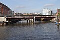
Twenty years on, the missing link became a void in the European rail network. Progress was finally possible after Prussia's annexation of Hanover in 1866; within a few years the Cologne-Minden Railway Company (CME) completed the Venlo–Hamburg railway as North German section of a Paris–Hamburg railway line, and thereby linking Hamburg with the industrial centers of the Rhineland and the Low Countries. The first railway bridges across Norder- and Süderelbe were built between 1869 and 1872, nowadays part of the Elbbrücken. Also starting in 1866, the port's infrastructure was substantially re-organized, in order to cope with the increased quantity of processed goods and to meet requirements of then commonly employed steam-powered vessels. This included an expansion of the port onto the islands of Steinwerder, Veddel and Wilhelmsburg, and set-up of an extensive rail network for the newly established Hamburg port railway (Hafenbahn). In 1887, the Neue Elbbrücke with its three lenticular trusses (each 102 meters long) became a Hamburg landmark and the first road bridge to cross the Norderelbe, serving many of the port's businesses. By 1899, the Alte Harburger Elbbrücke provided a road link across the Süderelbe.

Elbe Bridge I from the series Hamburg Bridges (1932) by Rolf Nesch Rolf-Nesch-Bro-Over-Elben.jpg
Elbe Bridge I from the series Hamburg Bridges (1932) by Rolf Nesch

New bridges across the Elbe anabranches and the Elbe islands' canals were and are continued to be built to this day. Over the years, some of them have set new standards or records in engineering. [3] With the Elbe bridges being perceived as a symbol of the many changes associated with the Industrial Age, they were continuously subject to artistic and intellectual reception, among others by artists of the Hamburg Secession (Sezession) during the interwar period, or latest by the Internationale Bauausstellung during the 2000s. In 2015, the Speicherstadt was acknowledged as a World Heritage Site.

Elbe

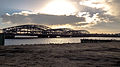
Bridges across the Elbe (Elbbrücken) in Hamburg; some 40 km (25 mi) of the Elbe's total of 1,094 km (680 mi) lie within Hamburg. Up-stream, the next bridge (outside the Hamburg state borders) is located at Geesthacht; down-stream there are no more bridges.

Norderelbe

Bridges across the Norderelbe

Map of bridges across the Norder- and Suderelbe. The two Elbe anabranches are separated by the island of Wilhelmsburg (center).
Neue Freihafenbrucke and Kohlbrandbrucke are the last bridges on the respective riverarm, and also the Elbe's last bridges before reaching the North Sea. Only subsequent river crossings are the Old Elbe Tunnel in St. Pauli and the Bundesautobahn 7's New Elbe Tunnel west of Altona. Karte Hamburger Elbbrucken.png
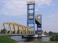
Map of bridges across the Norder- and Süderelbe. The two Elbe anabranches are separated by the island of Wilhelmsburg (center).
Neue Freihafenbrücke and Köhlbrandbrücke are the last bridges on the respective riverarm, and also the Elbe's last bridges before reaching the North Sea. Only subsequent river crossings are the Old Elbe Tunnel in St. Pauli and the Bundesautobahn 7's New Elbe Tunnel west of Altona.
ImageNameBuiltLengthLocationNotes
Elbe (Hamburg state border)
Norderelbbrucke A1 03.jpg
Moorfleeter Brücke
53°31′0″N10°4′0″E / 53.51667°N 10.06667°E / 53.51667; 10.06667
1962411 m
(1,348 ft)
Moorfleet, Wilhelmsburg designed by Hellmut Homberg  [ de ], carries Bundesautobahn 1
ElbbruckenF2885.JPG
Neue Elbbrücke
53°32′0″N10°2′0″E / 53.53333°N 10.03333°E / 53.53333; 10.03333
1887
(1959)
304.7 m
(1,000 ft)
Veddel, Rothenburgsort, Hammerbrook designed by Hermann Lohse, carries Bundesstraße 4 and 75
Norderelbbrucken 2014.jpg
Eisenbahnbrücke
53°31′58″N10°1′23″E / 53.53278°N 10.02306°E / 53.53278; 10.02306
1872 Veddel, Rothenburgsort, Hammerbrook designed by Heinrich Strack; carries the Hanover–Hamburg and Wanne-Eickel–Hamburg railway lines
Freihafen Elbbrucke 07.jpg
Neue Freihafenelbbrücke1917340 m
(1,120 ft)
Veddel, Rothenburgsort, Hammerbrook carries the Hamburg port railway
↓ confluence with Süderelbe to become Niederelbe (Lower Elbe)
Aerial view of the Speicherstadt's Hollandischbrookfleet and Wandrahmsfleet (center) and the Zollkanal (far right). 2013-06-08 Projekt Heissluftballon - Highflyer DSCF0975.jpg
Aerial view of the Speicherstadt's Holländischbrookfleet and Wandrahmsfleet (center) and the Zollkanal (far right).
Oberhafen, Zollkanal and Binnenhafen

Bridges across Oberhafen, Zollkanal and Binnenhafen between Hammerbrook, Altstadt and HafenCity

  • Oberhafenkanal
    • Billhorner Brücke
    • Oberhafenkanalbrücke
    • Bahnbrücke
  • Oberhafen
    • Oberhafenbrücke (1904, 152 m)
    • Oberbaumbrücke
  • Zollkanal
    • Wandrahmsteg
    • Kornhausbrücke (1899, 45 m)
    • Jungfernbrücke (1888, 41 m)
    • Kibbelsteg (1890, 220 m)
    • Brooksbrücke (1888, 50 m)
    • Kehrwiedersteg (1890)
  • Binnenhafen
    • Niederbaumbrücke (1880)
Speicherstadt and HafenCity canals

Bridges across Speicherstadt and HafenCity canals within HafenCity (sorted alphabetically by name of waterbody)

  • Baakenhafen
    • Baakenhafenbrücke (2013, 170 m)
  • Brooksfleet
    • Kibbelsteg (1890, 220 m)
  • Brooktorhafen
    • Brooktorkaibrücke
    • Leónbrücke
    • Shanghaibrücke
  • Ericusgraben
    • Ericusbrücke (1872)
  • Holländischbrookfleet
    • Holländischbrookfleetbrücke
  • Kehrwiederfleet
    • Sandbrücke
    • Kehrwiedersteg (1890)
    • Wilheminenbrücke
  • Kleines Fleet
    • Pickhubenbrücke
    • Kannengießerbrücke
  • Magdeburger Hafen
    • Busanbrücke
    • Magdeburger Brücke
  • Sandtorhafen
    • Mahatma-Gandhi-Brücke
  • St. Annenfleet
    • St. Annenbrücke
    • Neuerwegsbrücke
  • Wandrahmsfleet
    • Poggenmühlenbrücke
    • Wandrahmsfleetbrücke
    • Wandbereiterbrücke
    • Kannengießerortbrücke

Süderelbe

Bridges across the Süderelbe

ImageNameBuiltLengthLocationNotes
Elbe (Hamburg state border)
Neeland - Elv - Fischer.jpg
Moorwerder Brücke
53°28′0″N10°1′0″E / 53.46667°N 10.01667°E / 53.46667; 10.01667
970 m
(3,180 ft)
Moorwerder, Wilhelmsburg carries Bundesautobahn 1
Harburger Eisenbahnbrucke 2013-06-07.jpg
Eisenbahnbrücke
53°28′25″N9°59′44″E / 53.47361°N 9.99556°E / 53.47361; 9.99556
1872
(1979)
340 m
(1,120 ft)
Harburg, Wilhelmsburg carries the Hanover–Hamburg and Wanne-Eickel–Hamburg railway lines
Europabruecke close 2013-06-07.jpg
Europabrücke
53°31′58″N10°1′23″E / 53.53278°N 10.02306°E / 53.53278; 10.02306
1983471 m
(1,545 ft)
Harburg, Wilhelmsburg carries Bundesautobahn 253
Brücke des 17. Juni1937
(1949)
472 m
(1,549 ft)
Harburg, Wilhelmsburg originally named Wilhelmsburger Brücke, renamed after the 1953 uprising in East Germany
Elbbruecken von Innen2.jpg
Alte Harburger Elbbrücke
53°28′0″N10°0′0″E / 53.46667°N 10.00000°E / 53.46667; 10.00000
1899474 m
(1,555 ft)
Harburg, Wilhelmsburg designed by Hubert Stier
Kattwyk-P1010772.JPG
Kattwykbrücke
53°29′40″N9°57′6″E / 53.49444°N 9.95167°E / 53.49444; 9.95167
1973290 m
(950 ft)
Moorburg, Wilhelmsburg the world's tallest lift bridge, with a liftable height of 46 m (151 ft)
↓ Süderelbe continues as Köhlbrand
Kohlbrandbrucke o.jpg
Köhlbrandbrücke
53°31′18″N9°56′18″E / 53.52167°N 9.93833°E / 53.52167; 9.93833
19743,940 m
(12,930 ft)
Waltershof, Steinwerder designed by Paul Boué, Egon Jux and Hans Wittfoht; was the world's longest cable-stayed bridge from 1974 to 1991
↓ confluence with Norderelbe to become Niederelbe (Lower Elbe)

Este

Bridges across the Este in Hamburg; only 2 km (1.2 mi) of the Este's total of 62 km (39 mi) lie within the state borders of Hamburg.

Harburg canals

Bridges across harbor basins and canals in Harburg; the port of Harburg is indirectly fed through the Seeve.

  • Östlicher Bahnhofskanal
    • Östliche Bahnhofskanalklappbrücke
  • Westlicher Bahnhofskanal
    • Westliche Bahnhofskanalklappbrücke
  • Lotsekanal
    • Lotsebrücke
  • Holzhafen
    • Holzhafenbrücke

Wilhelmsburg canals

Bridges across Elbe anabranches and canals on the island of Wilhelmsburg (including the islands of Steinwerder, Kleiner Grasbrook and Veddel)

Reiherstieg Bascule Bridge (1984) Reiherstieg Klappbrucke 03.jpg
Reiherstieg Bascule Bridge (1984)
Rethe Lift Bridge (1934) Rethe-Hubbrucke 3.jpg
Rethe Lift Bridge (1934)
  • Aßmannkanal
    • Aßmannkanalbrücke
  • Grevenhofkanal
    • Grevenhofbrücke
    • Grevenhofkanalbrücke
  • Marktkanal
    • Marktkanalbrücke
  • Moorkanal
    • Moorkanalbrücke
  • Müggenburger Kanal
    • Reginenortbrücke
  • Müggenburger Zollhafen
    • Müggenburger Zollhafenbrücke
    • Wilhelmsburger Brücke
  • Peutekanal
    • Erste Peutebrücke
    • Zweite Peutebrücke
  • Querkanal
    • Erste Querbrücke
    • Zweite Querbrücke
  • Reiherstieg
    • Argentinienbrücke
    • Ellerholzbrücke
    • Reiherstiegbrücke (1985, 100 m)
  • Rethe
    • Rethebrücke (1934, 73 m)
  • Roßkanal
    • Roßkanalbrücke
    • Howaltbrücke
    • Hachmannbrücke
  • Saalehafen
    • Sachsenbrücke
    • Niedernfelder Brücke
  • Spreehafen
    • Spreehafenbrücke
  • Veddelkanal
    • Brandenburger Brücke
    • Veddelkanalbrücke
  • Veringkanal
    • Neue Veringkanalbrücke
    • Wollkämmereibrücke

Bridges elsewhere

Please note, this section only lists bridges and viaducts in Hamburg, not listed above (i.e. only bridges and viaducts not crossing a body of water).

Railway bridges and viaducts

Hamburg U-Bahn (Hochbahn) viaducts
  • Barmbek Markt (A 75) Viaduct (1912, 412 m) [4]
  • Baumwall Viaduct (1912)
  • Isestraße Viaduct (1912, 825 m) [4]
  • Rödingsmarkt Viaduct (1912)
  • Volksdorfer Straße Viaduct
  • Vorsetzen (A 199) Viaduct (1912, 240 m)
  • Walddörferbahnviadukt
Other railway viaducts
  • Sternbrücke (1893, 75 m)
  • Oberer Landweg Eisenbahnbrücke

Road bridges and viaducts

Carrying Bundesautobahn 7, Hochstrasse Elbmarsch is Germany's longest road bridge at a length of 4,258 m (13,970 ft). A7 Hamburg Waltershof 026.jpg
Carrying Bundesautobahn 7, Hochstraße Elbmarsch is Germany's longest road bridge at a length of 4,258 m (13,970 ft).

Foot bridges

See also

Literature

Related Research Articles

<span class="mw-page-title-main">Hamburg</span> City and state in Germany

Hamburg, officially the Free and Hanseatic City of Hamburg, is the second-largest city in Germany after Berlin, as well as the overall 8th-largest city and largest non-capital city within the European Union with a population of over 1.9 million. Hamburg's urban area has a population of around 2.5 million and is part of the Hamburg Metropolitan Region, which has a population of over 5.1 million people in total and is the eighth biggest metropolitan region by GDP in the European Union. At the southern tip of the Jutland Peninsula, Hamburg stands on the branching River Elbe at the head of a 110 km (68 mi) estuary down to the North Sea, on the mouth of the Alster and Bille. Hamburg is one of Germany's three city-states alongside Berlin and Bremen, and is surrounded by Schleswig-Holstein to the north and Lower Saxony to the south. The Port of Hamburg is Germany's largest and Europe's third-largest, after Rotterdam and Antwerp. The local dialect is a variant of Low Saxon.

<span class="mw-page-title-main">Elbe</span> Major river in Central Europe

The Elbe is one of the major rivers of Western Europe. It rises in the Giant Mountains of the northern Czech Republic before traversing much of Bohemia, then Germany and flowing into the North Sea at Cuxhaven, 110 kilometres northwest of Hamburg. Its total length is 1,094 km (680 mi).

<span class="mw-page-title-main">Havel</span> River in Germany

The Havel is a river in northeastern Germany, flowing through the states of Mecklenburg-Vorpommern, Brandenburg, Berlin and Saxony-Anhalt. The 325 kilometres (202 mi) long Havel is a right tributary of the Elbe. However, the direct distance from its source to its mouth is only 94 kilometres (58 mi). For much of its length, the Havel is navigable; it provides an important link in the waterway connections between the east and west of Germany, as well as beyond.

<span class="mw-page-title-main">Harburg, Hamburg</span> Borough of Hamburg in Germany

Harburg is a borough of the city of Hamburg, Germany. It is also the name of Harburg quarter in the borough, which used to be the capital of the Harburg district in Lower Saxony. The borough of Harburg lies on the southern banks of the river Elbe and covers parts of the port of Hamburg as well as residential and rural areas. It had a population of 169,221 as of 2020.

<span class="mw-page-title-main">Alster</span> River in Germany

The Alster is a right tributary of the Elbe river in Northern Germany. It has its source near Henstedt-Ulzburg, Schleswig-Holstein, flows somewhat southwards through much of the Free and Hanseatic City of Hamburg and joins the Elbe in central Hamburg.

<span class="mw-page-title-main">Außenalster</span> Artificial lake in Hamburg

Außenalster or Outer Alster Lake is the larger one of two artificial lakes, which are formed by the Alster River and are both located within the city limits of Hamburg, Germany. The other „lake“ is the Binnenalster. The Außenalster and its shores are used by the inhabitants of Hamburg for many sport and recreational purposes, such as sailing and rowing.

<span class="mw-page-title-main">Wilhelmsburg, Hamburg</span> Quarter of Hamburg in Germany

Wilhelmsburg is a quarter (Stadtteil) of Hamburg, Germany within the borough (Bezirk) of Hamburg-Mitte. It is situated on several islands between the Northern and Southern branches of the Elbe river, together with the other quarters of Steinwerder, Veddel and Kleiner Grasbrook. The latter almost exclusively consists of facilities of the port of Hamburg. In 2020 the population was 53,064.

<span class="mw-page-title-main">Kleiner Grasbrook</span> Quarter of Hamburg in Germany

Kleiner Grasbrook is a quarter of Hamburg, Germany within the borough of Hamburg-Mitte. It is situated on the eponymous island between the Northern and Southern branches of the Elbe river, together with the other quarters of Steinwerder, Veddel and Wilhelmsburg. It almost exclusively consists of facilities of the port of Hamburg. The four quarters are technically all islands of their own, as they are all separated by their own dams. In 2020 the population was 1,120.

Transport in Hamburg comprises an extensive, rail system, subway system, airports and maritime services for the more than 1.8 million inhabitants of the city of Hamburg and 5.3 million people in the Hamburg Metropolitan Region.

<span class="mw-page-title-main">Harburg (quarter)</span> Quarter of Hamburg in Germany

Harburg is a quarter (Stadtteil) in the Harburg borough (Bezirk) of Hamburg, Germany. It used to be the capital of the Harburg district in Lower Saxony. In 2020, the population was 25,979.

<span class="mw-page-title-main">Harburg S-Bahn</span> Railway line in southern Hamburg, Germany

The Harburg S-Bahn line is a railway line in southern Hamburg, Germany. It starts at Hamburg Hauptbahnhof and runs via Harburg to Stade. It mostly runs parallel with the line to Hanover and the Lower Elbe line and is now part of the Hamburg S-Bahn lines S3 and S31.

<span class="mw-page-title-main">Dove Elbe</span> River in Germany

The Dove Elbe is a closed anabranch of the Unterelbe, the lower part of the river Elbe.

<span class="mw-page-title-main">Norderelbe</span> River in Germany

The Norderelbe is one of the two big anabranches of the Unterelbe river in the area which is now the Port of Hamburg, Germany. The other anabranch is the Süderelbe. Together they form the island of Wilhelmsburg.

<span class="mw-page-title-main">Unterelbe</span> River in Germany

The Unterelbe or, in English usually the Lower Elbe, refers to the lower reaches of the river Elbe in Germany influenced by the tides.

<span class="mw-page-title-main">Hamburg freight rail bypass</span>

The Hamburg freight rail bypass is a railway line in the German city of Hamburg. It runs from Hamburg-Eidelstedt via Hamburg-Rothenburgsort to Hamburg-Harburg and connects the long-distance railways approaching Hamburg, bypassing the link line and the railway junctions on the approaches to Hamburg-Altona station and Hamburg Hauptbahnhof. The line is mainly used for rail freight.

<span class="mw-page-title-main">Altstadt, Hamburg</span> Place in Hamburg, Germany

Altstadt, more precisely Hamburg-Altstadt – as not to be mistaken with Hamburg-Altona-Altstadt – is one of the inner-city districts of the Free and Hanseatic City of Hamburg, Germany.

<span class="mw-page-title-main">Elbbrücken station</span>

Elbbrücken station is a public transit terminal station in Hamburg, Germany, near the railway and road bridges called Elbbrücken leading over the Norderelbe. It consists of two elevated stops, one for the Hamburg U-Bahn underground which opened in 2018, and one for the Hamburg S-Bahn suburban trains which opened a year later. Each stop has two tracks, interlinked by a "skywalk". The station is the terminus of the U4 U-Bahn line and is between Hammerbrook and Veddel on the S3/S5 S-Bahn lines. It was built to provide easier access to the new HafenCity quarter of Hamburg from the south.

<span class="mw-page-title-main">Elbbrücken (Hamburg)</span> Group of bridges across the Elbe in Hamburg

The Elbbrücken are several independent bridge structures crossing the river Elbe in Hamburg, Germany. Within Hamburg, the Elbe divides into two main anabranches, the Norderelbe and the Süderelbe, which, after the Alte Süderelbe was sealed off, reunite with the Norderelbe via the Köhlbrand anabranch, bypassing the Elbe islands, of which Wilhelmsburg is the largest river island on the Elbe.

References

  1. 1 2 Landesbetrieb Straßen, Brücken und Gewässer (LSBG) Hamburg, 2004
  2. private bridges excluded (e.g. factory premises or Hagenbeck's Tierpark)
  3. 1 2 3 4 5 Friedhelm Grundmann, Michael Zapf: Hamburg - Stadt der Brücken, Schubert; Leipzig, 2003, ISBN   3929229897
  4. 1 2 3 4 5 6 7 8 9 10 11 12 13 14 Hamburg und seine Bauten 1914, unter Berücksichtigung der Nachbarstädte Altona und Wandsbek (in German). Vol. Bd. 2. Hamburg: Architekten- und Ingenieurverein zu Hamburg. 1914. pp. 165 ff.

Commons-logo.svg Media related to Bridges in Hamburg at Wikimedia Commons