"},"elevation_ft":{"wt":"548"},"elevation_point":{"wt":""},"population_as_of":{"wt":"[[2020 United States census|2020]]"},"population_footnotes":{"wt":"{{Cite web| url=https://data.census.gov/cedsci/table?q=&g=1600000US1732408&tid=DECENNIALPL2020.P1| title=P1. Race – Hamel village, Illinois: 2020 DEC Redistricting Data (PL 94-171)| publisher=U.S. Census Bureau| access-date=February 17, 2023}}"},"population_total":{"wt":"929"},"pop_est_as_of":{"wt":""},"pop_est_footnotes":{"wt":""},"population_est":{"wt":""},"population_rank":{"wt":""},"population_density_km2":{"wt":"301.49"},"population_density_sq_mi":{"wt":"780.67"},"population_metro_footnotes":{"wt":""},"population_metro":{"wt":""},"population_density_metro_km2":{"wt":""},"population_density_metro_sq_mi":{"wt":""},"population_density":{"wt":""},"population_density_rank":{"wt":""},"population_blank1_title":{"wt":""},"population_blank1":{"wt":""},"population_density_blank1_km2":{"wt":""},"population_density_blank1_sq_mi":{"wt":""},"population_blank2_title":{"wt":""},"population_blank2":{"wt":""},"population_density_blank2_km2":{"wt":""},"population_density_blank2_sq_mi":{"wt":""},"population_demonym":{"wt":""},"population_note":{"wt":""},"demographics_type1":{"wt":""},"demographics1_footnotes":{"wt":""},"demographics1_title1":{"wt":""},"demographics1_info1":{"wt":""},"demographics_type2":{"wt":""},"demographics2_footnotes":{"wt":""},"demographics2_title1":{"wt":""},"demographics2_info1":{"wt":""},"timezone1":{"wt":"[[North American Central Time Zone|CST]]"},"utc_offset1":{"wt":"-6"},"timezone1_DST":{"wt":"[[North American Central Time Zone|CDT]]"},"utc_offset1_DST":{"wt":"-5"},"timezone2":{"wt":""},"utc_offset2":{"wt":""},"timezone2_DST":{"wt":""},"utc_offset2_DST":{"wt":""},"postal_code_type":{"wt":"[[ZIP code]]"},"postal_code":{"wt":"62046"},"postal2_code_type":{"wt":""},"postal2_code":{"wt":""},"area_code_type":{"wt":""},"area_code":{"wt":"[[Area code 618#United States|618]]"},"geocode":{"wt":""},"iso_code":{"wt":""},"blank_name":{"wt":"[[Federal Information Processing Standards|FIPS code]]"},"blank_info":{"wt":"17-32408"},"blank1_name":{"wt":"[[Geographic Names Information System|GNIS]] feature ID"},"blank1_info":{"wt":"2398229{{GNIS|2398229}}"},"blank2_name":{"wt":""},"blank2_info":{"wt":""},"blank_name_sec2":{"wt":""},"blank_info_sec2":{"wt":""},"blank1_name_sec2":{"wt":""},"blank1_info_sec2":{"wt":""},"blank2_name_sec2":{"wt":"Wikimedia Commons"},"blank2_info_sec2":{"wt":"Hamel, Illinois"},"website":{"wt":"{{URL|www.villageofhamel.com}}"},"footnotes":{"wt":""}},"i":0}}]}" id="mwBQ">Village in Illinois, United States
Hamel, Illinois | |
---|---|
Coordinates: 38°53′15″N89°50′38″W / 38.88750°N 89.84389°W | |
Country | United States |
State | Illinois |
County | Madison |
Township | Hamel |
Government | |
• Village President | Justin Gerstner |
Area | |
• Total | 1.20 sq mi (3.10 km2) |
• Land | 1.19 sq mi (3.08 km2) |
• Water | 0.01 sq mi (0.02 km2) |
Elevation | 548 ft (167 m) |
Population | |
• Total | 929 |
• Density | 780.67/sq mi (301.49/km2) |
Time zone | UTC-6 (CST) |
• Summer (DST) | UTC-5 (CDT) |
ZIP code | 62046 |
Area code | 618 |
FIPS code | 17-32408 |
GNIS feature ID | 2398229 [2] |
Wikimedia Commons | Hamel, Illinois |
Website | www |
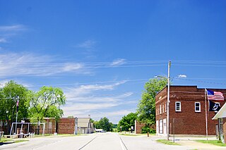
Hamel is a village in Madison County, Illinois, United States. The population was 929 at the 2020 census, [3] up from 816 in 2010. It is a part of the Illinois Metro East portion of the Greater St. Louis metropolitan area.
Hamel is located in northeastern Madison County at 38°53′15″N89°50′38″W / 38.88750°N 89.84389°W (38.887524, -89.843949). [4] Interstate 55 passes through the east side of the village, leading southwest 30 miles (48 km) to St. Louis and north 65 miles (105 km) to Springfield, the Illinois capital. Illinois Route 140 passes through the center of Hamel as State Street, leading east 23 miles (37 km) to Greenville and west 19 miles (31 km) to Alton.
According to the U.S. Census Bureau, Hamel has a total area of 1.20 square miles (3.11 km2), of which 0.01 square miles (0.03 km2), or 0.75%, are water. [1] Hamel is drained to the south by tributaries of Silver Creek, a south-flowing tributary of the Kaskaskia River.
Census | Pop. | Note | %± |
---|---|---|---|
1960 | 362 | — | |
1970 | 454 | 25.4% | |
1980 | 537 | 18.3% | |
1990 | 530 | −1.3% | |
2000 | 570 | 7.5% | |
2010 | 816 | 43.2% | |
2020 | 929 | 13.8% | |
U.S. Decennial Census [5] |
As of the census [6] of 2000, there were 570 people, 233 households, and 170 families living in the village. The population density was 491.3 inhabitants per square mile (189.7/km2). There were 242 housing units at an average density of 208.6 per square mile (80.5/km2). The racial makeup of the village was 98.25% White, 0.35% from other races, and 1.40% from two or more races. Hispanic or Latino of any race were 0.53% of the population.
There were 233 households, out of which 31.3% had children under the age of 18 living with them, 63.5% were married couples living together, 8.2% had a female householder with no husband present, and 27.0% were non-families. 24.5% of all households were made up of individuals, and 10.7% had someone living alone who was 65 years of age or older. The average household size was 2.45 and the average family size was 2.92.
In the village, the population was spread out, with 24.2% under the age of 18, 6.1% from 18 to 24, 31.8% from 25 to 44, 21.6% from 45 to 64, and 16.3% who were 65 years of age or older. The median age was 37 years. For every 100 females, there were 91.9 males. For every 100 females age 18 and over, there were 85.4 males.
The median income for a household in the village was $45,750, and the median income for a family was $55,694. Males had a median income of $41,023 versus $24,028 for females. The per capita income for the village was $19,062. About 4.0% of families and 3.6% of the population were below the poverty line, including 3.2% of those under age 18 and 5.5% of those age 65 or over.
Valier is a village in Franklin County, Illinois, United States. The population was 554 at the 2020 census.
Virgil is a village in Virgil Township, Kane County, Illinois, United States. It was incorporated on November 6, 1990. The population was 329 at the 2010 census, up from 266 in 2000.
Eagarville is a village in Macoupin County, Illinois, United States. The population was 114 at the 2020 census.
Sawyerville is a village in Macoupin County, Illinois, United States. As of the 2020 census the population was 268.
Standard City is a village in Macoupin County, Illinois, United States. The population was 135 at the 2020 census.
White City is a village in Macoupin County, Illinois, United States. The population was 212 as of the 2020 census.
Wilsonville is a village in Macoupin County, Illinois, United States. The population was 536 at the 2020 census.
Alhambra is a village in Madison County, Illinois, United States. The population was 622 at the 2020 census.
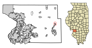
Grantfork is a village in Madison County, Illinois, United States. The population was 341 as of the 2020 census. It is part of the St. Louis Metropolitan Area.
Livingston is a village in Madison County, Illinois, United States. The population was 763 at the 2020 census, down from 858 in 2010.
Marine is a village in Madison County, Illinois, United States. The population was 912 at the 2020 census.
Maryville is a village in Madison County, Illinois, United States. The population was 8,221 at the 2020 census, up from 7,487 in 2010.
Rosewood Heights is an unincorporated community and census-designated place (CDP) in Madison County, Illinois, United States. The population was 3,971 at the 2020 census. It is part of the Metro East region of the Greater St. Louis metropolitan area.
St. Jacob or Saint Jacob is a village in Madison County, Illinois, United States. The population was 1,358 at the 2020 census, up from 1,098 in 2010.
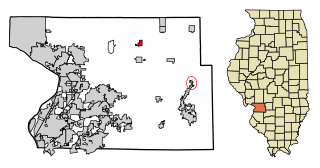
Worden is a village in Madison County, Illinois, United States. The population was 1,096 at the 2020 census.
Walshville is a small village in Montgomery County, Illinois, United States. The population was 61 at the 2020 census.
Tilden is a village in Randolph County, Illinois, United States. The population was 934 at the 2010 census.
Castorland is a village in Lewis County, New York, United States; it is north of Lowville and southeast of Carthage. The population was 360 in 2019.
Sans Souci is a census-designated place (CDP) in Greenville County, South Carolina, United States. The population was 7,869 at the 2010 census. It is part of the Greenville-Anderson-Mauldin, SC Metropolitan Statistical Area.
Oak Park Township is one of 29 townships in Cook County, Illinois and its boundaries are coterminous with the village of Oak Park. As of the 2020 census, the population was 54,583.