Hanover, Alabama | |
|---|---|
 Hanover, Alabama  Hanover, Alabama | |
| Coordinates: 33°00′07″N86°11′56″W / 33.00194°N 86.19889°W | |
| Country | United States |
| State | Alabama |
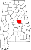
| County | Coosa |
| Area | |
• Total | 4.23 sq mi (10.96 km2) |
| • Land | 4.21 sq mi (10.91 km2) |
| • Water | 0.023 sq mi (0.06 km2) |
| Elevation | 771 ft (235 m) |
| Population (2020) | |
• Total | 151 |
| • Density | 35.8/sq mi (13.84/km2) |
| Time zone | UTC-6 (Central (CST)) |
| • Summer (DST) | UTC-5 (CDT) |
| Area codes | 256 & 938, 334 |
| GNIS feature ID | 2805890 [2] |
Hanover is a census-designated place in Coosa County, Alabama, United States.
Contents
Hanover is likely named for Hanover, Virginia. [3]
A post office operated under the name Hanover from 1847 to 1907. [4]
The Hanover Schist is named for Hanover. [5]
It was first named as a CDP in the 2020 Census which listed a population of 151. [6]