Hissop, Alabama

Last updated

Hissop, Alabama
Coosa County Alabama Incorporated and Unincorporated areas Hissop Highlighted 0134984.svg
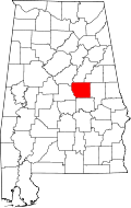
Location of Hissop in Coosa County, Alabama.
USA Alabama location map.svg
Red pog.svg
Hissop
Coordinates: 32°53′32″N86°09′12″W / 32.89222°N 86.15333°W / 32.89222; -86.15333
Country United States
State Alabama
County Coosa
Area
[1]
  Total
10.93 sq mi (28.31 km2)
  Land10.93 sq mi (28.30 km2)
  Water0.00 sq mi (0.01 km2)
Elevation
794 ft (242 m)
Population
 (2020)
  Total
209
  Density19.13/sq mi (7.39/km2)
Time zone UTC-6 (Central (CST))
  Summer (DST) UTC-5 (CDT)
Area code(s) 256 & 938
GNIS feature ID120154 [2]

Hissop is a census-designated place and unincorporated community in Coosa County, Alabama, United States. Its population was 209 as of the 2020 census.

Contents

Demographics

Historical population
CensusPop.Note
2020 209
U.S. Decennial Census [3]

2020 census

Hissop racial composition [4]
RaceNum.Perc.
White (non-Hispanic)4622.01%
Black or African American (non-Hispanic)15674.64%
Other/Mixed 31.44%
Hispanic or Latino 41.91%

As of the 2020 United States census, there were 209 people, 203 households, and 80 families residing in the CDP.

History

A post office was established as Hissop in 1880, and remained in operation until it was discontinued in 1990. [5] The community was named after the biblical plant Ezov, usually translated as hyssop. [6]

References

  1. "2020 U.S. Gazetteer Files". United States Census Bureau. Retrieved October 29, 2021.
  2. "Hissop". Geographic Names Information System . United States Geological Survey, United States Department of the Interior.
  3. "Census of Population and Housing". Census.gov. Retrieved June 4, 2016.
  4. "Explore Census Data". data.census.gov. Retrieved December 18, 2021.
  5. "Coosa County". Jim Forte Postal History. Retrieved October 1, 2014.
  6. Mann, Joel F. (January 1, 2005). An International Glossary of Place Name Elements. Scarecrow Press. p. 77. ISBN   978-0-8108-5040-8.