Nixburg, Alabama | |
|---|---|
 Nixburg, Alabama  Nixburg, Alabama | |
| Coordinates: 32°52′18″N86°05′58″W / 32.87167°N 86.09944°W | |
| Country | United States |
| State | Alabama |
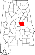
| County | Coosa |
| Area | |
• Total | 7.47 sq mi (19.35 km2) |
| • Land | 7.46 sq mi (19.33 km2) |
| • Water | 0.012 sq mi (0.03 km2) |
| Elevation | 732 ft (223 m) |
| Population (2020) | |
• Total | 329 |
| • Density | 44.1/sq mi (17.02/km2) |
| Time zone | UTC-6 (Central (CST)) |
| • Summer (DST) | UTC-5 (CDT) |
| Area codes | 256 & 938, 334 |
| GNIS feature ID | 2805891 [2] |
Nixburg is a census-designated place in Coosa County, Alabama, United States.