External links
Coordinates: 40°20′00″N76°45′02″W / 40.33333°N 76.75056°W / 40.33333; -76.75056
| | This Dauphin County, Pennsylvania state location article is a stub. You can help Wikipedia by expanding it. |
It is proposed that this article be deleted because of the following concern:
If you can address this concern by improving, copyediting, sourcing, renaming, or merging the page, please edit this page and do so. You may remove this message if you improve the article or otherwise object to deletion for any reason. Although not required, you are encouraged to explain why you object to the deletion, either in your edit summary or on the talk page. If this template is removed, do not replace it . The article may be deleted if this message remains in place for seven days, i.e., after 18:48, 30 August 2021 (UTC). Find sources: "Hanover Heights, Pennsylvania" – news · newspapers · books · scholar · JSTOR |
Hanover Heights is an unincorporated community in Dauphin County, Pennsylvania in the Harrisburg-Carlisle Metropolitan Statistical Area, the latitude is 40.333, and the longitude -76.751, its elevation is 509 feet.
Coordinates: 40°20′00″N76°45′02″W / 40.33333°N 76.75056°W

East Carroll Township is a township in Cambria County, Pennsylvania, United States. The population was 1,654 at the 2010 census. It is part of the Johnstown, Pennsylvania Metropolitan Statistical Area.

Lower Paxton Township is a township of the second class in Dauphin County, Pennsylvania, United States. The township was incorporated in 1767 from Paxton Township. The population was 47,360 at the 2010 census. It is the second-most populous municipality in the county, after Harrisburg.

West Hanover Township is a township in Dauphin County, Pennsylvania, United States. The population was 9,343 at the 2010 census, up from 6,505 at the 2000 census.

Millcreek Township is a township in Lebanon County, Pennsylvania, United States. The population was 3,892 at the 2010 census. It is part of the Lebanon, PA Metropolitan Statistical Area.

Rye Township is a township in Perry County, Pennsylvania, United States. The population was 2,364 at the 2010 census.

Hempfield Township is a township in Westmoreland County, Pennsylvania, United States. The population was 43,241 at the 2010 census, making it the second largest suburb in the Pittsburgh Metropolitan Area by population. Its name is taken from Hempfield in Lancaster County, which was formed in 1729 and is named after the hemp fields in the area.

Mount Jefferson is an unincorporated community in Loramie Township, Shelby County, Ohio, United States. It lies along State Route 66 south of Houston. At 958 feet (292 m) above sea level, it is not on a summit, but is located on the south slope of the valley formed by Ninemile Creek, a tributary of Loramie Creek.

Nantucket Sound is a roughly triangular area of the Atlantic Ocean offshore from the U.S. state of Massachusetts. It is 30 miles (48 km) long and 25 miles (40 km) wide, and is enclosed by Cape Cod on the north, Nantucket on the south, and Martha's Vineyard on the west. Between Cape Cod and Martha's Vineyard it is connected to the Vineyard Sound. Ports on Nantucket Sound include Nantucket and Hyannis, Massachusetts.

Blue Bell Hill is a chalk hill between Maidstone and Rochester in the English county of Kent. It overlooks the River Medway and is part of the North Downs. Settlements on the hill include the Walderslade suburb of Chatham and the villages of Blue Bell Hill and Kit's Coty. During the eighteenth and nineteenth centuries much of the hill was quarried for chalk.

LaSalle Township is located in LaSalle County, Illinois. As of the 2010 census, its population was 13,565 and it contained 6,356 housing units. LaSalle Township was formed from Peru Township on an unknown date.

The Magic Roundabout in High Wycombe, Buckinghamshire, England, is similar to the roundabouts with the same name in Hemel Hempstead and other places. It is located on the junction of the A40 and A404. The junction is the second meeting point of the two roads, they interchange at the start of the A404 in Marylebone, London, with the A40 forming the Westway. The two roads follow different routes to reach Wycombe, the A40 coming via Beaconsfield and the A404 via North London and Amersham. From the roundabout, the A40 continues towards Oxford, Cheltenham, Gloucester and South Wales, whilst the A404 goes south to Marlow and Maidenhead.
Woodbourne Heights, Baltimore is a community in northern Baltimore, Maryland. It is served by the Woodbourne Heights Community, the Woodbourne-McCabe Neighborhood and the Beauregard Neighborhood Associations.
Manada Hill, is an unincorporated community in East Hanover Township, Dauphin County, Pennsylvania, United States, adjoining the census-designated place of Skyline View. The village is bounded to the east along Route 39 at the intersection with Jonestown Road to the north, Manada View Drive to the south and Manada Creek to the east.

Clay Hill, also spelled Clayhill, is an unincorporated community in Marengo County, Alabama, United States. Clay Hill was established prior to the American Civil War. It had a post office at one time, but it no longer exists.

Tiétar is a river of Spain. It is a tributary of the Tagus. Its source is in the Sierra de Gredos mountain range and has a length of 170 km. It flows into the Tagus at Monfragüe.
Hanoverdale is an unincorporated community in Dauphin County, Pennsylvania in the Harrisburg-Carlisle Metropolitan Statistical Area, the latitude is 40.321, and the longitude -76.704, its elevation is 515 feet (157 m). Hanoverdale is located at the intersection of Hershey Road and Devonshire Heights Road.

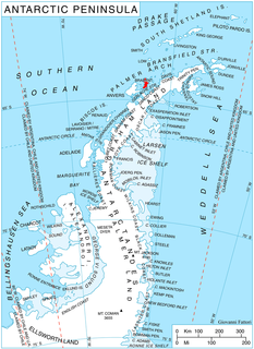
Stribog Mountains is the principal mountain system of Brabant Island in the Palmer Archipelago, Antarctica rising to 2520 m. The feature is 40 km long in north-south direction and 15 km wide, connected to Stavertsi Ridge on the northeast by Viamata Saddle, to Avroleva Heights on the east by Doriones Saddle, and to Solvay Mountains on the south by Aluzore Gap. It is heavily glaciated, with steeper and partly ice-free west slopes.
Bayard is an unincorporated community in Columbiana County, in the U.S. state of Ohio.

Altamont is an unincorporated community in Steubenville Township, Jefferson County, Ohio, United States. It is located south of Steubenville and just east of Hillsboro along Wilson Avenue, at 40°20′00″N80°37′03″W.

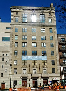
German School Brooklyn is a German international school in Downtown Brooklyn in New York City.