Las Flores is an unincorporated census-designated place (CDP) in Orange County, California, located adjacent to the City of Rancho Santa Margarita, California. The population was 5,971 at the 2010 census, up from 5,625 at the 2000 census. Las Flores does not have its own ZIP Code and is served by the same ZIP Code as adjacent Rancho Santa Margarita. The Rancho Santa Margarita dog/skate park is located in the CDP and is served by the Orange County Sheriff's Dept. and Orange County Fire Authority.

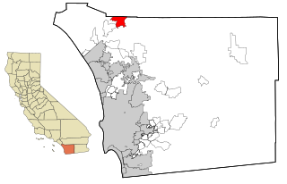
Rainbow is a census designated place (CDP) in northern San Diego County in the U.S. state of California. The population was 1,832 at the 2010 census, down from 2,026 at the 2000 census.

Fruitdale is a district of San Jose, California, located in West San Jose, though some portions are still unincorporated as a census-designated place. The population of the CDP was 935 at the 2010 census.

Long Hill is a census-designated place (CDP) in the town of Groton in New London County, Connecticut, United States. The population was 4,205 at the 2010 census.

Lacoochee is a census-designated place (CDP) in Pasco County, Florida, United States. The population was 1,345 at the 2000 census.

Selby-on-the-Bay is a census-designated place (CDP) in Anne Arundel County, Maryland, United States, for the 2000 census, at which time its population was 3,674. It was added to the Mayo CDP for the 2010 census.

South Gate was a census-designated place (CDP) in Anne Arundel County, Maryland, United States, for the 2000 census, at which time its population was 28,672. It was added primarily to the Glen Burnie CDP for the 2010 census.

Stony Point is an unincorporated community and census-designated place (CDP) in Monroe County in the U.S. state of Michigan. The population was 1,784 at the 2020 census. The CDP is located within Frenchtown Charter Township.

Wye is a unincorporated community in Missoula County, Montana, United States. It is part of the Missoula, Montana Metropolitan Statistical Area. The population was 511 at the 2010 census, an increase from its population of 381 in 2000. For statistical purposes, the United States Census Bureau has defined Saticoy as a census-designated place (CDP). Wye is named for the "y"-shaped DeSmet Junction where US 93 and MT 200 met former US 10.

Tome-Adelino is a former census-designated place (CDP) in Valencia County, New Mexico, United States. The population was 2,211 at the 2000 census. It is part of the Albuquerque Metropolitan Statistical Area. For the 2010 census, the CDP was split into the census-designated places of Tome and Adelino.

Valencia is a census-designated place (CDP) in Valencia County, New Mexico, United States. The population was 2,192 at the 2010 census. It is part of the Albuquerque Metropolitan Statistical Area.

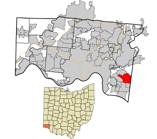
Dry Run is a census-designated place (CDP) in Hamilton County, Ohio, United States. The population was 7,672 at the 2020 census.

North Fork Village is an unincorporated community and former census-designated place (CDP) in Ross County, Ohio, United States. The population was 1,726 at the 2000 census. It was not delineated as a CDP for the 2010 census.

Orchard Hills is a census-designated place (CDP) in Armstrong County, Pennsylvania, United States. The population was 1,949 at the 2020 census.
Reiffton is a census-designated place (CDP) in Exeter Township, Berks County, Pennsylvania, United States. The population was 4,178 at the 2010 census.
West Wyomissing is a census-designated place (CDP) in Spring Township, Berks County, Pennsylvania, United States. The population was 3,407 at the 2010 census.

Lake Wynonah is a census-designated place (CDP) in Schuylkill County, Pennsylvania, United States. The population was 1,961 at the 2000 census, and 2,640 at the 2010 census. Lake Wynonah is a gated community with two lakes, Fawn Lake and Lake Wynonah, and as of July 2008, there are over 1200 homes and 1500 members. It is in South Manheim and Wayne Townships.

Como is a census-designated place (CDP) in the town of Geneva, Walworth County, Wisconsin, United States. The population was 2,356 at the 2020 census.

Glastonbury Center is a census-designated place (CDP) that constitutes the densely populated center of the town of Glastonbury in Hartford County, Connecticut, United States. The population was 7,387 at the 2010 census, out of a total town population of 34,427.
Machias is a census-designated place (CDP) corresponding to the central village area within the town of Machias in Washington County, Maine, United States. The population of the CDP was 1,274 at the 2010 census.


