Harveys Lake (Pennsylvania)

Last updated

Harveys Lake
Harvey Lake, Harvey's Lake
Harveys Lake from the south.JPG
Harveys Lake from the south
USA Pennsylvania relief location map.svg
Red pog.svg
Harveys Lake
Usa edcp relief location map.png
Red pog.svg
Harveys Lake
LocationHarveys Lake, Luzerne County, Pennsylvania
Coordinates 41°21′54″N76°02′31″W / 41.365°N 76.042°W / 41.365; -76.042 Coordinates: 41°21′54″N76°02′31″W / 41.365°N 76.042°W / 41.365; -76.042
Type glacial lake
EtymologyNamed after Benjamin Harvey, its discoverer
Primary inflows two unnamed streams, several springs
Primary outflows Harveys Creek
Catchment area ~3,600 acres (1,500 ha)
Basin  countries Luzerne County, Pennsylvania; Wyoming County, Pennsylvania
Max. length15,640 feet (4,770 m)
Max. width4,960 feet (1,510 m)
Surface area621.5 acres (251.5 ha)
Average depth36 feet (11 m)
Max. depth102 feet (31 m)
Water volume7.733 billion US gallons (6.439×10^9 imp gal; 29.27 hm3)
Residence time 1116 days
Shore length18.3 miles (13.4 km)
Surface elevation1,253 feet (382 m)
1 Shore length is not a well-defined measure.

Harveys Lake (also known as Harvey Lake or Harvey's Lake [1] ) is a natural lake in Luzerne County, Pennsylvania. It has a surface area of approximately 621.5 acres, or nearly a square mile. The lake is situated entirely within the borough of Harveys Lake. [2] [3] By volume, it is the largest natural lake in Pennsylvania, and by surface area, is the second-largest lake. It is a glacial lake surrounded by hills and is the source of Harveys Creek, a tributary of the Susquehanna River. The lake has a stone masonry dam. The lake's watershed has an area of approximately 3600 acres. The majority of the watershed is forested, but there is some developed land as well. Nearly all of the developed land is close to the lake itself, and the lake is surrounded entirely by a paved road.

Contents

Harveys Lake was affected by algae blooms from the mid-20th century onward, and these algae blooms were caused by pollution of nutrients, especially phosphorus. The lake was identified as impaired in 1994, with an annual phosphorus load of 1,019 pounds (462 kg). However, the phosphorus load has been reduced somewhat since then. The lake is listed on the Luzerne County Natural Areas Inventory. A number of rare or endangered plant species have been observed in its vicinity. Various species of fish inhabit the lake and a number of bird species have been observed in its vicinity.

Harveys Lake was accidentally discovered by Benjamin Harvey in 1781. The first settlers arrived at the lake in the 1790s and 1800s. Early industries in the area included lumbering and farming, but it became well known as a summer resort in the latter part of the 1800s and into the 1900s. It was also used as a water supply in the early 1900s. However, the lake began to develop significant environmental problems in the 1960s and a total maximum daily load was created for it in 1994. Since 1968, the lake has been located in the borough of Harveys Lake.

Geography

Harveys Lake dam Harveys Lake Dam.JPG
Harveys Lake dam

Harveys Lake is the largest natural lake in Pennsylvania by volume and the second-largest by surface area. [3] [4] [5] It has a surface area of 621.5 acres and an average depth of 36 feet (11 meters), [3] as well as a maximum depth of 102 feet (31 m). [5] The lake's shoreline is 8.3 miles (13.4 km) long. [6] By surface area, it was approximately twice its current size when it was first surveyed in the late 1700s. [7]

Harveys Lake is situated in the borough of Harveys Lake, [2] and it is 12 miles (19 km) northwest of the city of Wilkes-Barre. [7]

Harveys Lake is of glacial origin. [8] It is surrounded by steep hills on all sides. At their highest point, to the south of the lake, the hills reach 410 feet (120 m) above the lake's elevation. [5] The lake has a gravel bottom. [7]

The main outflow of Harveys Lake is Harveys Creek, a tributary of the Susquehanna River. [2] [4] The lake's major inflows include two unnamed streams with widths between 4 and 8 feet (1.2 and 2.4 m) and depths of 6 inches (15 cm). Springs also feed into it. [5] The lake's elevation is 1,253 feet (382 m) above sea level. [1] The lake is located in north-central Luzerne County, in the Lower North Branch Susquehanna drainage basin and the Upper Susquehanna - Lackawanna basin. [5] [9]

A 1921 book described the shape of Harveys Lake as "very irregular". The lake has a maximum length of 15,640 feet (4,770 m) and a maximum width of 4,960 feet (1,510 m). It has a capacity of 7.733 billion US gallons (29.27 million cubic metres). Harveys Lake is dammed by a stone masonry dam with two spillways. The dam is 120 feet (37 m) long and 4 feet (1.2 m) high. [5]

Harveys Lake was described as "one of the most beautiful" lakes in Pennsylvania in Henry C. Bradsby's 1893 book History of Luzerne County, Pennsylvania. [7]

Watershed

Satellite imagery of Harveys Lake Harveys Lake Enviromapper image.png
Satellite imagery of Harveys Lake
Harveys Lake from the north Harveys Lake from the north 1.JPG
Harveys Lake from the north

Harveys Lake is situated in the United States Geological Survey quadrangles of Harveys Lake and Noxen. [1] The watershed of the lake has an area of 3,600 acres (1,500 ha). [3] [4] Most of the watershed is in Luzerne County, but its northeasternmost portion is in Wyoming County. [9]

The vast majority (2,841 acres [1,150 ha]) of the watershed of Harveys Lake is forested land. Developed land and farmland comprise 499 acres (202 ha) and 154.7 acres (62.6 ha), respectively. Unpaved roads make up 2.5 acres (1.0 ha) of the watershed. [3] The majority of the developed land in the watershed is directly on the shoreline and nearly all is within 0.5 miles (0.80 km) of the lake. [9] [10] Most of the developed land is used for residential and commercial purposes. [9] One developed area in the watershed is known as Hemlock Gardens, which occupies an area of 28 acres (11 ha) and has 26 homes. The development had steep slopes (8 to 18 percent grade), unpaved roads, and no infrastructure for dealing with stormwater. However, a nutrient-separating baffle box and a water polishing unit were installed in the development, reducing the phosphorus load of Harveys Lake by an estimated 36 pounds (16 kg) per year. [10]

The shoreline of Harveys Lake is entirely surrounded by a paved road, which is atypical for a lake shoreline. Homes and cottages are situated on the road opposite the lake, [3] and significant development has occurred in the vicinity of the lake. [11] A ditch and outlet drainage structure made of concrete at Wardens Place drains into the lake; its purpose is to control small-scale local road flooding. [12]

Hydrology

Although Harveys Lake's waters were described as having "great purity" in 1893, the lake has experienced nutrient pollution, especially from phosphorus since at least the mid-20th century. [3] [7] Algae blooms occurred on the lake and caused a reduction in water quality throughout the latter half of the 20th century. A sewage system was installed in the borough of Harveys Lake in the summer of 1976, but this did not completely stop the algae blooms. [9] However, the phosphorus load in the lake has been reduced by 29 percent. [4] The lake was identified as impaired in 1994, with the cause of the impairment being large algae blooms and sedimentation in some areas. It is an anoxic lake. [3]

In the 1990s, the concentration of phosphorus in the waters of Harveys Lake was measured to be 0.031 milligrams per liter. The annual load of phosphorus was 1,019 pounds (462 kg) per year. The lake's total maximum daily load for phosphorus is 0.024 milligrams per liter and 789 pounds (358 kg) per year. [3]

In the 1990s, 255 pounds (116 kg) of the annual phosphorus load of Harveys Lake came from internal loading, 233 pounds (106 kg) came from groundwater, 199 pounds (90 kg) came from developed land, and 150 pounds (68 kg) came from shorelines. Smaller sources of phosphorus included farmland (95 pounds (43 kg) per year), forests (51 pounds (23 kg) per year), septic systems (33 pounds (15 kg) per year), and unpaved roads (3.4 pounds (1.5 kg) per year). [3]

The hydraulic residence time of Harveys Lake is 1116 days. [3] The lake causes substantially reduced peak flood flows on Harveys Creek. [12] Visibility in the lake is typically approximately 10 feet (3.0 m). However, it can be as low as 5 feet (1.5 m) or as high as 15 feet (4.6 m). [6]

History and recreation

Boats on Harveys Lake Boats on Harveys Lake.JPG
Boats on Harveys Lake

Harveys Lake was entered into the Geographic Names Information System on August 2, 1979. Its identifier in the Geographic Names Information System is 1200085. [1] Lake Township is named after the lake. [7]

Harveys Lake is named after Benjamin Harvey, a member of the Sons of Liberty and among the first settlers of the Wyoming Valley. Harvey inadvertently discovered the lake in 1781, while returning home after being held as a prisoner of war in Fort Niagara. [8] The first resident in the vicinity of the lake was Matthew Scouten, who arrived in the early 1790s, but the first settlers were the Worthingtons, who arrived in 1806. [8] The lake was first surveyed by Christopher Hurlbert in 1794, and the first person of European descent to explore the lake by canoe was Andrew Bennett, in 1800. [7]

The early settlers in the vicinity of Harveys Lake mainly engaged in lumbering and farming, which was a common occupation. [8] At one point during the 1800s, the mills of Hollenback & Urquhart were cutting more than a million board feet of lumber annually at the lake. [7] However, by 1853, summer resorts used by Wyoming Valley residents began appearing near the lake. Hotels such as the Lake House Hotel and later the Rhoads Hotel, the Lake Grove Hotel, and the Grand Hotel Oneonta were among the hotels on the lake in the late 1800s. [8] Grand Hotel Oneonta was especially prominent in the early 1900s, and former United States President Theodore Roosevelt visited the hotel in August 1912. [8] [13] In the early 1900s, there were three hotels, two hundred cottages, and sixty boathouses on the lake, most of them at least 15 feet (4.6 m) above the water line. [5]

The Harvey Lake and Towanda Branch of the Lehigh Valley Railroad was constructed in the late 1800s. It ran directly from Wilkes-Barre to Harveys Lake. In the 1890s, railroad lines were constructed from the lake to the communities of Pittston and Towanda. [7]

Harveys Lake has been popular for recreational purposes since the late 1800s. [3] Places such as Warden Place and Sandy Beach were popular recreational areas near the lake in the early 1900s. [8] Around this time period, there were four steamboats on Harveys Lake. They were used for carrying passengers and freight. [5] Recreational steamboat rides on the lake were popular between 1900 and 1920. [8] A 60-foot (18-meter) high Shoot the Chute was built in the area by Charles Shelley in 1910. It was one of the largest attractions in the lake's vicinity. [13] A casino near the lake was opened by Frank Devlin in May 1924, but was demolished in 1980. Devlin also opened the largest bowling alley in Northeastern Pennsylvania near the lake. [13] Throughout the 20th century, prior to and after World War II, the lake attracted thousands of visitors yearly. [8]

In the early 1900s, Harveys Lake was used as a water supply for Nanticoke, as a private ice supply, and as a summer resort. [5]

Harveys Lake has been the subject of scientific studies since the late 1940s, when C. B. Reif conducted limnological studies on it. [9] By the 1960s, Harveys Lake began to develop environmental problems. [8] It was the subject of a number of studies in the late 1980s and early 1990s. These studies indicated that the lake was eutrophic. Algae blooms caused it to be closed to swimming in 1981 and 1990. [3] The Pennsylvania Department of Environmental Protection completed a phosphorus TMDL for the lake in 2002. [9]

In modern times, the main recreational uses of Harveys Lake include swimming, fishing, and boating. [3] However, it lacks public access locations for SCUBA diving. [6] According to its TMDL document, the lake is "one of the most heavily used lakes in the area". [3] It has been situated within the borough of Harveys Lake since January 1, 1968, when the borough was incorporated. [8] In 2004, a plan to dredge and develop a patch of wetland for 30 boat slips near the lake was opposed due to safety concerns (poor visibility) as well as environmental concerns. [14]

Biology

Harveys Lake is listed on the Luzerne County Natural Areas Inventory. [11]

Numerous rare or endangered plant species have been observed in the vicinity of Harveys Lake. Plants in the vicinity of the lake include Vasey's pondweed, flat-leaved pondweed, grassy pondweed, broad-leaved water-milfoil, and Beck's water-marigold. However, exotic and invasive plants such as fanwort and aquatic coontail also inhabit the area and have altered the habitat in the vicinity of the lake. [11] Second-growth forests occur in the area surrounding the lake. [5]

Algae blooms have occurred on Harveys Lake due to high levels of nutrients in the water. [4]

Harveys Lake is inhabited by various species of native fish of Pennsylvania. [8] In 1972, Field and Stream noted that the lake was inhabited by rainbow trout, sockeye salmon, and some lake trout. [15] As the basin of Harveys Creek upstream of the tributary Pikes Creek is designated as a High-Quality Coldwater Fishery, the lake itself has the same designation. [9] Harveys Lake has regulations permitting a creel limit of three trout per day, with only one being allowed to be more than 18 inches (46 cm) long. [16]

Various bird species have been observed in the vicinity of Harveys Lake. These include surf scoters and black scoters, which have been observed there in the winter. Although greater scaups are rare in Pennsylvania away from Lake Erie, one was observed at the lake in July 1992. Franklin's gulls have also been observed near the lake, as have snow buntings and black-legged kittiwakes, and ruddy ducks. Nine brant geese were observed on the lake in May 1997. [17]

See also

Related Research Articles

Lake Apopka Body of water

Lake Apopka is the fourth largest lake in the U.S. state of Florida. It is located 15 miles (24 km) northwest of Orlando, mostly within the bounds of Orange County, although the western part is in Lake County. Fed by a natural spring, rainfall and stormwater runoff, water from Lake Apopka flows through the Apopka-Beauclair Canal and into Lakes Beauclair and Dora. From Lake Dora, water flows into Lake Eustis, then into Lake Griffin and then northward into the Ocklawaha River, which flows into the St. Johns River.

Bowman Creek River

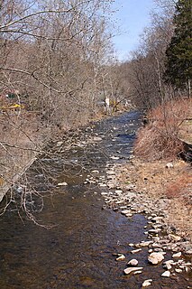
Bowman Creek is a tributary of the Susquehanna River in Luzerne County and Wyoming County, in Pennsylvania, in the United States. It is approximately 26 miles (42 km) long and flows through Ross Township and Lake Township in Luzerne County and Noxen Township, Monroe Township, and Eaton Township in Wyoming County. The watershed of the creek has an area of 120 square miles (310 km2). The creek is not designated as an impaired waterbody and its pH is close to neutral, although it has experienced some problems with acid rain. It has low concentrations of dissolved solids like calcium. The creek is relatively small in its upper reaches, but by Noxen, its width is 40 to 60 feet. It is also relatively shallow in many reaches. Rock formations in the watershed include the Catskill Formation, the Huntley Mountain Formation, Burgoon Sandstone, the Mauch Chunk Formation, the Pottsville Group, and the Pocono Formation. Soil associations in the creek's watershed include the Wellsboro-Morris-Oquaga association, the Oquaga-Lackawanna-Arnot association, the Mardin-Bath-Volusia association, and the Wyoming-Pope association.

Harveys Creek Tributary of the Susquehanna River in Luzerne County, Pennsylvania

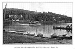
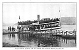
Harveys Creek is a tributary of the Susquehanna River in Luzerne County, Pennsylvania, in the United States. It is approximately 14.5 miles (23.3 km) long and flows through Harveys Lake, Lake Township, Lehman Township, Jackson Township, and Plymouth Township. The creek's watershed has an area of 46.3 square miles (120 km2). The creek has four named tributaries, which are known as Bear Hollow Creek, Paint Spring Run, Pikes Creek, and East Fork Harveys Creek. The watershed is designated as a High-Quality Coldwater Fishery and a Migratory Fishery above Pikes Creek and as a Coldwater Fishery and a Migratory Fishery below it. The creek's source is Harveys Lake, the largest natural lake in Pennsylvania.

Black Creek (Nescopeck Creek tributary)

Black Creek is a long source tributary of Nescopeck Creek so part of the Susquehanna River drainage basin. It is also the second & longer stream of the same name recognized by the USGS GNIS system in Luzerne County, Pennsylvania, in the United States—compared to the Black Creek beyond the ridgeline of the drainage divide, so in the Lehigh River valley and Carbon County. The headwaters of both Black Creeks in Luzerne county are only a few miles apart, and both valleys were traversed by the Lausanne-Nescopeck Turnpike in the first half of the 19th-century.

Little Nescopeck Creek Tributary of Nescopeck Creek in Luzerne County, Pennsylvania, United States

Little Nescopeck Creek is a tributary of Nescopeck Creek in Luzerne County, Pennsylvania, in the United States. It is approximately 8.5 miles (13.7 km) long and flows through Butler Township, Sugarloaf Township, and Conyngham. The watershed of the creek has an area of 14.0 square miles (36 km2). The creek is acidic and receives mine water from the Jeddo Tunnel. The main rock formation in the watershed is the Mauch Chunk Formation. However, the Pottsville Formation also appears in some areas. Soil series in the drainage basin include the Arnot Series, the Basher Series, and various other soil types.

Mahoning Creek (Susquehanna River tributary) Tributary in Susquehanna River

Mahoning Creek is a tributary of the Susquehanna River in Columbia County and Montour County, in Pennsylvania, in the United States. It is approximately 10.6 miles (17.1 km) long and flows through Madison Township in Columbia County and West Hemlock Township, Derry Township, Valley Township, Mahoning Township, and Danville in Montour County. The watershed of the creek has an area of 39.6 square miles (103 km2). Its tributaries include Kase Run, Mauses Creek, and Sechler Run. Mahoning Creek is designated as a Trout-Stocking Fishery and a Migratory Fishery for part of its length and as a Warmwater Fishery and a Migratory Fishery for the remainder.

Solomon Creek River of the Susquehanna River, Pennsylvania

Solomon Creek is a tributary of the Susquehanna River in Luzerne County, Pennsylvania, in the United States. It is approximately 8.8 miles (14.2 km) long and flows through Fairview Township, Hanover Township, and Wilkes-Barre. The creek is affected by acid mine drainage and has significant loads of iron, aluminum, and manganese. The creek's named tributaries are Spring Run, Sugar Notch Run, and Pine Creek. The Solomon Creek watershed is located in the Anthracite Valley section of the ridge-and-valley geographical province. Major rock formations in the watershed include the Mauch Chunk Formation, the Spechty Kopf Formation, and the Catskill Formation.

Newport Creek is a tributary of the Susquehanna River in Luzerne County, Pennsylvania, in the United States. It is 4.9 miles (7.9 km) in length. Named tributaries of the creek include South Branch Newport Creek. The entire watershed of Newport Creek is considered by the Pennsylvania Department of Environmental Protection to be impaired.

North Branch Mahantango Creek is a tributary of Mahantango Creek in Snyder County, Pennsylvania, in the United States. It is 13.3 miles (21.4 km) long and flows through West Perry Township, Perry Township, and Chapman Township. The creek's mouth is at 438 feet (134 m) above sea level.

Kipps Run River

Kipps Run is a tributary of the Susquehanna River in Northumberland County, Pennsylvania, in the United States. It is approximately 3.3 miles (5.3 km) long and flows through Rush Township and the borough of Riverside. Wilson Run is a tributary of the stream. Kipps Run has an annual sediment load of 4,985,600 pounds (2,261,400 kg), most of which comes from cropland. The stream's watershed has an area of 6.38 square miles, nearly all of which is agricultural or forested land. The stream has a riparian buffer.

Cranberry Creek is a tributary of Stony Creek in Luzerne County, Pennsylvania, in the United States. It is approximately 4.4 miles (7.1 km) long and flows through Hazle Township. The creek is affected by acid mine drainage. It also contains metals such as iron, manganese, and aluminum. It is in the drainage basin of the Jeddo Tunnel. Major roads in the creek's watershed include Pennsylvania Route 924, Pennsylvania Route 309, and Interstate 81. At least one bridge has been built over it. The creek has undergone restoration and there are plans to construct an area known as the Cranberry Creek Gateway Park in its vicinity.

Hunlock Creek River in eastern Pennsylvania

Hunlock Creek is a tributary of the Susquehanna River in Luzerne County, Pennsylvania, in the United States. It is approximately 7.8 miles (12.6 km) long and flows through Lehman Township and Hunlock Township. The watershed of the creek has an area of 32.5 square miles (84 km2) and is situated in northwestern Luzerne County. It has one named tributary, which is known as Roaring Brook, and a number of unnamed and unofficially named tributaries, such as "West Branch Hunlock Creek".

Sugar Notch Run is a tributary of Solomon Creek in Luzerne County, Pennsylvania, in the United States. It is approximately 3.0 miles (4.8 km) long and flows through Hanover Township, Sugar Notch, and Ashley. The watershed of the stream has an area of 2.33 square miles (6.0 km2). The stream is considered to be impaired by abandoned mine drainage for its entire length. Brook trout and various macroinvertebrate taxa inhabit portions of the stream and it is designated as a Coldwater Fishery. Coal mining has historically been done in the watershed and a small intake dam was on the stream in the early 1900s. Recreational opportunities in the watershed include the Sugar Notch Trail System and Pennsylvania State Game Lands Number 207.

Toby Creek River in the United States of America

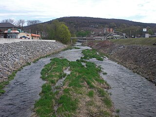
Toby Creek is a tributary of the Susquehanna River in Luzerne County, Pennsylvania, in the United States. It is approximately 10.5 miles (16.9 km) long and flows through Dallas Township, Dallas, Kingston Township, Courtdale, Luzerne, Pringle, Kingston, Edwardsville, and Larksville. The watershed of the creek has an area of 36.5 square miles (95 km2). The entire drainage basin is designated as a Migratory Fishery and parts are designated as either a Coldwater Fishery, a Warmwater Fishery, or a Trout Stocking Fishery. The creek has two named tributaries: Huntsville Creek and Trout Brook. It is said to show "some degraded conditions", but does not experience severe pollution and is not considered to be impaired. The creek is piped underground in Pringle, but resurfaces in Edwardsville.

Abrahams Creek Creek in Pennsylvania

Abrahams Creek is a tributary of the Susquehanna River in Luzerne County, Pennsylvania, in the United States. It is approximately 10.7 miles (17.2 km) long and flows through Franklin Township, Dallas Township, Kingston Township, West Wyoming, Wyoming, and Forty Fort. The watershed of the creek has an area of 17.4 square miles (45 km2) and occupies portions of nine municipalities in northeastern Luzerne County. The watershed is divided into the upper Abraham Creek watershed and the lower Abraham Creek watershed, which are joined by a canyon known as The Hollow. The upper part of the watershed is mostly rural, but the lower part is heavily urbanized. The creek's channel has been heavily modified in many places. Its drainage basin is designated as a Coldwater Fishery and a Migratory Fishery.

Lake Jean Body of water

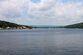
Lake Jean is a lake in Luzerne County and Sullivan County, in Pennsylvania, in the United States. It has a surface area of approximately 245 acres (99 ha) and is situated in Colley Township, Sullivan County and Fairmount Township, Luzerne County. The lake's main inflow is the outlet of Ganoga Lake. Lake Jean is fairly shallow, with an average depth of 5.9 feet (1.8 m). It is in the watershed of Fishing Creek. The main rock formations in the lake's watershed include Burgoon Sandstone and the Mauch Chunk Formation. The lake is dammed by the Lake Jean Dam and is owned by the Pennsylvania Department of Conservation and Natural Resources.

Spruce Run (Buffalo Creek tributary) River

Spruce Run is a tributary of Buffalo Creek in Union County, Pennsylvania, in the United States. It is approximately 14 miles (23 km) long and flows through Hartley Township, Lewis Township, West Buffalo Township, White Deer Township, Buffalo Township, and Kelly Township. The watershed of the stream has an area of 27.2 square miles (70 km2). The stream has two named tributaries: Black Run and Muddy Run. It is not designated as an impaired waterbody, but it is affected by sediment and nutrients.

Stony Run (Buffalo Creek tributary) River in the United States of America

Stony Run is a tributary of Buffalo Creek in Union County, Pennsylvania, in the United States. It is approximately 3.3 miles (5.3 km) long and flows through West Buffalo Township and Buffalo Township. The watershed of the stream has an area of 1.46 square miles (3.8 km2). The stream is impacted by nutrient pollution, sediment, E. coli, and thermal radiation. The watershed mostly consists of forested land and agricultural land. It is designated as a High-Quality Coldwater Fishery and a Migratory Fishery. The stream also has a healthy population of benthic macroinvertebrates.

Rapid Run (Buffalo Creek tributary) River

Rapid Run is a tributary of Buffalo Creek in Centre County and Union County in Pennsylvania, in the United States. It is approximately 14.4 miles (23.2 km) long and flows through Miles Township in Centre County and Hartley Township, Lewis Township, West Buffalo Township, and Buffalo Township in Union County. The watershed of the stream has an area of 18.7 square miles (48 km2). Some streams in the watershed are impacted by nutrients, sediment, E. coli, and thermal radiation and one unnamed tributary is designated as an impaired waterbody. Rapid Run is a freestone mountain stream in the ridge and valley physiographic province. It flows through a lake known as Halfway Lake and also passes through the Rapid Run Gap.

North Branch Buffalo Creek River in Pennsylvania, USA

North Branch Buffalo Creek is a tributary of Buffalo Creek in Centre County and Union County, in Pennsylvania, in the United States. It is approximately 13.5 miles (21.7 km) long and flows through Haines Township in Centre County and Hartley Township, Lewis Township, and West Buffalo Township. The watershed of the creek has an area of 22.9 square miles (59 km2). The creek has two named tributaries: Panther Run and Coal Run. Some streams in the watershed are impacted by nutrients, sedimentation, and siltation. The creek generally flows through mountainous terrain and has a sinuous channel. Rock formations made of sandstone are in its watershed and rock containing carbonate minerals is at its headwaters.

References

  1. 1 2 3 4 Geographic Names Information System, Feature Detail Report for: Harveys Lake , retrieved February 2, 2015
  2. 1 2 3 United States Geological Survey, The National Map Viewer , retrieved February 2, 2015
  3. 1 2 3 4 5 6 7 8 9 10 11 12 13 14 15 Pennsylvania Department of Environmental Protection (March 1, 2002), Harveys Lake TMDL (PDF), retrieved February 2, 2015
  4. 1 2 3 4 5 United States Environmental Protection Agency, Harveys Lake, Pennsylvania Nonpoint Source Success Story , retrieved February 2, 2015
  5. 1 2 3 4 5 6 7 8 9 10 Water Supply Commission of Pennsylvania (1921), Water Resources Inventory Report, pp. 80–81
  6. 1 2 3 Bloomsburg University SCUBA Club, Harveys Lake Diving, archived from the original on March 3, 2016, retrieved February 2, 2015
  7. 1 2 3 4 5 6 7 8 9 Henry C. Bradsby, ed. (1893), History of Luzerne County, Pennsylvania, pp. 29, 262, 597–598
  8. 1 2 3 4 5 6 7 8 9 10 11 12 Harveys Lake Borough, History of Harveys Lake , retrieved February 2, 2015
  9. 1 2 3 4 5 6 7 8 Princeton Hydro, LLC. (March 2010), Prioritization of BMPs and Implementation of Watershed Projects for Harveys Lake (PDF), retrieved February 2, 2015
  10. 1 2 Fred S. Lubnow, John A. Miller, The Design and Installation of an Innovativ Best Management Practice Structure to Reduce the Annual Phosphorus Load to a 633 acre Lake in Northeastern Pennsylvania (PDF), retrieved February 3, 2015
  11. 1 2 3 Pennsylvania Natural Heritage Program, Western Pennsylvania Conservancy (2006), A NATURAL AREAS INVENTORY LUZERNE COUNTY, PENNSYLVANIA Update – 2006 (PDF), p. 111, retrieved February 2, 2015
  12. 1 2 Federal Emergency Management Agency, Flood Insurance Study VOLUME 1 of 6 LUZERNE COUNTY, PENNSYLVANIA (ALL JURISDICTIONS) (PDF), p. 35, archived from the original (PDF) on April 2, 2015, retrieved February 2, 2015
  13. 1 2 3 Harrison Wick (2009), Pennsylvania's Back Mountain, Arcadia Publishing, pp. 116–119, ISBN   9780738562780
  14. Camille Fioti (November 23, 2004), "Dredging plan hits opposition: Dep hears public input on the proposed developing of a wetlands area in Harveys Lake", Times Leader, retrieved February 3, 2015
  15. Field & Stream, February 1972, p. 117
  16. Pennsylvania Fish and Boat Commission (October 2009), Strategic Plan for Management of Trout Fisheries in Pennsylvania 2010 - 2014 (PDF), p. 50, archived from the original (PDF) on March 4, 2016, retrieved February 3, 2015
  17. Gerald M. McWilliams, Daniel W. Brauning (2000), The Birds of Pennsylvania, Cornell University Press, pp. 74, 94, 99, 101, 111, 195, 211, 422, ISBN   0801436435