Helperknapp

Last updated
Helperknapp
Mairie Tuntange, 2 rue de Hollenfels.jpg
Helperknapp map.svg
Map of Luxembourg with Helperknapp highlighted in orange, and the canton in dark red
Coordinates: 49°43′2″N6°0′38″E / 49.71722°N 6.01056°E / 49.71722; 6.01056
Country Flag of Luxembourg.svg Luxembourg
Canton Mersch
Government
  Mayor Paul Mangen
Area
  Total
37.61 km2 (14.52 sq mi)
  Rank 16th of 100
Highest elevation
393 m (1,289 ft)
  Rank 56th of 100
Lowest elevation
225 m (738 ft)
  Rank 38th of 100
Population
 (2025)
  Total
5,289
  Rank 35th of 100
  Density140/km2 (360/sq mi)
   Rank 60th of 100
Time zone UTC+1 (CET)
  Summer (DST) UTC+2 (CEST)
LAU 2 LU0000403

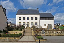
Helperknapp is a commune in central Luxembourg, in the canton of Mersch. It was established on 1 January 2018 from the amalgamation of the communes of Boevange-sur-Attert and Tuntange.

Contents

Populated places

The commune consists of the following villages:

History

In two referendums held simultaneously in Boevange-sur-Attert and Tuntange on 25 May 2014, the citizens of both communes approved a municipal merger, with 69.51% and 64.09%, respectively, in favour. Based on the poll, legislators of the two communes voted in favor of the merger. Consequently, on January 1, 2018, Boevange-sur-Attert and Tuntange were subsumed into the new municipality of Helperknapp. The name "Helperknapp" derives from the name of a hill of the same name located within the commune. [1]

Population

010002000300040005000182119101947198120052020yHelperknapp population by year
See or edit source data.

[2]

Twin towns — sister cities

Helperknapp is twinned with: [3]

References

  1. "Am 1. Januar in Luxemburgs Gemeinden: Fusionen werden Realität". Luxemburger Wort. 2017-12-31. Retrieved 2018-12-28.
  2. "Population par canton et commune". statistiques.public.lu. Retrieved 11 January 2022.
  3. "Zechin - Helperknapp". amt-golzow.de (in German). Amt Golzow. Retrieved 2019-09-17.