Name [1]
Luxembourgish name | Canton [1] | Population
(2025) [2] | Area [1] | Population density |
|---|
| km2 | mi2 |
|---|
 | Beaufort Beefort | Echternach | 3,124 | 13.74 | 5.31 | 222.2/km2 (575.5/sq mi) |
 | Bech Bech | Echternach | 1,379 | 23.31 | 9.00 | 58.2/km2 (150.8/sq mi) |
 | Beckerich Biekerech | Redange | 2,879 | 28.41 | 10.97 | 100.9/km2 (261.3/sq mi) |
 | Berdorf Bäerdref | Echternach | 2,235 | 21.93 | 8.47 | 101.2/km2 (262.1/sq mi) |
 | Bertrange Bartreng | Luxembourg | 9,097 | 17.39 | 6.71 | 498.4/km2 (1,291.0/sq mi) |
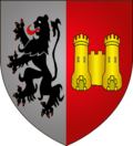 | Bettembourg Beetebuerg | Esch-sur-Alzette | 11,628 | 21.49 | 8.30 | 531.5/km2 (1,376.6/sq mi) |
 | Bettendorf Bettenduerf | Diekirch | 3,116 | 23.24 | 8.97 | 131.3/km2 (340.1/sq mi) |
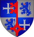 | Betzdorf Betzder | Grevenmacher | 4,071 | 26.08 | 10.07 | 157.4/km2 (407.7/sq mi) |
 | Bissen Biissen | Mersch | 3,535 | 20.75 | 8.01 | 166.3/km2 (430.6/sq mi) |
 | Biwer Biwer | Grevenmacher | 1,911 | 23.08 | 8.91 | 83.4/km2 (216.1/sq mi) |
 | Boulaide Bauschelt | Wiltz | 1,572 | 32.13 | 12.41 | 46.7/km2 (120.8/sq mi) |
 | Bourscheid Buerschent | Diekirch | 1,761 | 36.86 | 14.23 | 45.5/km2 (117.9/sq mi) |
 | Bous-Waldbredimus Bous-Waldbriedemes | Remich | 3,270 | 28 | 11 | 110.3/km2 (285.7/sq mi) |
 | Clervaux Klierf | Clervaux | 6,289 | 85.05 | 32.84 | 70.8/km2 (183.4/sq mi) |
 | Colmar-Berg Colmer-Bierg | Mersch | 2,480 | 12.31 | 4.75 | 189.8/km2 (491.5/sq mi) |
 | Consdorf Konsdref | Echternach | 2,108 | 25.72 | 9.93 | 82.3/km2 (213.2/sq mi) |
 | Contern Conter | Luxembourg | 4,716 | 20.55 | 7.93 | 212.8/km2 (551.3/sq mi) |
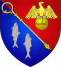 | Dalheim Duelem | Remich | 2,388 | 18.98 | 7.33 | 126.9/km2 (328.6/sq mi) |
 | Diekirch Diekrech | Diekirch | 7,336 | 12.42 | 4.80 | 587.4/km2 (1,521.3/sq mi) |
 | Differdange Déifferdeng | Esch-sur-Alzette | 30,789 | 22.18 | 8.56 | 1,331.7/km2 (3,449.0/sq mi) |
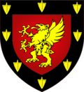 | Dippach Dippech | Capellen | 4,667 | 17.42 | 6.73 | 266.1/km2 (689.1/sq mi) |
 | Dudelange Diddeleng | Esch-sur-Alzette | 22,203 | 21.38 | 8.25 | 1,026.8/km2 (2,659.4/sq mi) |
 | Echternach Iechternach | Echternach | 5,936 | 20.49 | 7.91 | 286.5/km2 (742.0/sq mi) |
 | Ell Ell | Redange | 1,664 | 21.55 | 8.32 | 73.4/km2 (190.1/sq mi) |
 | Erpeldange-sur-Sûre Ierpeldeng op der Sauer | Diekirch | 2,596 | 17.97 | 6.94 | 135.2/km2 (350.1/sq mi) |
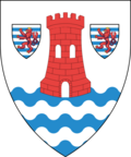 | Esch-sur-Alzette Esch-Uelzecht | Esch-sur-Alzette | 37,922 | 14.35 | 5.54 | 2,552.3/km2 (6,610.3/sq mi) |
 | Esch-sur-Sûre Esch-Sauer | Wiltz | 3,279 | 51.26 | 19.79 | 61.0/km2 (158.1/sq mi) |
 | Ettelbruck Ettelbréck | Diekirch | 10,149 | 15.18 | 5.86 | 638.2/km2 (1,653.0/sq mi) |
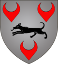 | Feulen Feelen | Diekirch | 2,435 | 22.76 | 8.79 | 104.0/km2 (269.2/sq mi) |
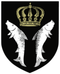 | Fischbach Fëschbech | Mersch | 1,306 | 19.61 | 7.57 | 66.7/km2 (172.8/sq mi) |
 | Flaxweiler Fluessweiler | Grevenmacher | 2,281 | 30.17 | 11.65 | 72.7/km2 (188.3/sq mi) |
 | Frisange Fréiseng | Esch-sur-Alzette | 5,078 | 18.43 | 7.12 | 266.5/km2 (690.3/sq mi) |
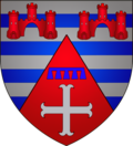 | Garnich Garnech | Capellen | 2,311 | 20.95 | 8.09 | 109.3/km2 (283.0/sq mi) |
 | Goesdorf Géisdref | Wiltz | 1,667 | 29.41 | 11.36 | 56.6/km2 (146.5/sq mi) |
 | Grevenmacher Gréiwemaacher | Grevenmacher | 5,274 | 16.48 | 6.36 | 309.0/km2 (800.3/sq mi) |
 | Groussbus-Wal Groussbus-Wal | Redange | 2,352 | 39.85 | 15.39 | 55.7/km2 (144.4/sq mi) |
 | Habscht Habscht | Capellen | 5,260 | 32.51 | 12.55 | 145.5/km2 (376.8/sq mi) |
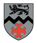 | Heffingen Hiefenech | Mersch | 1,560 | 13.34 | 5.15 | 116.1/km2 (300.7/sq mi) |
 | Helperknapp Helperknapp | Mersch | 5,289 | 37.61 | 14.52 | 131.4/km2 (340.3/sq mi) |
 | Hesperange Hesper | Luxembourg | 17,146 | 27.22 | 10.51 | 603.7/km2 (1,563.6/sq mi) |
 | Junglinster Jonglënster | Grevenmacher | 9,031 | 55.38 | 21.38 | 155.7/km2 (403.2/sq mi) |
 | Käerjeng Käerjeng | Capellen | 11,589 | 33.67 | 13.00 | 327.1/km2 (847.3/sq mi) |
 | Kayl Keel | Esch-sur-Alzette | 9,969 | 14.86 | 5.74 | 663.9/km2 (1,719.4/sq mi) |
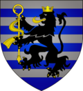 | Kehlen Kielen | Capellen | 7,148 | 28.18 | 10.88 | 226.8/km2 (587.4/sq mi) |
 | Kiischpelt Kiischpelt | Wiltz | 1,257 | 33.58 | 12.97 | 37.5/km2 (97.2/sq mi) |
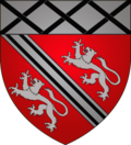 | Koerich Käerch | Capellen | 2,783 | 18.88 | 7.29 | 143.3/km2 (371.2/sq mi) |
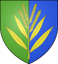 | Kopstal Koplescht | Capellen | 4,626 | 7.9 | 3.1 | 542.5/km2 (1,405.2/sq mi) |
 | Lac de la Haute-Sûre Stauséigemeng | Wiltz | 2,325 | 48.5 | 18.7 | 46.5/km2 (120.3/sq mi) |
 | Larochette Fiels | Mersch | 2,229 | 15.4 | 5.9 | 143.4/km2 (371.3/sq mi) |
 | Lenningen Lenneng | Remich | 2,145 | 20.35 | 7.86 | 101.7/km2 (263.5/sq mi) |
 | Leudelange Leideleng | Esch-sur-Alzette | 2,788 | 13.57 | 5.24 | 203.8/km2 (527.9/sq mi) |
 | Lintgen Lëntgen | Mersch | 3,483 | 15.25 | 5.89 | 225.3/km2 (583.6/sq mi) |
 | Lorentzweiler Luerenzweiler | Mersch | 4,691 | 17.45 | 6.74 | 259.1/km2 (671.0/sq mi) |
 | Luxembourg City ‡ Lëtzebuerg | Luxembourg | 136,161 | 51.46 | 19.87 | 2,580.2/km2 (6,682.7/sq mi) |
 | Mamer Mamer | Capellen | 11,368 | 27.54 | 10.63 | 386.5/km2 (1,000.9/sq mi) |
 | Manternach Manternach | Grevenmacher | 2,332 | 27.68 | 10.69 | 83.0/km2 (215.0/sq mi) |
 | Mersch Miersch | Mersch | 10,645 | 49.74 | 19.20 | 208.9/km2 (541.2/sq mi) |
 | Mertert Mäertert | Grevenmacher | 5,557 | 15.25 | 5.89 | 303.9/km2 (787.2/sq mi) |
 | Mertzig Mäerzeg | Diekirch | 2,415 | 11.1 | 4.3 | 213.5/km2 (553.0/sq mi) |
 | Mondercange Monnerech | Esch-sur-Alzette | 7,292 | 21.4 | 8.3 | 332.7/km2 (861.6/sq mi) |
 | Mondorf-les-Bains Munneref | Remich | 5,432 | 13.66 | 5.27 | 397.1/km2 (1,028.4/sq mi) |
 | Niederanven Nidderaanwen | Luxembourg | 6,990 | 41.36 | 15.97 | 161.0/km2 (417.1/sq mi) |
 | Nommern Noumer | Mersch | 1,509 | 22.44 | 8.66 | 64.0/km2 (165.9/sq mi) |
 | Parc Hosingen Parc Housen | Clervaux | 4,305 | 70.65 | 27.28 | 57.1/km2 (148.0/sq mi) |
 | Pétange Péiteng | Esch-sur-Alzette | 21,806 | 11.93 | 4.61 | 1,723.6/km2 (4,464.2/sq mi) |
 | Préizerdaul Préizerdaul | Redange | 1,834 | 15.6 | 6.0 | 117.1/km2 (303.3/sq mi) |
 | Putscheid Pëtschent | Vianden | 1,177 | 27.13 | 10.47 | 42.5/km2 (110.1/sq mi) |
 | Rambrouch Rammerech | Redange | 5,004 | 79.09 | 30.54 | 61.1/km2 (158.4/sq mi) |
 | Reckange-sur-Mess Reckeng op der Mess | Esch-sur-Alzette | 2,855 | 20.42 | 7.88 | 133.9/km2 (346.8/sq mi) |
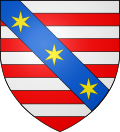 | Redange-sur-Attert Réiden op der Attert | Redange | 2,855 | 31.95 | 12.34 | 95.7/km2 (248.0/sq mi) |
 | Reisdorf Reisduerf | Diekirch | 1,445 | 14.84 | 5.73 | 91.2/km2 (236.1/sq mi) |
 | Remich Réimech | Remich | 4,149 | 5.29 | 2.04 | 759.0/km2 (1,965.7/sq mi) |
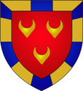 | Roeser Réiser | Esch-sur-Alzette | 7,054 | 23.8 | 9.2 | 279.7/km2 (724.4/sq mi) |
 | Rosport-Mompach Rouspert-Mompech | Echternach | 3,755 | 57.07 | 22.03 | 64.9/km2 (168.1/sq mi) |
| Rumelange Rëmeleng | Esch-sur-Alzette | 5,735 | 6.83 | 2.64 | 833.4/km2 (2,158.4/sq mi) |
 | Saeul Sëll | Redange | 1,025 | 14.86 | 5.74 | 66.2/km2 (171.3/sq mi) |
 | Sandweiler Sandweiler | Luxembourg | 3,874 | 7.73 | 2.98 | 485.3/km2 (1,256.8/sq mi) |
 | Sanem Suessem | Esch-sur-Alzette | 19,085 | 24.42 | 9.43 | 750.7/km2 (1,944.4/sq mi) |
 | Schengen Schengen | Remich | 5,215 | 31.42 | 12.13 | 165.4/km2 (428.3/sq mi) |
 | Schieren Schieren | Diekirch | 2,123 | 10.41 | 4.02 | 206.4/km2 (534.7/sq mi) |
 | Schifflange Schëffleng | Esch-sur-Alzette | 11,589 | 7.71 | 2.98 | 1,473.8/km2 (3,817.1/sq mi) |
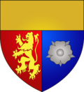 | Schuttrange Schëtter | Luxembourg | 4,466 | 16.1 | 6.2 | 272.5/km2 (705.7/sq mi) |
 | Stadtbredimus Stadbriedemes | Remich | 2,009 | 10.17 | 3.93 | 195.1/km2 (505.3/sq mi) |
 | Steinfort Stengefort | Capellen | 6,081 | 12.16 | 4.70 | 482.8/km2 (1,250.5/sq mi) |
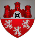 | Steinsel Steesel | Luxembourg | 6,018 | 21.81 | 8.42 | 254.0/km2 (657.8/sq mi) |
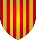 | Strassen Stroossen | Luxembourg | 10,637 | 10.71 | 4.14 | 983.9/km2 (2,548.4/sq mi) |
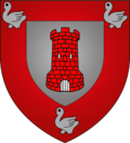 | Tandel Tandel | Vianden | 2,346 | 41.72 | 16.11 | 53.6/km2 (138.9/sq mi) |
 | Troisvierges Ëlwen | Clervaux | 3,654 | 37.86 | 14.62 | 92.8/km2 (240.3/sq mi) |
 | Useldange Useldeng | Redange | 2,148 | 23.92 | 9.24 | 86.7/km2 (224.7/sq mi) |
 | Vallée de l'Ernz Äerenzdallgemeng | Diekirch | 2,864 | 39.73 | 15.34 | 69.7/km2 (180.6/sq mi) |
 | Vianden Veianen | Vianden | 2,221 | 9.67 | 3.73 | 227.8/km2 (590.0/sq mi) |
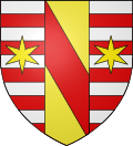 | Vichten Viichten | Redange | 1,431 | 12.26 | 4.73 | 116.2/km2 (301.0/sq mi) |
 | Waldbillig Waldbëlleg | Echternach | 1,972 | 23.28 | 8.99 | 84.2/km2 (218.1/sq mi) |
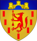 | Walferdange Walfer | Luxembourg | 8,937 | 7.06 | 2.73 | 1,236.5/km2 (3,202.6/sq mi) |
 | Weiler-la-Tour Weiler zum Tuer | Luxembourg | 2,519 | 17.07 | 6.59 | 146.3/km2 (379.0/sq mi) |
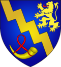 | Weiswampach Wäiswampech | Clervaux | 2,623 | 35.25 | 13.61 | 65.6/km2 (169.9/sq mi) |
 | Wiltz Wolz | Wiltz | 8,310 | 39.25 | 15.15 | 202.5/km2 (524.5/sq mi) |
 | Wincrange Wëntger | Clervaux | 5,002 | 113.36 | 43.77 | 42.4/km2 (109.8/sq mi) |
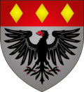 | Winseler Wanseler | Wiltz | 1,534 | 30.42 | 11.75 | 47.8/km2 (123.9/sq mi) |
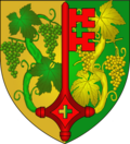 | Wormeldange Wuermer | Grevenmacher | 3,255 | 17.25 | 6.66 | 183.8/km2 (476.1/sq mi) |


