Schieren is served by a railway station, and the commune encompasses the hamlet of Birtrange, which contains Birtrange castle.
Schieren was formed on 1 July 1850, when it was detached from the commune of Ettelbruck, along with the commune of Erpeldange. The law forming Schieren was passed on 22 January 1850.[1]
In 1894, Schieren established a fire station with five volunteer firefighters. It contains a church.
Population
Graphs are unavailable due to technical issues. There is more info on Phabricator and on MediaWiki.org.
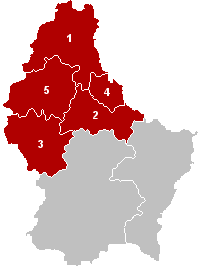
The District of Diekirch was one of three districts of the Grand Duchy of Luxembourg. Immediately prior to its abolition on 3 October 2015, it contained five cantons divided into 43 communes:
Clervaux
Diekirch
Redange
Vianden
Wiltz
Junglinster is a commune in central Luxembourg, which draws its name from its principal town, Junglinster. It is one of six communes in the Luxembourg canton of Grevenmacher. The 18th-century St Martin's church is a national monument.
Strassen is a commune and town in central Luxembourg. It is part of the canton of Luxembourg.
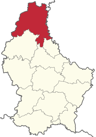
Diekirch is a canton in the north of Luxembourg. Neither the canton, town, nor commune of Diekirch should be confused with the former district of Diekirch, one of three administrative units in Luxembourg abolished in October 2015. It borders Germany.
Ettelbruck is a commune with town status in central Luxembourg, with a population of 9,965 inhabitants.
Clervaux is the largest, northernmost, highest and least densely populated canton of Luxembourg. It makes up a large part of the Éislek region. It borders Belgium & Germany.
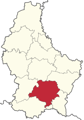
Luxembourg is a canton in the south of the Grand Duchy of Luxembourg. Its name, like the name of the Grand Duchy itself, derives from the name of its principal city, Luxembourg. It is not to be confused with the former district of Luxembourg, one of three administrative units in Luxembourg abolished in October 2015.
Rumelange is a commune with town status in south-western Luxembourg, on the border with France.
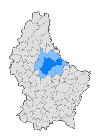
Luxembourg's 100 communes conform to LAU Level 2 and are the country's lowest administrative divisions.
Weiswampach is a commune and small town in northern Luxembourg, in the canton of Clervaux.
Erpeldange-sur-Sûre is a commune and small town in north-eastern Luxembourg. It lies along the river Sûre, between Ettelbruck and Diekirch. It is part of the canton of Diekirch.
Rambrouch is a commune and small town in western Luxembourg, in the canton of Redange. It lies close to the border with Belgium.
Schifflange is a commune and town in south-western Luxembourg. It is part of the canton of Esch-sur-Alzette.
Walferdange is a commune and small town in central Luxembourg.
Nordstad is a development area in north-central Luxembourg, and a colloquial term to refer to the combined urban areas in the region. The name is Luxembourgish for 'northern city', but it remains the title, both formal and informal, of the region in any language.
Hollerich is a quarter in south-western Luxembourg City, in southern Luxembourg.
Schieren railway station is a railway station serving Schieren, in central Luxembourg. It is operated by Chemins de Fer Luxembourgeois, the state-owned railway company.
The following outline is provided as an overview of and topical guide to Luxembourg:
Birtrange Castle is a castle near Schieren, Luxembourg.
This page is based on this Wikipedia article Text is available under the CC BY-SA 4.0 license; additional terms may apply. Images, videos and audio are available under their respective licenses.