The Gold Coast is a coastal city and region in the state of Queensland, Australia, approximately 66 kilometres (41 mi) south-southeast of the centre of the state capital Brisbane. With a population over 600,000, the Gold Coast is the sixth-largest city in Australia, the nation's largest non-capital city, and Queensland's second-largest city after Brisbane. The city's Central Business District is located roughly in the centre of the Gold Coast in the suburb of Southport, with the suburb holding more corporate office space than anywhere else in the city. The urban area of the Gold Coast is concentrated along the coast sprawling almost 60 kilometers, joining up with the Greater Brisbane Metropolitan Area to the north and to the state border with New South Wales to the south.

Fairfield is a town in Fairfield County, Connecticut, United States. It borders the city of Bridgeport and towns of Trumbull, Easton, Weston, and Westport along the Gold Coast of Connecticut. As of 2020 the town had a population of 61,512. The town is part of the Greater Bridgeport Planning Region.
Ormskirk is a market town in the West Lancashire district of Lancashire, England, 13 miles (21 km) north of Liverpool, 11 miles (18 km) northwest of St Helens, 9 miles (14 km) southeast of Southport and 18 miles (29 km) southwest of Preston. Ormskirk is known for its gingerbread. In 2011 it had a population of 24,073.
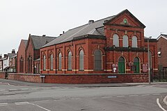
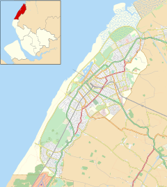
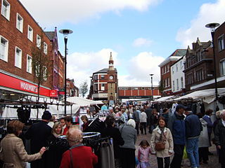
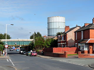
Southport is a seaside town in the Metropolitan Borough of Sefton in Merseyside, England. At the 2001 census, it had a population of 90,336, making it the eleventh most populous settlement in North West England.

Great Crosby is an area of the town of Crosby, in the Metropolitan Borough of Sefton, Merseyside, England and is historically, part of Lancashire.

Formby is a town and civil parish in the Metropolitan Borough of Sefton, Merseyside, England.

Crossens is the northernmost district of the town of Southport, Merseyside, England.
Blowick is a suburb on the east side of the town of Southport, Merseyside, England.

Churchtown is a suburb of Southport, Merseyside, England. Historically in Lancashire, it is surrounded by Crossens, High Park and Marshside in the ancient parish of North Meols on the northern fringe of what is now Southport.
Main Beach is a coastal town and suburb in the City of Gold Coast, Queensland, Australia. In the 2016 census, the suburb of Main Beach had a population of 3,883 people.

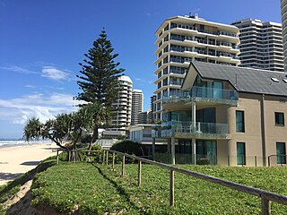
Southport is a coastal town and suburb in the City of Gold Coast in Queensland, Australia. It contains the Gold Coast central business district. In the 2021 census, Southport had a population of 36,786 people.

Southport is a census-designated place (CDP) in the town of Fairfield, Connecticut. It is located along Long Island Sound between Mill River and Sasco Brook, where it borders Westport. As of the 2020 census, it had a population of 1,710. Settled in 1639, Southport center has been designated a local historic district since 1967. In 1971, it was listed on the National Register of Historic Places as the Southport Historic District.

Southport railway station serves the town of Southport, Merseyside, England. The station is the terminal of the Southport branch of the Northern Line of the electric Merseyrail network and the diesel-operated Manchester-Southport Line. It is the fourth busiest station on the Merseyrail network. The station and services to Liverpool and Hunts Cross are operated by Merseyrail, with Manchester services operated by Northern Trains.

Kew is a suburb and ward of Southport, a seaside town in Sefton, Merseyside, England. It makes up the southeastern edge of the town, bordering Scarisbrick in West Lancashire. It is a middle class area of mostly modern development, and one of Southport's smallest suburbs.

Berry Springs is a locality in the Northern Territory of Australia. The locality is a mostly rural area situated on the Cox Peninsula Road and is sparsely populated. A few businesses and a school are located in the locality. In the 2016 census, the population of Berry Springs was 818. It is located 58.5 kilometres (36.4 mi) by road from the Darwin Central Business District and lies within the Litchfield Municipality local government area.

The Southport Historic District in the town of Fairfield, Connecticut is a 225-acre (91 ha) area historic district that was listed on the National Register of Historic Places in 1971. It preserves a portion of the modern neighborhood and former borough of Southport, Connecticut. Since the British burnt almost all of Southport's structures in 1779, there is only one home built prior to that date, the Meeker House at 824 Harbor Road, which survives.
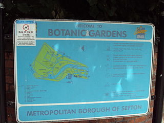
Southport Botanic Gardens is a botanical garden situated in the suburban village of Churchtown, Southport, in Merseyside, England. It is often called "The Jewel in the Crown" as it is nationally known for its floral displays, which have been featured in the BBC TV program Gardener's World.

Hillside is a residential suburb of the seaside town of Southport, England. It is surrounded by Birkdale, a former town in its own right, but part of Southport itself since amalgamation in 1912. It takes its name from a building named Hill Side, clearly evident on early maps. There was also Hillside Farm, part of which still survives on Hillside Golf Course. The original Birkdale station was in Hillside, situated at the present junction of Dunkirk Road and Dover Road.
The Gold Coast central business district (CBD) is the planned main commercial centre of the Gold Coast, Queensland, Australia. The area encompasses an eastern portion of the Southport suburb. Its north–south axis runs from North Street in the north to Brighton Parade in the south. Its east–west axis runs from Broadwater in the east to the High Street in the west.