| Lunt | |
|---|---|
| Village | |
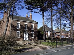 Old house, Lunt | |
 Lunt Location within Merseyside | |
| OS grid reference | SD3491802708 |
| Civil parish | |
| Metropolitan borough | |
| Metropolitan county | |
| Region | |
| Country | England |
| Sovereign state | United Kingdom |
| Post town | LIVERPOOL |
| Postcode district | L29 |
| Dialling code | 0151 |
| Police | Merseyside |
| Fire | Merseyside |
| Ambulance | North West |
| UK Parliament | |
Lunt is a small village in the civil parish of Sefton, in the borough of Sefton in Merseyside, England, close to Sefton Village and to the west of Maghull and is in the L29 postcode.
