This article needs additional citations for verification .(July 2013) |
Hinunangan | |
---|---|
Municipality of Hinunangan | |
Motto: Rice Granary of Southern Leyte | |
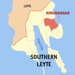
Location within the Philippines | |
Coordinates: 10°24′N125°12′E / 10.4°N 125.2°E | |
Country | Philippines |
Region | Eastern Visayas |
Province | Southern Leyte |
District | 2nd district |
Barangays | 40 (see Barangays) |
Government | |
• Type | Sangguniang Bayan |
• Mayor | Reynaldo C. Fernandez (PDPLBN) |
• Vice Mayor | Marian D. Pelin (PDPLBN) |
• Representative | Christopherson M. Yap |
• Municipal Council | Members |
• Electorate | 21,548 voters (2022) |
Area | |
• Total | 170.58 km2 (65.86 sq mi) |
Elevation | 4.8 m (15.7 ft) |
Highest elevation | 401 m (1,316 ft) |
Lowest elevation | −1 m (−3 ft) |
Population (2020 census) [4] | |
• Total | 29,149 |
• Density | 170/km2 (440/sq mi) |
• Households | 7,402 |
Economy | |
• Income class | 3rd municipal income class |
• Poverty incidence | 25.21 |
• Revenue | ₱ 138.2 million (2020) |
• Assets | ₱ 254 million (2020) |
• Expenditure | ₱ 136 million (2020) |
• Liabilities | ₱ 97.01 million (2020) |
Service provider | |
• Electricity | Southern Leyte Electric Cooperative (SOLECO) |
Time zone | UTC+8 (PST) |
ZIP code | 6608 |
PSGC | |
IDD : area code | +63 (0)53 |
Native languages | Boholano dialect Cebuano Tagalog |
Hinunangan, officially the Municipality of Hinunangan (Kabalian: Lungsod san Hinunangan; Cebuano : Lungsod sa Hinunangan; Tagalog : Bayan ng Hinunangan), is a 3rd class municipality in the province of Southern Leyte, Philippines. According to the 2020 census, it has a population of 29,149 people. [4]
Hinunangan is known as the "Rice Granary of the Province" for its vast plain land that is entirely planted with rice. Hinunangan has great potential for tourism because of its beautiful sandy beaches and islands. The town is also a producer of rattan and wood-based furniture, abaca handicraft items, pineapple, vegetables, other forest products, and bamboo furniture. It has a potential for mineral water and root crop processing and copper mining. [6]
Hinunangan is also known as a major gateway in Leyte because of its near proximity to Tacloban City. The opening of Abuyog–Silago Road cuts travel time from Tacloban by half from the previous 6 hours to less than 3 hours. It is also the place in Southern Leyte with the most immigrants from Europe and North America.
It has a lot of tourist places, such as Tahusan, Talisay, or the twin islands (known as Cabugan Grande and Cabugan Chico as Pigafetta stated in his account during their travel with Magellan).[ citation needed ]. There are also hotels, inns, a public market, and beach resorts.
In 1521, Magellan recorded the sighting Hunonganan (Hinunangan) during the voyage in Leyte Gulf. As far back as 1750, Hinunangan was a mid-way station of Boholanos trading in Eastern Leyte. They rested overnight at the mouth of Das-ay River where they moored their boats. A shelter was built for the crews and tenders known as "hononganan" or stopover. Hence the name. In 1822, a certain Boholano named Palonoy founded Hinunangan. [7] At this time, Silago to the north and Hinundayan and Anahawan to the south were part of Hinunangan.
In 1944, in the greatest naval battle in history the blocking warship of the Liberation waylaid the Japanese Fleet near Hinunangan. Thus, the area in Southern Leyte is the natural frontier of historically significant events in Philippine history.
On July 19, 2007, a strong earthquake hit the town with a magnitude 6 on the Richter scale and damaged some properties. The partial assessment report of Hinunangan dated July 20, a copy of which was obtained by PIA through Gov. Mercado, placed the estimated cost of damage to properties at P1,650,000.00 broken down as P790,000 for government infrastructure and P860,000 from private infrastructure. [8]
Among the public properties destroyed were the water system - P 500,000; Das-ay Bridge railguard - P100,000; East Central School Concrete Fence - P80,000; Otama Elementary School - P50,000; Patong Elementary School - P40,000; and Tahusan Elementary School—P20,000. [8]
The private infrastructure damaged included the Roman Catholic Bell tower - P100,000; Water tank of the Catholic convent - P40,000; Manalog barangay Chapel - P20,000; Santo Nino barangay Chapel - P10,000; a number of houses - P400,000, and various appliances, P290,000.
Hinunangan is home to the highest mountain in the province, Mount Nacolod, with an elevation of 948 metres (3,110 ft) above sea level. [9]
Hinunangan is politically subdivided into 40 barangays. Each barangay consists of puroks and some have sitios.
There are two of which are island barangays located at the east of the town. The twin islands are accessible by motorized boats through Barangay Canipa-an.
Barangay | Population (2007) | Population (2010) | Population (2015) | Population (2020) |
---|---|---|---|---|
Ambacon | 637 | 637 | 678 | 615 |
Badiangon | 647 | 589 | 641 | 681 |
Bangcas A | 668 | 743 | 777 | 862 |
Bangcas B | 903 | 959 | 982 | 913 |
Biasong | 609 | 566 | 599 | 652 |
Bugho | 961 | 1,003 | 1,061 | 1,147 |
Calag-itan | 1,167 | 1,180 | 1,206 | 1,163 |
Calayugan | 678 | 700 | 754 | 866 |
Calinao | 317 | 264 | 261 | 218 |
Canipaan | 1,425 | 1,509 | 1,635 | 1,611 |
Catublian | 1,373 | 1,503 | 1,580 | 1,445 |
Ilaya | 520 | 472 | 518 | 457 |
Ingan | 923 | 1,018 | 1,049 | 937 |
Labrador | 800 | 802 | 844 | 745 |
Libas | 463 | 449 | 512 | 431 |
Lumbog | 363 | 337 | 381 | 334 |
Manalog | 700 | 731 | 754 | 781 |
Manlico | 745 | 752 | 766 | 701 |
Matin-ao | 506 | 520 | 547 | 551 |
Nava | 1,798 | 1,801 | 1,946 | 1,924 |
Nueva Esperanza | 651 | 664 | 683 | 724 |
Otama | 543 | 593 | 531 | 504 |
Palongpong | 405 | 475 | 533 | 488 |
Panalaron | 588 | 677 | 753 | 790 |
Patong | 706 | 710 | 718 | 735 |
Poblacion | 799 | 898 | 923 | 638 |
Pondol | 957 | 993 | 1,035 | 989 |
Salog | 349 | 353 | 374 | 368 |
Salvacion | 519 | 483 | 496 | 483 |
San Pablo Island | 427 | 440 | 460 | 445 |
San Pedro Island | 473 | 486 | 493 | 459 |
Santo Niño I | 559 | 524 | 552 | 513 |
Santo Niño II | 946 | 1,004 | 1,043 | 1,096 |
Tahusan | 920 | 960 | 991 | 1,080 |
Talisay | 553 | 597 | 693 | 663 |
Tawog | 486 | 523 | 557 | 594 |
Toptop | 434 | 419 | 443 | 411 |
Tuburan | 600 | 627 | 635 | 587 |
Union | 397 | 378 | 402 | 404 |
Upper Bantawon | 197 | 162 | 170 | 144 |
Climate data for Hinunangan, Southern Leyte | |||||||||||||
---|---|---|---|---|---|---|---|---|---|---|---|---|---|
Month | Jan | Feb | Mar | Apr | May | Jun | Jul | Aug | Sep | Oct | Nov | Dec | Year |
Average high °C (°F) | 28 (82) | 29 (84) | 29 (84) | 30 (86) | 30 (86) | 30 (86) | 29 (84) | 29 (84) | 29 (84) | 29 (84) | 29 (84) | 29 (84) | 29 (84) |
Average low °C (°F) | 22 (72) | 22 (72) | 22 (72) | 23 (73) | 25 (77) | 25 (77) | 25 (77) | 25 (77) | 25 (77) | 24 (75) | 24 (75) | 23 (73) | 24 (75) |
Average precipitation mm (inches) | 78 (3.1) | 57 (2.2) | 84 (3.3) | 79 (3.1) | 118 (4.6) | 181 (7.1) | 178 (7.0) | 169 (6.7) | 172 (6.8) | 180 (7.1) | 174 (6.9) | 128 (5.0) | 1,598 (62.9) |
Average rainy days | 16.7 | 13.8 | 17.3 | 18.5 | 23.2 | 26.5 | 27.1 | 26.0 | 26.4 | 27.5 | 24.6 | 21.0 | 268.6 |
Source: Meteoblue [10] |
Year | Pop. | ±% p.a. | ||
---|---|---|---|---|
1903 | 8,574 | — | ||
1918 | 11,491 | +1.97% | ||
1939 | 16,983 | +1.88% | ||
1948 | 17,556 | +0.37% | ||
1960 | 12,665 | −2.68% | ||
1970 | 16,142 | +2.45% | ||
1975 | 18,648 | +2.94% | ||
1980 | 20,568 | +1.98% | ||
1990 | 22,454 | +0.88% | ||
1995 | 22,170 | −0.24% | ||
2000 | 25,016 | +2.62% | ||
2007 | 27,712 | +1.42% | ||
2010 | 28,415 | +0.92% | ||
2015 | 29,976 | +1.02% | ||
2020 | 29,149 | −0.55% | ||
| ||||
Source: Philippine Statistics Authority [11] [12] [13] [14] |
Graphs are temporarily unavailable due to technical issues. |
Mobile:
Cable television:
Internet:
Balangiga, officially the Municipality of Balangiga, is a 4th class municipality in the province of Eastern Samar, Philippines. According to the 2020 census, it has a population of 14,341 people.
Abuyog, officially the Municipality of Abuyog, is a first class municipality in the province of Leyte, Philippines. According to the 2020 census, it has a population of 61,216 people.
Alangalang, officially the Municipality of Alangalang, is a 2nd class municipality in the province of Leyte, Philippines. According to the 2020 census, it has a population of 57,185 people.
Silago, officially the Municipality of Silago, is a 4th class municipality in the province of Southern Leyte, Philippines. According to the 2020 census, it has a population of 13,116 people. It was used to be barrio of Hinunangan until Executive Order No. 326 dated May 17, 1951 separated it from the mother town. The town has an ebony beach with unique black sand.
Culaba, officially the Municipality of Culaba, is a 5th class municipality in the province of Biliran, Philippines. According to the 2020 census, it has a population of 12,972 people.The town's populace predominantly speak Waray language.
Anahawan, officially the Municipality of Anahawan, is a 5th class municipality in the province of Southern Leyte, Philippines. According to the 2020 census, it has a population of 8,429 people.
Hinundayan, officially the Municipality of Hinundayan, is a 5th class municipality in the province of Southern Leyte, Philippines. According to the Hinundayan has a total land area of 6,108 hectares or 61.08 square kilometers, comprising 17 barangays. 2020 census, it has a population of 12,398 people.
Limasawa, officially the Municipality of Limasawa, is an island municipality in the province of Southern Leyte, Philippines. According to the 2020 census, it has a population of 6,191 people.
San Francisco, officially the Municipality of San Francisco, is a 5th class municipality in the province of Southern Leyte, Philippines. According to the 2020 census, it has a population of 13,436 people.
San Juan, officially the Municipality of San Juan, is a 5th class municipality in the province of Southern Leyte, Philippines. According to the 2020 census, it has a population of 14,912 people.
San Ricardo, officially the Municipality of San Ricardo, is a 5th class municipality in the province of Southern Leyte, Philippines. According to the 2020 census, it has a population of 10,500 people.
Bato, officially the Municipality of Bato, is a 4th class municipality in the province of Leyte, Philippines. According to the 2020 census, it has a population of 38,505 people.
Leyte, officially the Municipality of Leyte, is a 4th class municipality in the province of Leyte, Philippines. According to the 2020 census, it has a population of 40,397 people.
Mayorga, officially the Municipality of Mayorga, is a 5th class municipality in the province of Leyte, Philippines. According to the 2020 census, it has a population of 18,071 people.
Palo, officially the Municipality of Palo, is a 3rd class municipality in the province of Leyte, Philippines. According to the 2020 census, it has a population of 76,213 people, making it the most populous municipality (non-city) in the province.
Pastrana, officially the Municipality of Pastrana, is a 5th class municipality in the province of Leyte, Philippines. According to the 2020 census, it has a population of 19,359 people.
San Miguel, officially the Municipality of San Miguel, is a 4th class municipality in the province of Leyte, Philippines. According to the 2020 census, it has a population of 19,753 people.
Santa Fe, officially the Municipality of Santa Fe, is a 5th class municipality in the province of Leyte, Philippines. According to the 2020 census, it has a population of 22,102 people.
Tabango, officially the Municipality of Tabango, is a 4th class municipality in the province of Leyte, Philippines. According to the 2020 census, it has a population of 33,868 people.
Tunga, officially the Municipality of Tunga, is a 6th class municipality in the province of Leyte, Philippines. According to the 2020 census, it has a population of 7,656 people.