History of rail transport in Malawi

Last updated
A Malawi Railways diesel railcar, 1984. Malawi Railways diesel railcar.JPG
A Malawi Railways diesel railcar, 1984.

The history of rail transport in Malawi began shortly after the turn of the twentieth century.

Contents

Transport by rail was introduced to British Central Africa Protectorate (BCA), the British protectorate occupying present-day Malawi, in 1904. Three years later, the name of the area was changed to Nyasaland.

Railways have continued to serve the area ever since, including in the period since Malawi became independent in 1964.

British colonial period

Background

From the 1890s, small river steamers operated between Chinde at the mouth of the Zambezi and Chiromo on the Lower Shire River, a distance of 290 kilometres (180 mi). However, the main areas of economic activity in the BCA were around Blantyre in the Shire Highlands, over 80 km (50 mi) from Chiromo, and transport to the river was costly and inefficient. Steamers also navigated the Upper Shire and Lake Nyasa (now Lake Malawi), but about 80 km (50 mi) of the Middle Shire was impassable. Railways could supplement water transport and, as the BCA was nowhere nearer than 320 km (200 mi) to a suitable Indian Ocean port, a short rail link to river ports was more practical than a line direct to the coast. [1]

Shire Highlands Railway

Low Shire River levels after 1896 made water transport more difficult. In 1901, the Shire Highlands Railway Company was formed by Blantyre-based investors. It soon obtained a concession to build a railway from Port Herald (now Nsanje) on the Shire River at the southernmost point of the protectorate, to Fort Johnston (now Mangochi), at the southern end of Lake Nyasa, via Chiromo and Blantyre. The first section of this line, between Port Herald and Chiromo, was handed over to traffic on 1 September 1904. [2]

Further construction of the railway was greatly hampered by a difference in elevation of more than 900 m (3,000 ft) between Chiromo and Blantyre. The difficulties were so severe that the Shire Highlands Railway ran out of funds, with the consequence that another company, the British South Africa Company, assumed the task of completing the section, which was finally opened on 23 January 1909. [3] Additional reductions in the Shire River's flow made Port Herald unsatisfactory, so a Zambezi port was needed.

Central African Railway

In 1914, the British South Africa Company built the Central African Railway of 98 km (61 mi) from Port Herald to Chindio on the north bank of the Zambezi. From there, goods went by river steamers to Chinde then by sea to Beira, involving three transhipments and delays. The Central African Railway was poorly built, and soon needed extensive repairs. [4]

Trans-Zambezia Railway

In the early 20th century, Beira developed as a major port: it was far superior to Chinde, which was severely damaged by a cyclone in 1922. The Trans-Zambezia Railway, constructed between 1919 and 1922, ran 269 km (167 mi) from the south bank of the Zambezi to join the main line from Beira to Rhodesia. Its promoters had interests in Beira port, and they ignored its high cost and limited benefit to Nyasaland or a shorter alternative route to the small port of Quelimane. [5] River transport was practically defunct after 1935. The only recorded traffic on the Shire River within Nyasaland was a seasonal service run by the Shire Highlands Railway for the collection of cotton and other produce between Chiromo and Chikwawa. [6]

Nyasaland Railways Limited

The Zambezi crossing remained the weak point in the link to Beira. The ferry used old steamers towing barges between Chindio on the north bank and Muracca on the south bank, and its capacity was limited. [7] For two months a year the river was too shallow, at other times it flooded.

In 1930, Nyasaland Railways Limited was formed. The new company acquired the Shire Highlands Railway and Central African Railway, and made plans to extend the railway north and south. In 1935, the ferry was replaced by the construction of the Dona Ana Bridge (or Zambezi Bridge), over three kilometres (2 mi) long, creating an uninterrupted rail link to the sea. The new bridge crossed the Zambezi 39 km (24 mi) upstream from the Chindio-Muracca ferry. [8]

The northern extension from Blantyre to Salima near Lake Nyasa was also completed in 1935, and a terminal for lake services was developed at the nearby lake port of Chipoka. [9] The government turned over operation of lake services to Nyasaland Railways, who operated cargo and passenger services between ports on the lake. [10]

After the completion of the Dona Ana bridge, connecting the railway sections of Malawi and Mozambique became possible. When the sections were finally connected, the line between Dondo (Mozambique) and Blantyre (Malawi) was named Sena railway.

Colonial railway operations

Unfortunately, the Zambezi Bridge and northern extension to Lake Nyasa created less traffic than anticipated, and it was only in 1946 that the traffic levels predicted in 1937 were reached. By this time, motor transport was becoming an alternative to rail, but government regulations designed to promote the use of the railway hindered the development of road transport. All the rail lines were narrow gauge and single track, and the Shire Highlands Railway in particular had sharp curves and steep gradients, so the system was inadequate for heavy train loads. Maintenance costs were high and freight volumes were low, so freight rates were up to three times those of Rhodesian and East African lines. [11] [12]

Independent Malawi

Upon independence, Nyasaland Railways changed its name to Malawi Railways Limited.

On 17 May 1968 work began on a 101 km rail extension to connect Malawi Railways to the existing Nacala railway in Mozambique, to give Malawi access to the seaport of Nacala in northern Mozambique. The new railway connected to Malawi's north–south line at Nkaya, and to the existing Nacala line at Nova Freixo in Mozambique (present-day Cuamba). The line was inaugurated by President Hastings Banda on 4 July 1970 and began operations on 3 August. The project cost £5.4 million, financed by a long-term, low-interest loan from the Industrial Development Corporation of South Africa. [13] [14] An extension of the Sena railway, starting from the city Salima, towards the west, reaching Lilongwe and Mchinji, was completed in 1979. [15]

Although costly and inefficient, the rail link to Beira remained a main bulk transport link until 1979 when it was destroyed by RENAMO forces in the Mozambican Civil War. By then, Malawi had its second rail link to the Mozambique port of Nacala. In 1984 the Nacala link was also lost, when the Nacala railway was destroyed by RENAMO forces.

Lake services were separated from Malawi Railways in 1994.

The Nacala railway link was later restored, and is Malawi's principal route for imports and exports today. [16] In 2017, the Nacala railway link was extended west from Nkaya junction to the coal mines at Moatize in Mozambique.

See also

Related Research Articles

<span class="mw-page-title-main">Transport in Malawi</span>

Transportation in Malawi is poorly developed. The country of almost 14 million has 39 airports, 6 with paved runways and 33 with unpaved runways. It has 797 kilometres of railways, all narrow-gauge and about 45 percent of its roads are paved. Though it is landlocked, Malawi also has 700 km (435 mi) of waterways on Lake Malawi and along the Shire River.

Chinde is a town of Mozambique, and a port for the Zambezi valley. It is located on the Chinde River, and is an important fishing center. It exports copra and sugar, and had a population of 16,500 in 1980. Chinde lies in Chinde District of Zambezia Province.

<span class="mw-page-title-main">Nyasaland</span> British protectorate from 1907 to 1964

<span class="mw-page-title-main">British Central Africa Protectorate</span> British protectorate from 1893 to 1907

The British Central Africa Protectorate (BCA) was a British protectorate proclaimed in 1889 and ratified in 1891 that occupied the same area as present-day Malawi: it was renamed Nyasaland in 1907. British interest in the area arose from visits made by David Livingstone from 1858 onward during his exploration of the Zambezi area. This encouraged missionary activity that started in the 1860s, undertaken by the Universities' Mission to Central Africa, the Church of Scotland and the Free Church of Scotland, and which was followed by a small number of settlers. The Portuguese government attempted to claim much of the area in which the missionaries and settlers operated, but this was disputed by the British government. To forestall a Portuguese expedition claiming effective occupation, a protectorate was proclaimed, first over the south of this area, then over the whole of it in 1889. After negotiations with the Portuguese and German governments on its boundaries, the protectorate was formally ratified by the British government in May 1891.

<span class="mw-page-title-main">Harry Johnston</span> British explorer (1858–1927)

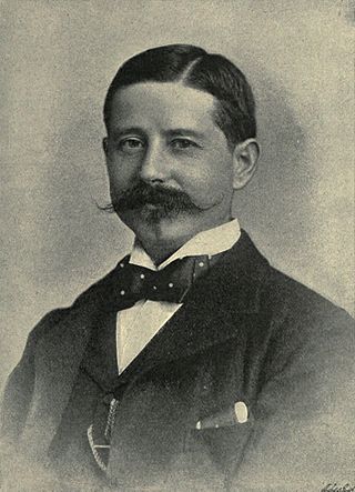
Sir Henry Hamilton Johnston was a British explorer, botanist, artist, colonial administrator, and linguist who travelled widely in the contient of Africa and spoke some of the languages spoken by people on that continent. He published 40 books on subjects related to the continent of Africa and was one of the key players in the Scramble for Africa that occurred at the end of the 19th century.

<span class="mw-page-title-main">Shire River</span> River in Malawi, Mozambique

The Shire is the largest river in Malawi. It is the only outlet of Lake Malawi and flows into the Zambezi River in Mozambique. Its length is 402 kilometres (250 mi). The upper Shire River issues from Lake Malawi and runs approximately 19 km (12 mi) before it enters shallow Lake Malombe. It then drains Lake Malombe and flows south through Liwonde National Park where large concentrations of hippopotamus are common along its shores. Between the towns of Matope and Chikwawa, the middle river drops approximately 400 m (1,300 ft) through a series of falls and gorges, including Kapachira Falls. Two hydroelectric dams have been built along the Shire northwest of Blantyre.

The African Lakes Corporation plc was a British company originally set-up in 1877 by Scottish businessmen to co-operate with Presbyterian missions in what is now Malawi. Despite its original connections with the Free Church of Scotland, it operated its businesses in Africa on a commercial rather than a philanthropic basis. It had political ambitions in the 1880s to control part of Central Africa and engaged in armed conflict with Swahili traders. Its businesses in the colonial era included water transport on the lakes and rivers of Central Africa, wholesale and retail trading including the operation of general stores, labour recruitment, landowning and later an automotive business. The company later diversified, but suffered an economic decline in the 1990s and was liquidated in 2007. One of the last directors of the company kindly bought the records of the company and donated them to Glasgow University Archive Services, where they are still available for research.

<span class="mw-page-title-main">Shire Highlands</span> Plateau in southern Malawi

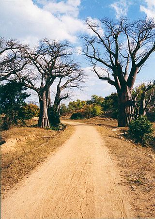
The Shire Highlands are a plateau in southern Malawi, located east of the Shire River. It is a major agricultural area and the most densely populated part of the country.

Chindio is a village on the north bank of the Zambezi River in Mozambique, downstream of its junction with the Shire River. Chindio is not the same place as Chinde, although they are both on the Zambezi and in Mozambique.

<span class="mw-page-title-main">Malawi Railways</span> Former government corporation running Malawis rail network

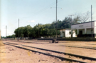
Malawi Railways was a government corporation that ran the national rail network of Malawi, Africa, until privatisation in 1999. With effect from 1 December 1999, the Central East African Railways consortium led by Railroad Development Corporation won the right to operate the network. This was the first rail privatisation in Africa which did not involve a parastatal operator.

<span class="mw-page-title-main">Dona Ana Bridge</span> Railway bridge in Mozambique spanning the Zambezi

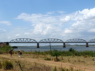
The Dona Ana Bridge spans the lower Zambezi River between the towns of Vila de Sena and Mutarara in Mozambique, effectively linking the two halves of the country. It was originally constructed as a railway bridge to link Malawi and the Moatize coal fields to the port of Beira.

Malawi Railways is the national rail network in Malawi, run by a government corporation until privatisation in 1999. As of 1 December 1999 the Central East African Railways, a consortium led by Railroad Development Corporation, won the right to operate the network.

<span class="mw-page-title-main">History of rail transport in Mozambique</span>

The history of rail transport in Mozambique began in the latter years of the nineteenth century.

<span class="mw-page-title-main">Malawi–Mozambique relations</span> Bilateral relations

Malawi–Mozambique relations refers to the current and historical relationship between the countries of Malawi and Mozambique. As Malawi shares a large border with Mozambique, much of the substance of their foreign relations pertain to the border separating the two nations. Both of the sovereign states have amicably agreed that lacustrine borders on Lake Malawi remain the largest priority between the two countries, as the exploitation of natural resources within the waters of Lake Malawi remain an issue the two countries continue to resolve. The moment considered an act of generosity and sympathy within the two countries relations is when, during the Mozambique Civil War, Malawi housed over one million Mozambican refugees between 1985 and 1995. After this gesture, Malawian relations with Mozambique crumbled under the tenure of Bingu wa Mutharika, notoriously reaching a nadir when Malawian police launched a raid into Mozambique's territory.

Eugene Charles Albert Sharrer was a British subject by naturalisation but of German descent, who was a leading entrepreneur in what is now Malawi for around fifteen years between his arrival in 1888 and his departure. He rapidly built-up commercial operations including wholesale and retail trading, considerable holdings of land, cotton and coffee plantations and a fleet of steamers on the Zambezi and Shire rivers. Sharrer was prominent in pressure groups that represented the interests of European planters and their businesses to the colonial authorities, and was responsible for the development of the first railway in what had become the British Central Africa Protectorate, whose construction was agreed in 1902. In 1902, Sharrer consolidate all his business interests into the British Central Africa Company Ltd and became its principal shareholder Shortly after this he left British Central Africa permanently for London, although he retained his financial interests in the territory. Very little is known of his history before he arrived in Central Africa but he died in London during the First World War.

The British Central Africa Company Ltd was one of the four largest European-owned companies that operated in colonial Nyasaland, now Malawi. The company was incorporated in 1902 to acquire the business interests that Eugene Sharrer, an early settler and entrepreneur, had developed in the British Central Africa Protectorate. Sharrer became the majority shareholder of the company on its foundation. The company initially had trading and transport interests, but these were sold by the 1930s. For most of the colonial period, its extensive estates produced cotton, tobacco or tea but the British Central Africa Company Ltd developed the reputation of being a harsh and exploitative landlord whose relations with its tenants were poor. In 1962, shortly before independence, the company sold most of its undeveloped land to the Nyasaland government, but it retained some plantations and two tea factories. It changed its name to The Central Africa Company Ltd and was acquired by the Lonrho group, both in 1964.

John Buchanan (1855–1896), was a Scottish horticulturist who went to Central Africa, now Malawi, in 1876 as a lay member of the missionary party that established Blantyre Mission. Buchanan came to Central Africa as an ambitious artisan: his character was described as dour and devout but also as restlessly ambitious, and he saw in Central Africa a gateway to personal achievement. He started a mission farm on the site of Zomba, Malawi but was dismissed from the mission in 1881 for brutality. From being a disgraced missionary, Buchanan first became a very influential planter owning, with his brothers, extensive estates in Zomba District. He then achieved the highest position he could in the British administration as Acting British Consul to Central Africa from 1887 to 1891. In that capacity declared a protectorate over the Shire Highlands in 1889 to pre-empt a Portuguese expedition that intended to claim sovereignty over that region. In 1891, the Shire Highlands became part of the British Central Africa Protectorate. John Buchanan died at Chinde in Mozambique in March 1896 on his way to visit Scotland, and his estates were later acquired by the Blantyre and East Africa Ltd.

<span class="mw-page-title-main">Shire Highlands Railway Company</span>

The Shire Highlands Railway Company Ltd was a private railway company in colonial Nyasaland, incorporated in 1895 with the intention of constructing a railway from Blantyre to the effective head of navigation of the Shire River. After problems with routing and finance, a South African 3 ft 6 in gauge railway was constructed between 1903 and 1907, and extended in 1908 to a Nsanje, a distance of 113 miles (182 km) as water levels in the Shire River fell.

<span class="mw-page-title-main">Nacala railway</span>

Nacala railway, also known as Northern Corridor railway and Nacala Corridor railway, is a railway line that operates in northern Mozambique on a 912 kilometres (567 mi) line that runs west from the port city of Nacala, crossing the central region of Malawi, connecting with the coal belt of Moatize, in northwest Mozambique. It is connected to the Dona Ana-Moatize railway branch and the Sena railway (Chipata-Lilongwe-Blantyre-Nhamayabue-Dondo). It also has a 262 kilometres (163 mi) branch line from Cuamba to Lichinga.

<span class="mw-page-title-main">Sena railway</span>

Sena railway, also called Shire Highlands railway, Dondo-Malawi railway and North-South Malawi railway, is a railway that connects Dondo, Mozambique, to Chipata, in Zambia. It is c. 1000 km long, in a 1067 mm gauge.

References

Notes

  1. Mandala 2006.
  2. Baltzer 1916 , p. 158.
  3. Baltzer 1916 , p. 158.
  4. Hammond, Newcombe & Carter 1929 , pp. 32, 37.
  5. Vail 1975.
  6. J Perry (1969) The growth of the transport network of Malawi- The Society of Malawi Journal, 1969 Vol. 22, No. 2, p. 32.
  7. Nkana, Robert (1999). "Malawi Railways: an Historical Review." The Society of Malawi Journal Vol. 52, No. 1 (1999), pp. 39-45
  8. Nkana, Robert (1999). "Malawi Railways: an Historical Review." The Society of Malawi Journal Vol. 52, No. 1 (1999), pp. 39-45
  9. Hammond, Newcombe & Carter 1929 , pp. 11–14, 38-9.
  10. Nkana, Robert (1999). "Malawi Railways: an Historical Review." The Society of Malawi Journal Vol. 52, No. 1 (1999), pp. 39-45
  11. UK Colonial Office, An Economic Survey of the Colonial Territories, 1951 (London, HMSO, 1952), pp. 45-6.
  12. A. MacGregor-Hutcheson (1969). New Developments in Malawi's Rail and Lake Services, The Society of Malawi Journal, Vol. 22, No. 1, pp. 32-4.
  13. Perry, J.W.B (1971). "Malawi's New Outlet to the Sea." Geography Vol. 56, No. 2 (April 1971), pp. 138-140.
  14. Nkana, Robert (1999). "Malawi Railways: an Historical Review." The Society of Malawi Journal Vol. 52, No. 1 (1999), pp. 39-45
  15. Nkana, Robert (1999). "Malawi Railways: an Historical Review." The Society of Malawi Journal Vol. 52, No. 1 (1999), pp. 39-45
  16. J McCraken, (2012). A History of Malawi, 1859-1966 Woodbridge, James Currey pp. 173-6. ISBN   978-1-84701-050-6.

Bibliography

  • Baltzer, Franz (1916). Die Kolonialbahnen mit besonderer Berücksichtigung Afrikas [The Colonial Railways with particular reference to Africa]. Berlin, Leipzig, Göschen: (Reprint: Leipzig 2007: Holzminden Reprint-Verl.). ISBN   9783826202339.(in German)
  • Crosby, Cynthia A. (1974). A History of the Nyasaland Railway, 1895 - 1935: A Study in Colonial Economic Development. Syracuse, New York: PhD thesis, Syracuse University.
  • Fox, Sir Douglas; Metcalfe, Sir Charles T., Bart. (1899). Report on the survey through the Shiré Highlands. London: Waterlow and Sons. OCLC   642487385.
  • Hammond, F. D.; Newcombe, E. O. A.; Carter, E. P. (1929). Report on the Nyasaland Railways and Proposed Zambesi Bridge, 1927. London: H.M. Stationery Office. OCLC   14379881.
  • Hollingsworth, J B (1980). Atlas of the World's Railways. Adelaide: Rigby. pp. 229–230. ISBN   0727003054.
  • Mandala, E (2006). "Feeding and Fleecing the Native: How the Nyasaland Transport System Distorted a New Food Market, 1890s-1920s". Journal of Southern African Studies . 32 (3): 508–512. doi:10.1080/03057070600830474.
  • Rees, J D (1908). Nyasaland and the Shiré Highlands Railway with map: issued for the information of intending settlers, planters, miners and travellers. London: British Central Africa Co. OCLC   681153850.
  • Robinson, Neil (2009). World Rail Atlas and Historical Summary. Volume 7: North, East and Central Africa. Barnsley, UK: World Rail Atlas Ltd. ISBN   978-954-92184-3-5.
  • Vail, L (1975). "The Making of an Imperial Slum: Nyasaland and Its Railways, 1895–1935". The Journal of African History . 16: 96–101.

Winchester, Clarence, ed. (1936), "Pioneering in Nyasaland", Railway Wonders of the World, pp. 998–1003 illustrated account of the railways of Nyasaland

Commons-logo.svg Media related to Rail transport in Malawi at Wikimedia Commons