
Eastern Creek is a suburb of Sydney, in the state of New South Wales, Australia. Eastern Creek is located 35 kilometres (22 mi) west of the Sydney central business district, in the Blacktown local government area and is part of the Greater Western Sydney region.

Blackett is a suburb of Sydney, in the state of New South Wales, Australia. Blackett is located 48 kilometres west of the Sydney central business district, in the local government area of the City of Blacktown and is part of the Greater Western Sydney region.

Dean Park is a suburb of Sydney, in the state of New South Wales, Australia. Dean Park is located 43 kilometres west of the Sydney central business district, in the local government area of the City of Blacktown and is part of the Western Sydney region.

Glendenning is a suburb of Sydney, in the state of New South Wales, Australia. Glendenning is located 44 kilometres west of the Sydney central business district, in the local government area of the City of Blacktown and is part of the Greater Western Sydney region.
Glenwood is a suburb of Sydney, in the state of New South Wales, Australia. Glenwood is located 33 kilometres north-west of the Sydney central business district in the local government area of the City of Blacktown and part of the Greater Western Sydney region.
Rossmore is a suburb of Sydney, in the state of New South Wales, Australia.

Luddenham is a suburb of Sydney, in the state of New South Wales, Australia 42 kilometres west of the Sydney central business district, in the local government areas of the City of Penrith and City of Liverpool. It is part of the Greater Western Sydney region.
Lurnea is a suburb of Sydney, in the state of New South Wales, Australia. It is 35 kilometres south-west of the Sydney central business district, in the local government area of the City of Liverpool.
Beaumont Hills is a suburb of Sydney, in the state of New South Wales, Australia 40 kilometres north west of the Sydney central business district, in the local government area of The Hills Shire. Beaumont Hills is part of the Greater Western Sydney region and the Hills District.
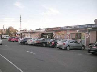
Canley Heights is a suburb of Sydney, in the state of New South Wales, Australia 31 kilometres west of the Sydney central business district, in the local government area of the City of Fairfield and is part of the South-western Sydney region.

Carramar is a suburb of Sydney, in the state of New South Wales, Australia. Carramar is located 30 kilometres west of the Sydney central business district, in the local government area of the City of Fairfield and is part of the South Western Sydney region.

Cartwright is a suburb in south-western Sydney, in the state of New South Wales, Australia 38 kilometres south-west of the Sydney central business district, in the local government area of the City of Liverpool.
Cecil Park is a suburb of Sydney, in the state of New South Wales, Australia 40 kilometres west of the Sydney central business district, in the local government area of the City of Fairfield. It is part of the Greater Western Sydney region.
Greenfield Park is a suburb of Sydney, in the state of New South Wales, Australia. Greenfield Park is located 36 kilometres west of the Sydney central business district in the local government area of the City of Fairfield. The suburb has one of the highest proportions of Assyrian people in the Sydney area and Australia per se.

Hammondville is a suburb, in south-western Sydney, in the state of New South Wales, Australia. Hammondville is located 31 kilometres south-west of the Sydney central business district in the local government area of the City of Liverpool.

Heckenberg is a suburb in south-western Sydney, in the state of New South Wales, Australia 36 kilometres south-west of the Sydney central business district, in the local government area of the City of Liverpool.

Cecil Hills is a suburb of Sydney, in the state of New South Wales, Australia. Cecil Hills is located 38 kilometres west of the Sydney central business district, in the local government area of the City of Liverpool and is part of the Greater Western Sydney region.

Colyton is a suburb of Sydney, in the state of New South Wales, Australia 43 kilometres west of the Sydney central business district, in the local government area of the City of Penrith. It is part of the Greater Western Sydney region.

Horningsea Park is a suburb of Sydney, in the state of New South Wales, Australia. Horningsea Park is located 39 kilometres south-west of the Sydney central business district, in the local government area of the City of Liverpool and is part of the Greater Western Sydney region.

Leppington is a suburb of Sydney, in the state of New South Wales, Australia. Leppington is located 52 kilometres south-west of the Sydney central business district, in the local government areas of the City of Liverpool and Camden Council.
