
The Kanangra-Boyd National Park is a protected national park that is located in the Central Tablelands region, west of the Southern Highlands and Macarthur regions, in New South Wales, in eastern Australia. The 68,660-hectare (169,700-acre) national park is situated approximately 180 kilometres (110 mi) south-west of Sydney and is contiguous with the Blue Mountains National Park and the Nattai National Park. The park was established in 1969.

Wadbilliga National Park is a 985.3 km2 (380 sq mi) national park that is located in high country spanning the Monaro and South Coast regions of south-eastern New South Wales, Australia.

The Werrikimbe National Park is a protected national park located in the catchment zone of the Upper Hastings River in New South Wales, Australia. Gazetted in 1975, the 33,309-hectare (82,310-acre) park is situated approximately 486 kilometres (302 mi) north of Sydney and 65 kilometres (40 mi) from Wauchope, and 90 kilometres (56 mi) east of Walcha on the eastern escarpment of the Great Dividing Range.

The Ansel Adams Wilderness is a wilderness area in the Sierra Nevada of California, USA.The wilderness spans 231,533 acres (93,698 ha): 33.9% of which is in the Inyo National Forest, 65.8% is in the Sierra National Forest, and the remaining 0.3% covers nearly all of Devils Postpile National Monument. Yosemite National Park lies to the north and northwest, while the John Muir Wilderness lies to the south.

The John Muir Wilderness is a wilderness area that extends along the crest of the Sierra Nevada of California for 90 miles (140 km), in the Inyo and Sierra National Forests. Established in 1964 by the Wilderness Act and named for naturalist John Muir, it contains 581,000 acres (2,350 km2). The wilderness lies along the eastern escarpment of the Sierra from near Mammoth Lakes and Devils Postpile National Monument in the north, to Cottonwood Pass near Mount Whitney in the south. The wilderness area also spans the Sierra crest north of Kings Canyon National Park, and extends on the west side of the park down to the Monarch Wilderness.

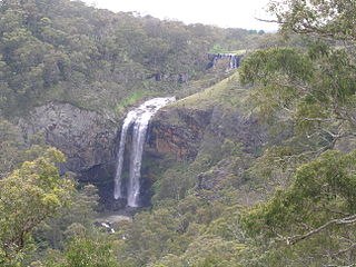
The Colo River, a perennial stream that is part of the Hawkesbury-Nepean catchment, is located in the Central Tablelands of New South Wales, Australia.

Devil's Bridge is a village and community in Ceredigion, Wales. Above the River Mynach on the edge of the village is the unusual road bridge from which the village gets its English name.

Mount Jagungal or sometimes Jagungal, Big Bogong, The Big Bogong Nr., or The Big Bogong Mountain, is a mountain within the Jagungal Wilderness Area of the Kosciuszko National Park in the Snowy Mountains region of New South Wales, Australia.

The Piney Creek Wilderness is an 8,122-acre (33 km2) wilderness area in Missouri. The United States Congress designated it wilderness in 1980. The Piney Creek Wilderness is located within the Ava-Cassville-Willow Springs Ranger District of the Mark Twain National Forest, east of Cassville, Missouri. The area is named after Piney Creek, which runs the length of the wilderness area and eventually empties into the James River arm of Table Rock Lake. The Piney Creek Wilderness is one of eight wilderness areas of the Mark Twain National Forest that are protected and preserved in Missouri.
The United States Congress designated the Bell Mountain Wilderness in 1980. The wilderness area now has a total of 9,027 acres (36.53 km2). Bell Mountain is located within the Potosi-Fredericktown Ranger District of the Mark Twain National Forest, south of Potosi, Missouri in the United States. The wilderness lies in the Saint Francois Mountains and it was named after its highest point, Bell Mountain. The namesake Bell Mountain has the name of Henry Bell, a pioneer settler. The Bell Mountain Wilderness is one of eight wilderness areas protected and preserved in Missouri. The area is popular for hiking as there are 12 miles (19 km) of trail, including a section of the Ozark Trail.

The Watagan Mountains or Watagans or Wattagan Mountains, a mountain range that is part of the Great Dividing Range, is located on the Upper Hunter region of New South Wales, Australia. The range is situated between the Upper Hunter River catchment and the Tuggerah Lakes. The Watagans are a popular tourist location and are close to Newcastle, Sydney and the Central Coast.
Guy Fawkes River, a perennial stream that is part of the Clarence River catchment, is in the New England and Northern Tablelands districts of New South Wales, Australia.

The Grose River, a perennial river that is part of the Hawkesbury-Nepean catchment, is located in the Blue Mountains region of New South Wales, Australia.

Boulder River Wilderness is a 48,674-acre (197 km2) wilderness area within the Mount Baker-Snoqualmie National Forest in the western Cascade Range of Washington state.
Buckenbowra River, a perennial river of the Clyde River catchment, is located in the upper ranges of the South Coast region of New South Wales, Australia.
The Kowmung River, a perennial river that is part of the Hawkesbury-Nepean catchment, is located in the Central Tablelands region of New South Wales, Australia.
The South Prince of Wales Wilderness is a wilderness area on Prince of Wales Island, Alaska, protecting 90,968 acres of undeveloped Pacific temperate rainforest, much of which is old-growth. Managed by the United States Forest Service as part of the Tongass National Forest, the wilderness area was designated in a provision of the 1980 Alaska National Interest Lands Conservation Act. This wilderness contains 75 or more islands that range from a few to over 500 acres in size. The South Prince of Wales Wilderness sees tidal bores, tidal surges, fierce winds, and heavy storms regularly.
The Kanangra Creek, a perennial stream of the Hawkesbury-Nepean catchment, is located in the Blue Mountains region of New South Wales, Australia.

The Happy Jacks Creek, a perennial river that is part of the Murrumbidgee catchment within the Murray–Darling basin, is located in the Snowy Mountains region of New South Wales, Australia.
The Devil's Staircase Wilderness is a forested wilderness area adjacent to the Umpqua River in the Southern Oregon Coast Range of the U.S. state of Oregon. It was officially designated in March 2019.


