
Richmond is a town in New South Wales, in the local government area of the City of Hawkesbury. It is located 19 metres above sea level on the alluvial Hawkesbury River flats, at the foot of the Blue Mountains on the Cumberland Plain. It is about 65 km by road from Sydney and about 78 km by road from Lithgow.

The Municipality of Strathfield, also known as Strathfield Council, is a local government area in the Inner West of Sydney, in the state of New South Wales, Australia.
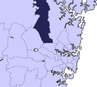
The Hills Shire is a local government area in the Greater Western Sydney region of Sydney, New South Wales, Australia. The suburb is north-west of the Sydney central business district, and encompasses 401 square kilometres (155 sq mi) stretching from the M2 Hills Motorway in the south to Wiseman's Ferry on the Hawkesbury River in the north. The Hills Shire had a population of 157,243 as at the 2016 census.
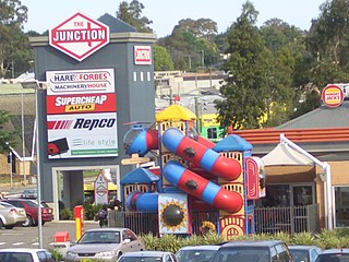
Northmead is a suburb of Greater Western Sydney, in the state of New South Wales, Australia. Northmead is located 26 kilometres west of the Sydney central business district, in the local government area of the City of Parramatta.

The City of Hawkesbury is a local government area of New South Wales, Australia, part of which is at the fringe of the Sydney metropolitan area, about 50 kilometres (31 mi) north-west of the Sydney central business district. Hawkesbury City is named after the Hawkesbury River.

Toongabbie is a suburb of Sydney, in the state of New South Wales, Australia. One of the oldest suburbs in Sydney, Toongabbie is located approximately 30 kilometres west of the Sydney central business district and is part of the Greater Western Sydney region. Toongabbie is split between the local government areas of the City of Parramatta, the City of Blacktown and Cumberland Council. The suburb is often locally referred to as "Toonie", "Toonga Bay" and "Bayside".
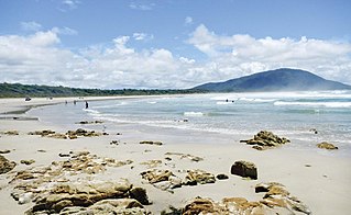
Old Bar is a coastal town in New South Wales, Australia in Mid-Coast Council. It lies around 16 kilometres (10 mi) east of Taree on the Mid North Coast, and around 315 kilometres (196 mi) north of Sydney.

Cullen Bullen is a village in New South Wales, Australia. It is located on Mudgee Road, 168 km north-west of Sydney, 28 km north of Lithgow. At the 2016 census, Cullen Bullen had a population of 279 people, up from 198 ten years earlier. The Cullen Bullen village is sustained by local mines and the Mount Piper Power Station.
Yarramundi is a suburb of Sydney, in the state of New South Wales, Australia. Yarramundi is located 69 kilometres west of the Sydney central business district, in the local government area of the City of Hawkesbury.

The Lane Cove Council is a local government area located on the Lower North Shore of Sydney, New South Wales, Australia. The administrative seat of Lane Cove is located 10 kilometres (6.2 mi) north-west of the Sydney central business district.
North Richmond is a semi-rural suburb of Richmond, in the state of New South Wales, Australia. North Richmond is located 67 kilometres north-west of the Sydney central business district in the local government area of the City of Hawkesbury. It is separated from Richmond to the south-east by the Hawkesbury River.
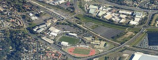
Leumeah is a suburb of Sydney, in the state of New South Wales, Australia 39 kilometres south-west of the Sydney central business district, in the local government area of the City of Campbelltown. It is north of the suburb of Campbelltown and is part of the Macarthur region.
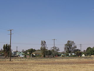
Grong Grong is a small town that is located in the Riverina region of New South Wales, Australia. The town is situated on the Newell Highway, 23 kilometres (14 mi) east of Narrandera in the Shire of Narrandera.

Kurrajong is a small town in New South Wales, Australia. Kurrajong is located 75 kilometres (47 mi) north-west of Sydney, in the local government area of the City of Hawkesbury.
Speers Point is a suburb of Greater Newcastle, and the location of the council seat of the City of Lake Macquarie local government area in New South Wales, Australia. It is 17 kilometres (10.6 mi) west-southwest of the city of Newcastle on the northern shore of Lake Macquarie, in Cockle and Warners Bays, between the suburbs of Cardiff and Warners Bay.

Valley View is a suburb of Adelaide, South Australia. It spans three separate local government areas. They are the City of Salisbury, the City of Port Adelaide Enfield, and the City of Tea Tree Gully. The suburb's boundaries are defined by the intersection of Walkleys, Grand Junction and North East Roads in the south, and Wright and Kelly Roads in the north and east.

Kamarah, is a village community in the central north part of the Riverina. It is situated by road, about 11 kilometres west of Ardlethan and 12 kilometres east of Moombooldool. At the 2006 census, Kamarah had a population of 130 people.

Kurrajong Heights is a small town in the state of New South Wales, Australia. Kurrajong Heights is 79 kilometres (49 mi) north-west of Sydney, in the local government area of the City of Hawkesbury. It is stretched across the Bells Line of Road in the Blue Mountains, west of Kurrajong and east of Bilpin. At the 2016 census, Kurrajong Heights had a population of 1,342 people.
Kurmond is a village 70.5 km west of Sydney, in the state of New South Wales, Australia. It is located in the City of Hawkesbury between Kurrajong and North Richmond on Bells Line of Road.

Corfield is a town and locality in the Shire of Winton in north-western Queensland, Australia. In the 2016 census, Corfield had a population of 183 people.


