
Dorset is a ceremonial county in South West England. It is bordered by Somerset to the north-west, Wiltshire to the north and the north-east, Hampshire to the east, the Isle of Wight across the Solent to the south-east, the English Channel to the south, and Devon to the west. The largest settlement is Bournemouth, and the county town is Dorchester.

Bournemouth is a coastal resort town in the Bournemouth, Christchurch and Poole unitary authority area, in the ceremonial county of Dorset, England. The 2021 census built-up area had a population of 196,455, making it the largest town in Dorset.
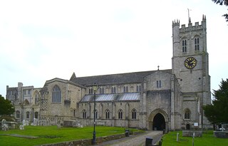
Christchurch is a town and civil parish on the south coast of Dorset, England. The parish had a population of 31,372 in 2021. It adjoins Bournemouth to the west, with the New Forest to the east. Part of the historic county of Hampshire, Christchurch was a borough within the administrative county of Dorset from 1974 until 2019, when it became part of the new Bournemouth, Christchurch and Poole unitary authority.

Hurn is a village and civil parish in the Bournemouth, Christchurch and Poole district of Dorset, England. It is situated between the River Stour and River Avon 3 miles (5 km) north-west of Christchurch and 5 miles (8 km) north-east of Bournemouth town centre. In 2001, the village had a population of 468.

Hamworthy is a suburb of Poole, in the Bournemouth, Christchurch and Poole district, in the ceremonial county of Dorset, England. It is sited on a peninsula of approximately 3 square kilometres (1.2 sq mi) that is bordered by the town of Upton to the north, Poole Harbour to the south, Lytchett Bay to the west and Holes Bay to the east. Poole Bridge, the southern terminus of the A350 road, connects the suburb with the town centre. Hamworthy is the location of the Port of Poole ferry passenger terminal and cargo handling operations.

Pokesdown is a suburb of Bournemouth, in the Bournemouth, Christchurch and Poole districts, in the ceremonial county of Dorset, England. It lies just east of Boscombe and west of Southbourne.

Canford Heath is a suburb, an area of heathland, and an electoral ward in Poole, Dorset. It is known for being the largest heathland in Dorset, and the largest lowland heath in the UK. It is also the name of the housing development built on the heathland in the 1960s, 1970s and 1980s. At the 2021 census the population of the ward was 14,387.

Kinson is a former village which has been absorbed by the town of Bournemouth, in the Bournemouth, Christchurch and Poole district, in the ceremonial county of Dorset, England. The area became part of Bournemouth on 1 April 1931. There were two electoral wards containing the name Kinson. Their joint population at the 2011 Census was 19,824.

Holdenhurst is a village in the civil parish of Throop and Holdenhurst, in the Bournemouth, Christchurch and Poole district, in Dorset, England, situated in the green belt land of the north-east suburbs of Bournemouth. The village comprises fewer than 30 dwellings, two farms and the parish church. There are no shops and few local facilities in the village.
Throop is a village in the civil parish of Throop and Holdenhurst, in the Bournemouth, Christchurch and Poole district, in Dorset, England, situated on the outskirts of Bournemouth. It is renowned for its expansive fishing industry.
Stanpit is a neighbourhood in the Bournemouth, Christchurch and Poole unitary authority in the ceremonial county of Dorset, England. Stanpit is within Mudeford parish, and is situated on the shore of Christchurch Harbour, 1 mile (1.6 km) east of Christchurch town centre. Traditionally it is part of the historic county of Hampshire, and was a small village until the growth of the South East Dorset conurbation in the 20th century. The Stanpit road connects from the end of the original Mudeford road through to Purewell Cross.

Charminster is a residential and commercial suburb of Bournemouth in Dorset, situated between the suburbs of Springbourne and Winton. It was incorporated into the County Borough of Bournemouth in 1901.

Bournemouth, Christchurch and Poole (BCP) is a unitary authority area in the ceremonial county of Dorset, England. The district was created on 1 April 2019 by the merger of the areas that were previously administered by the unitary authorities of Bournemouth and Poole, and the non-metropolitan district of Christchurch. The authority covers much of the area of the South Dorset conurbation.

Bournemouth, Christchurch and Poole Council, which styles itself BCP Council, is the local authority for Bournemouth, Christchurch and Poole, a local government district in the ceremonial county of Dorset, England. The council is a unitary authority, being a district council which also performs the functions of a county council. It is independent from Dorset Council, the unitary authority which administers the rest of the county. The district was created on 1 April 2019 by the merger of the areas that were previously administered by the unitary authorities of Bournemouth and Poole, and the non-metropolitan district of Christchurch.
Dorset Council is the local authority for the non-metropolitan county of Dorset in England. It is a unitary authority, being a district council which also performs the functions of a county council. The non-metropolitan county is smaller than the ceremonial county of Dorset, which also includes Bournemouth, Christchurch and Poole. The council was created in 2019 when local government across Dorset was reorganised.

Strouden Park or Strouden is an area of Bournemouth, Dorset, England.

Fairmile is a suburb of Christchurch, Dorset.

Friars Cliff is a neighborhood and beach in Christchurch, Dorset. It is east of Mudeford and west of Highcliffe.

